Catalog Archive
Auction 103, Lot 134

"Map Illustrating the Plan of the Defences of the Western & North-Western Frontier, as proposed by Charles Gratiot, in his report of Oct. 31, 1837", Gratiot, Charles

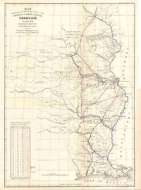
Subject: Central United States

Period: 1860 (published)

Publication: Military Affairs, Vol. VII, No. 753-B

Color: Hand Color

Size:
15.2 x 21.5 inches
38.6 x 54.6 cm
Download High Resolution Image
(or just click on image to launch the Zoom viewer)

This map is a later printing from the series of maps that illustrated the factious Congressional debate over the nature of the Frontier Defenses between the Mississippi River and the Rocky Mountains. Issued under the direction of Col. A.A. Abert by W. Hood, the map depicts the states of Missouri, Arkansas, Louisiana and Indian nations bordering them to the west. It shows the locations of many military forts and outposts from Ft. Jessup to Ft. Snelling with notations throughout concerning lands ceded by several Indian nations with dates of the treaties. The threat posed by hostile Indians, whose numbers greatly exceeded those of the settlers in the area, resulted in a protracted Congressional debate concerning the defenses required along the frontier. Gratiot’s plan uses color to trace the common roads and rivers. A table lower left notes distances between forts and "days of march" at 15 miles per day.

References: cf Wheat [TMW] #426.

Condition: A

Back with archival tissue. Lightly toned along one fold, still very good.

Estimate: $350 - $400

Sold for: $325

Closed on 6/11/2003

Archived