Catalog Archive
Auction 103, Lot 102
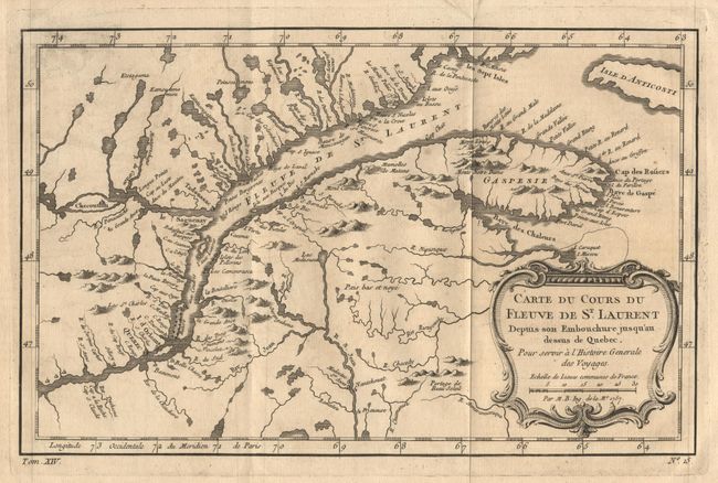
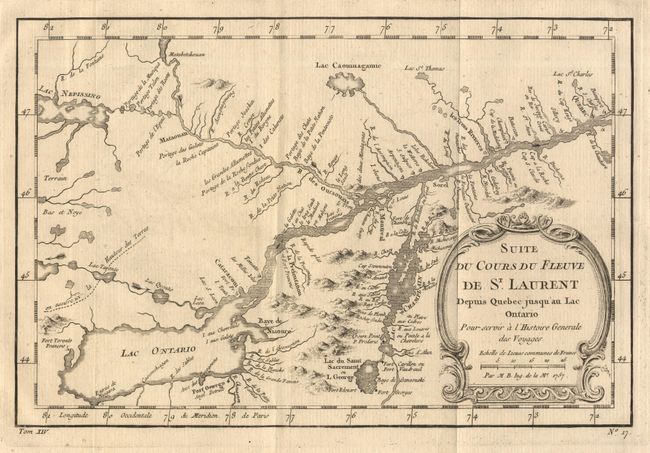
"[Lot of 2] Carte du Cours du Fleuve de St. Laurent Depuis son Embouchure jusqu' au dessus de Quebec [and] Suite du Cours du Fleuve de St. Laurent Depuis Quebec jusqu'au Lac Ontario", Bellin, Jacques Nicolas
1 of 2
Subject: Canada
Period: 1757 (dated)
Publication: Histoire Generale des Voyages
Color: Black & White
Size:
11.7 x 7.5 inches
29.7 x 19.1 cm
Download High Resolution Image
(or just click on image to launch the Zoom viewer)
(or just click on image to launch the Zoom viewer)