Catalog Archive
Auction 103, Lot 100

"[Amerique Septentrionale, sheet 8]", Mitchell/Le Rouge

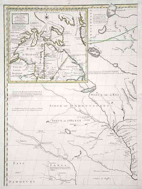
Subject: Colonial Midwest

Period: 1776 (published)

Publication:

Color: Hand Color

Size:
18.7 x 25.7 inches
47.5 x 65.3 cm
Download High Resolution Image
(or just click on image to launch the Zoom viewer)

This is sheet one (upper left) from the French edition of John Mitchell's seminal map of the United States that was used to delineate the boundaries at the Treaty of Paris. The eight sheet map "Amerique Septentrionale avec les Routes...et Etablissements Francois et Anglois par Docteur Mitchel Traduit de Anglois" was published by Le Rouge. This sheet shows the area of today's Iowa and Minnesota, with part Illinois, Wisconsin, Nebraska, Kansas & Dakota. Includes the large inset: "Nouvelle Carte de la Baye d'Hudson et de Labrador…" Many place names and Indian villages are included with a good depiction of the Mississippi River. Part one only of this huge eight-part map.

References:

Condition: B

Dark impression on thick paper with two watermarks. Verso repair along centerfold. Clean tear just entering map at top with old repair. Missing section of upper margin with old repair that includes 1/2" facsimile to neatline.

Estimate: $500 - $600

Sold for: $450

Closed on 6/11/2003

Archived