Catalog Archive
Auction 102, Lot 51

"Hemisphere Septentrional pour Voir plus Distinctement les Terres Arctiques…", Delisle, Guillaume

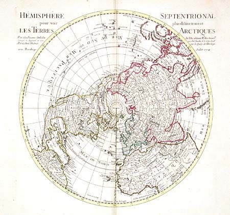
Subject: Northern Hemisphere

Period: 1714 (dated)

Publication: Atlas Geographique et Universel

Color: Hand Color

Size:
18.2 x 18.2 inches
46.2 x 46.2 cm
Download High Resolution Image
(or just click on image to launch the Zoom viewer)

First edition of this important map of the Northern Hemisphere drawn with Delisle’s characteristic scientific approach. This map is the first map to correctly place the west coast of North America by moving it east substantially from previous mapping. California is correctly shown as a peninsula (at a time when it was often still shown as an island - even in other maps drawn by Delisle). Near the northern coast of Asia is Terre de la Compagnie and an uncertain Terre de Gama. Delisle based his depiction of the Northern Pacific on the voyage of Fondant in 1709.

References: Phillips (A) 3525, No. 4.

Condition: B

Good impression on large sheet of handlaid paper with lovely beads and cross watermark. A few spots and very light toning along centerfold, else very good.

Estimate: $400 - $500

Sold for: $375

Closed on 3/5/2003

Archived