Catalog Archive
Auction 102, Lot 33

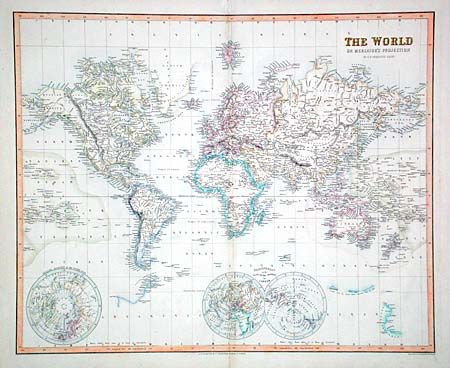
"The World on Mercator's Projection", Fullarton, Archibald & Co.
Subject: World

Period: 1858 (published)

Publication: The Royal Illustrated Atlas, Modern Geography…

Color: Hand Color

Size:
19.7 x 16 inches
50 x 40.6 cm
Download High Resolution Image
(or just click on image to launch the Zoom viewer)

Handsome and very detailed map of the world. Even the tinniest islands are named and much of Antarctica is depicted according to the recent discoveries. A small double hemisphere "on the Plane of the Horizon of London" and an inset of the North Pole are included.

References: Phillips (A) #835.

Condition: A

Faint toning on fold and tiny fold separations in blank margins, else fine.

Estimate: $160 - $200

Sold for: $120

Closed on 3/5/2003

Archived