Catalog Archive
Auction 102, Lot 313

"Mappa Aestivarum Insularum, alias Barmudas Dictarum…", Blaeu, Willem
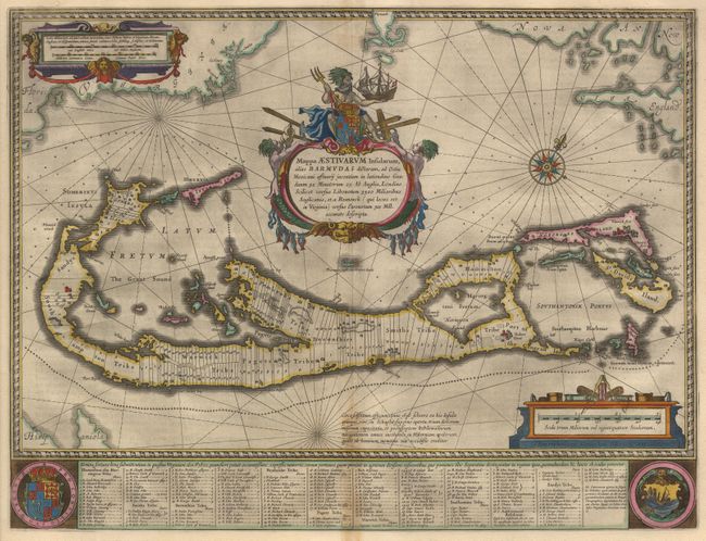
Subject: Bermuda

Period: 1635 (circa)

Publication:

Color: Hand Color

Size:
21 x 15.7 inches
53.3 x 39.9 cm
Download High Resolution Image
(or just click on image to launch the Zoom viewer)

This magnificent map is based on the famous survey by John Norwood of the Bermuda Company in 1618. The map shows the division into the original Tribes and shows the various landowners, with their names in a table below the map. The beautiful title cartouche features Neptune astride the Royal Arms. Further adorned with scale cartouches, coats of arms and compass rose with a fluer-de-lys. The map is superimposed over a map of the Atlantic with the coastlines of Britain, North America and Hispanola showing the location of Bermuda. Latin text on verso.

References: MCC 19 (Palmer) #7; Van der Krogt (Atlantes) #9660:2.

Condition: B

Crisp impression with beautiful old color. Slight toning along bottom centerfold, else fine with wide margins.

Estimate: $2,000 - $2,400

Sold for: $2,200

Closed on 3/5/2003

Archived