Catalog Archive
Auction 102, Lot 242

"A New & Accurate Map of Mexico or New Spain together with California New Mexico &c, Drawn from the best Modern Maps & Charts…", Bowen, Emanuel

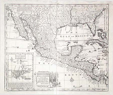
Subject: Southern United States, Mexico and Central America

Period: 1747 (circa)

Publication:

Color: Black & White

Size:
16.5 x 13.8 inches
41.9 x 35.1 cm
Download High Resolution Image
(or just click on image to launch the Zoom viewer)

A nicely engraved map covering the region from Carolina to California, as well as all of Mexico and Central America. A descriptive legend in Southern California gives credit to Father Kino for discovering that California is a peninsula rather than an island. Inset at the lower left of the Galapagos Islands. The title cartouche features a vignette of a man subduing a pair of slaves.

References: Wheat (TMW) #126.

Condition: C

A cleaned and restored example backed with Japanese tissue. Loss of paper in upper margin, a few holes and one long tear, all very professionally repaired. Ink a little weak at center. Despite flaws, will frame nicely.

Estimate: $150 - $200

Sold for: $150

Closed on 3/5/2003

Archived