Catalog Archive
Auction 102, Lot 213

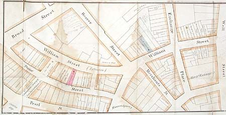
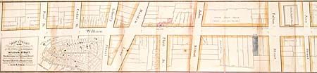
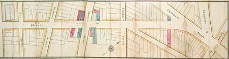
"Map and Plan of the Proposed Continuation & Extension of William Street from Maiden Lane to Chatham Street…", Pitkin, John R.

Subject: New York City

Period: 1835 (circa)

Publication:

Color: Hand Color

Size:
89 x 9 inches
226.1 x 22.9 cm
Download High Resolution Image
(or just click on image to launch the Zoom viewer)

Very scarce real estate promotional map of the financial district of New York City. This folding map covers a narrow strip of land fronting William Street from Broad Street to Chambers Street "Showing the situation of the Property advertised." John R. Pitkin was a wealthy merchant from Connecticut who moved to Long Island in 1835 to build a manufacturing center in East New York. He abandoned his plan during a depression in 1837. Then in the 1850s, after persuading the railroad to build a station, he founded the village of Woodville (later named Woodhaven). It is not known when the development shown on this map was done, but a lease expiring in 1836 is noted on the map. Each parcel is shown along with the names of landowners including the Bank of America and the North Dutch Church. Pitkin and his brother-in-law George W. Thrall are shown to own several parcels, which are designated by hand coloring. The map includes an inset map of the district between Battery Park and Leonard Street. Folding into marble paper covered boards labeled "General Map of William Street, Price Two Dollars."

References:

Condition: B

Some damp staining, short separation on folds and a short tear closed with archival tape. Several pencil notations on the map. Covers damp stained and warped.

Estimate: $400 - $500

Sold for: $325

Closed on 3/5/2003

Archived