Catalog Archive
Auction 102, Lot 208

"Map of the State of Nevada", General Land Office
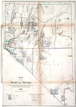
Subject: Nevada

Period: 1866 (dated)

Publication: Annual Report of the Commr. Genl. Land Office

Color: Hand Color

Size:
18.7 x 26.2 inches
47.5 x 66.5 cm
Download High Resolution Image
(or just click on image to launch the Zoom viewer)

Development is limited to the mining districts and the vicinity around Carson City and Virginia City. Provides details of the numerous mineral areas with color codes to indicate silver, gold or copper. The Emigrant Road and the proposed route for the Central Pacific Railroad are shown in detail. Map scale: 18 miles to an inch. First edition in original color.

References: Phillips (A) #1388-19; Wheat (TMW) #1152.

Condition: B

Backed with original linen, and close binding trim, as issued. Little scattered foxing and toning along folds. Couple of small holes along one fold, and two splits along folds archivally repaired.

Estimate: $200 - $250

Unsold

Closed on 3/5/2003

Archived