Catalog Archive
Auction 102, Lot 168

"Sketch of Public Surveys in New Mexico", General Land Office

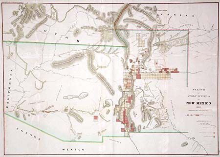
Subject: Southwestern United States - New Mexico and Arizona

Period: 1860 (dated)

Publication:

Color: Hand Color

Size:
32.5 x 23.4 inches
82.6 x 59.4 cm
Download High Resolution Image
(or just click on image to launch the Zoom viewer)

Early, large-scale, territorial map by the Surveyor Generals Office, Santa Fe New Mexico. Extends into the future Colorado and includes all of today's Arizona. The area of present-day New Mexico is depicted with limited surveying, and naming numerous towns and villages. In today's Arizona the cartographic information is almost non-existent, locating two Indian Reservations, a few rivers and mountain ranges. Hachuring indicates those private and pueblo claims, and townships that have been surveyed.

References:

Condition: B

All folds and one tear closed and reinforced on verso. A couple small areas with loss at fold intersections. Modern coloring.

Estimate: $180 - $220

Sold for: $170

Closed on 3/5/2003

Archived