Catalog Archive
Auction 102, Lot 160

"Preliminary Map of Routes Reconnoitered and Opened in the Territory of Utah…", U.S. Government
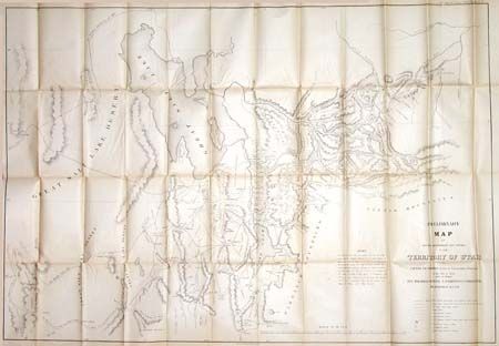
Subject: Western United States

Period: 1858 (dated)

Publication: Sen. Doc #40, 35th Cong., 2nd Session

Color: Black & White

Size:
43 x 30 inches
109.2 x 76.2 cm
Download High Resolution Image
(or just click on image to launch the Zoom viewer)

A large, accurate and carefully drawn map detailing that portion of Utah from the Great Salt Lake Desert to Fort Bridger, to above the Great Salt Lake and south to below Goshen and Mt. Nebo. Terrific detail of roads and towns, springs & sinks, watershed, military camps as well as topographical information. Tooele is here called Tuilla, Big & Little Cottonwood creeks are located. The Uintah Mountains are not named. The map was probably made to facilitate the movements of BGen. Johnson's Army during the Utah campaign as it shows locations of Mormon Fortifications by which the Mormons sought to halt Johnson's movements. A great, early map of the territory.

References: Wheat (TM) #998.

Condition: A

Ivory age toning. Several short splits at fold intersections with no loss, still very good.

Estimate: $150 - $200

Sold for: $375

Closed on 3/5/2003

Archived