Catalog Archive
Auction 102, Lot 158

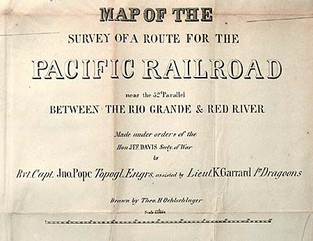
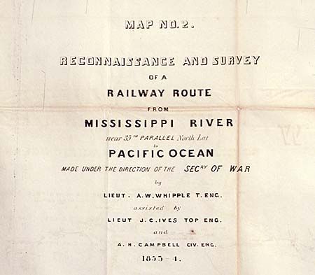
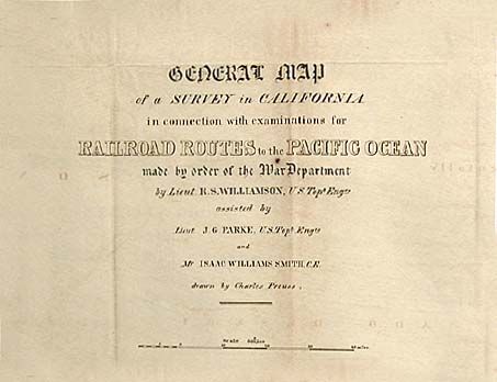
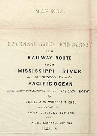
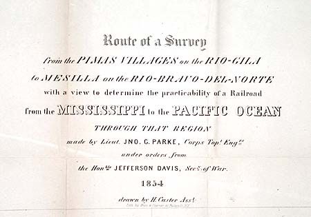
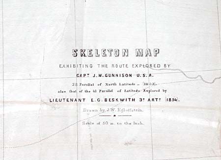
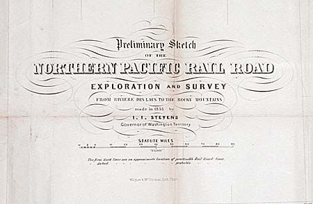
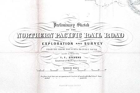
"[Lot of 8 Maps from the Pacific Railroad Surveys]", U.S. Government

Subject: United States - Western

Period: 1854 (published)

Publication: HR ex doc 736, 737, 739, 33rd Cong., 1st Sess.

Color: Black & White

Size:
See Description
Download High Resolution Image
(or just click on image to launch the Zoom viewer)

In 1832 the idea of a transcontinental railway was first proposed. After lengthy and often acrimonious debate, Congress finally authorized the Secretary of War (Jefferson Davis) to initiate explorations and surveys to determine favorable routes. Davis chose four routes and in 1854 submitted to Congress preliminary reports of some of the surveys. Known as the Octavo Edition, two volumes and an atlas were printed. A third volume encountered so many delays that it was superceded by the larger and better-known Quarto Edition. The Octavo Atlas contained 9 maps and 5 profiles. This lot includes 8 of these maps (titles are somewhat truncated): 1) Preliminary Sketch...from Riviere des Lacs to the Rocky Mountains, 33 x 18.5", 1853, Stevens; 2) Preliminary Sketch of the Northern Pacific Rail Road Exploration and Survey from the Rocky Mountains to Puget Sound, 34 x 18.5",1853/54, Stevens; 3) Skeleton map...route explored by Capt. Gunnison, 38th Parallel, 37.5 x 25.3", 1853, Beckwith; 4) Map No. 1 Reconnaissance…from the Mississippi River near the 35th Parallel North Latitude to the Pacific Ocean, 80.5 x 26.5", 1853-4, Whipple; 5)Map No. 2 Reconnaissance…from Mississippi River near the 35th Parallel North Latitude to the Pacific Ocean, 50.3 x 22", 1853-4, Whipple & Ives; 6) Map of the Survey of a route for the Pacific Rail Road, near the 32nd Parallel between The Rio Grande and Red River, 85 x 32", 1855, Pope; 7) Route…from the Pimas Villages on the Gila River to Mesilla on the Rio Bravo del Norte…, 66 x 26", 1855, Parke; 8) General Map of a Survey in California. In connection with examinations for Rail Road Routes to the Pacific Ocean... 72.5 x 24", 1855, Williamson. A matched set of very historical maps in remarkably good condition.

References: Wheat (TMW) 862, 863, 842, 872, 873, 857, 851, 876.

Condition: B

All on sound paper with only toning along folds. No splits or tears. Issued folding, all now backed with archival tissue.

Estimate: $1,000 - $1,200

Sold for: $500

Closed on 3/5/2003

Archived