Catalog Archive
Auction 102, Lot 128

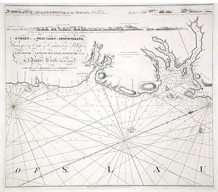
"A Chart of the West Coast of Newfoundland, Surveyed by Order of Commodore Pallisser, Governor of Newfoundland, Labradore &c.&c.", Cook, James (Capt.)

Subject: Canada

Period: 1769 (dated)

Publication:

Color: Black & White

Size:
22.7 x 20 inches
57.7 x 50.8 cm
Download High Resolution Image
(or just click on image to launch the Zoom viewer)

Fine sea chart showing the coastline from Lark Harbour to Shallow Bay, including Bay of Islands. Includes soundings, anchorages and loxodromic lines and handsomely embellished with two sailing ships and a fleur-de-lys. North is oriented towards the lower left on this chart, and there are several topographic profiles that have been included at the top of the chart. Prior to the Pacific voyages for which Capt. James Cook is renowned, he was chosen to chart the Saint Lawrence River and the rugged coast of Newfoundland. His excellent charts of the region, of which this is the fourth of four charts, brought him to the attention of the Royal Navy and set the stage for his later expeditions. Published by Robert Sayer.

References:

Condition: A+

Tissue repairs of some very small tears in the blank margins.

Estimate: $300 - $350

Sold for: $600

Closed on 3/5/2003

Archived