Catalog Archive
Auction 102, Lot 110

"Map of Hudson's River with the Adjacent Country", Anon.

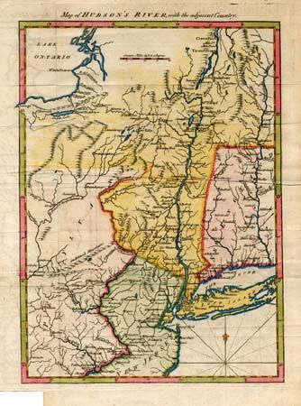
Subject: Colonial New England

Period: 1778 (circa)

Publication: Gentleman's Magazine

Color: Hand Color

Size:
8.5 x 11.8 inches
21.6 x 30 cm
Download High Resolution Image
(or just click on image to launch the Zoom viewer)

Great little map from this British periodical that was designed to familiarize the magazine's readers with the location of the hostilities in the "American War." This map was meant to illustrate the region of the Hudson and Delaware Rivers and the marches of the armies under the Generals Howe, Clinton and Burgoyne. It covers New York and New England as far east as the Connecticut River, south to include Philadelphia, and north to encompass Crown Point and Ticonderoga.

References: Jolly-GENT #257.

Condition: B

Attractive map with binder's trim of lower blank margin, minor creases along two folds. Some offsetting-else fine.

Estimate: $275 - $325

Sold for: $220

Closed on 3/5/2003

Archived