Catalog Archive
Auction 102, Lot 105

"Le Cours du Fleuve Missisipi Selon les Relations les plus modernes", Bernard, Jean Frederic

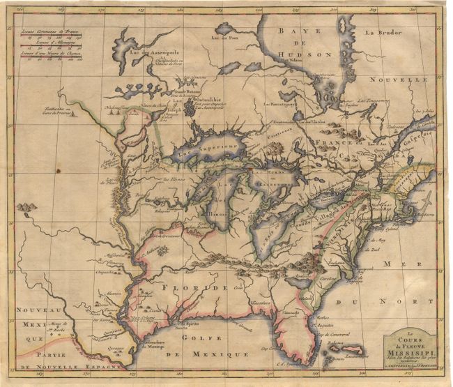
Subject: Colonial United States and Canada - Great Lakes

Period: 1737 (dated)

Publication:

Color: Hand Color

Size:
17.2 x 14.6 inches
43.7 x 37.1 cm
Download High Resolution Image
(or just click on image to launch the Zoom viewer)

Excellent early map, based upon Louis Hennepin's seminal map of the Mississippi River and the Great Lakes. Hennepin's map presented a marked improvement on Sanson's depiction of the lake routes into the interior and the Great Lakes region, particularly the delineation of Lakes Superior, Michigan and Huron. Even with these improvements, the lack of accuracy is very evident; depicting the lakes enlarged and exaggerated, Hudson Bay too far to the east and the Mississippi River too far to the west with its mouth in what is present-day Texas. The spurious lake described by LeMoyne is depicted just south of the Appalachians. A number of early settlements and Indian Tribes are shown around the Great Lakes and along the Mississippi and this map has been updated to show the location of New Orleans. Scarce and desirable early Hennepin variant.

References: McCorkle #737.1.

Condition: B

Couple of tiny stains on fold and a professionally repaired binding tear entering border at right.

Estimate: $2,300 - $2,500

Unsold

Closed on 3/5/2003

Archived