Catalog Archive
Auction 101, Lot 80

"Totius Americae Septentrionalis et Meridionalis Novissima Repraesentatio…", Homann, Johann Baptist

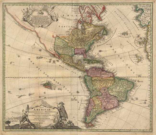
Subject: Western Hemisphere

Period: 1724 (circa)

Publication:

Color: Hand Color

Size:
22.5 x 19.4 inches
57.2 x 49.3 cm
Download High Resolution Image
(or just click on image to launch the Zoom viewer)

A revision of the elder Homann's 1710 map of the Americas. After his death in 1724, his son (Johann Christoph Homann) re-engraved the plate to correct the western coastline of North America. California is no longer shown as an island, although the remnants of the interior sea can be seen near the Pais de Moozemleck. Good detail near the Great Lakes, which were actively being explored by the French fur traders and Hudson's Bay Company. Two large pictorial cartouches (uncolored, as issued) and two small compass roses.

References:

Condition: B

Good impression and very nice coloring on hand laid, watermarked paper. Small wrinkles and crease along center from backstrap and some surface soiling. Old paper reinforcing in bottom margin, apparently by the publisher.

Estimate: $1,000 - $1,200

Sold for: $750

Closed on 12/4/2002

Archived