Catalog Archive
Auction 101, Lot 471
"Carte du Golfe de Benin et Partie de la Cote de Guinee… [together with] Carte de l'Embouchure de la Riviere de Congo ou de Zayre [and] Carte de la Riviere de Kalbar", Bellin, Jacques Nicolas
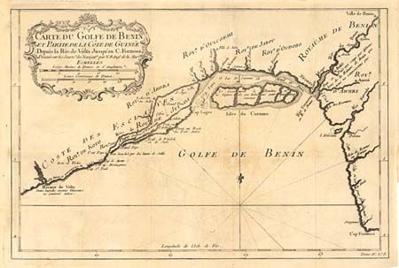
Subject: Western Africa
Period: 1760 (circa)
Publication:
Color: Black & White
Size:
See Description
Download High Resolution Image
(or just click on image to launch the Zoom viewer)
(or just click on image to launch the Zoom viewer)