Catalog Archive
Auction 101, Lot 41

"Typus Orbis A Ptol. Descriptus", Munster, Sebastian

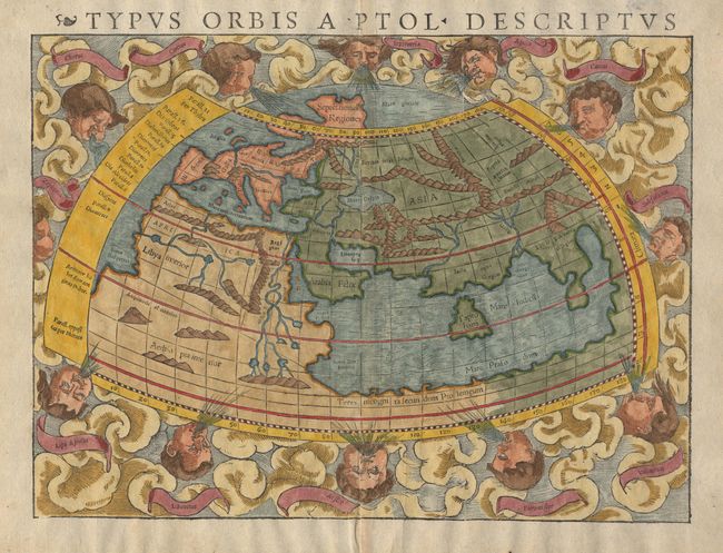
Subject: Ancient World

Period: 1541 (circa)

Publication: Geographia Universalis

Color: Hand Color

Size:
13.2 x 10 inches
33.5 x 25.4 cm
Download High Resolution Image
(or just click on image to launch the Zoom viewer)

Clouds and eight named windheads surround Munster’s woodblock world map. Displays the prevailing conception of the world geography prior to the discovery of the New World and according to Claudius Ptolemy. Enclosed Indian Ocean, large Taprobana (Ceylon), and multiple lake sources for the Nile. This is the second edition with the fine vertical crack line across the upper right-hand part of the map. Latin text on verso. This map is also found in editions from 1542, 1545 and 1552.

References: Shirley #76.

Condition: A

Good impression and modern color. Wide margins with a few tiny marginal chips.

Estimate: $1,400 - $1,600

Sold for: $1,700

Closed on 12/4/2002

Archived