Catalog Archive
Auction 101, Lot 307

"Tabula Geographica Angliae et Walliae…", Von Euler, Leonhard

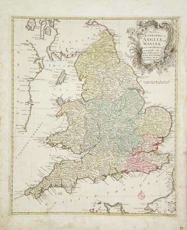
Subject: England & Wales

Period: 1755 (published)

Publication: Prussian Royal Academy

Color: Hand Color

Size:
12.6 x 15 inches
32 x 38.1 cm
Download High Resolution Image
(or just click on image to launch the Zoom viewer)

An attractive county map of England and Wales in original full wash color with compass rose. Very detailed throughout. Shows Adrians Wall extending across the country near the border with Scotland. Trimmed and mounted on stiffer paper for inclusion in the Von Euler's Atlas. Von Euler was a Swiss mathematician and was closely associated with the Delisles. An unobtrusive and unidentified hand printed library stamp at lower right. Original uncolored cartouche.

References:

Condition: B

Marginal soiling into border at one place, else very good.

Estimate: $150 - $200

Sold for: $100

Closed on 12/4/2002

Archived