Catalog Archive
Auction 101, Lot 284
"Carte Particuliere des Costs de Flandres de Picardie et de Normandie, depuis Nieuport jusqua Dieppe, avec les Costes d'Angleterre…", Depot de la Marine
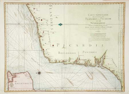
Subject: English Channel
Period: 1793 (circa)
Publication:
Color: Hand Color
Size:
31.7 x 23.5 inches
80.5 x 59.7 cm
Download High Resolution Image
(or just click on image to launch the Zoom viewer)
(or just click on image to launch the Zoom viewer)