Catalog Archive
Auction 101, Lot 176

"Map Showing the Disputed Boundary of Missouri and Iowa", U.S. Government

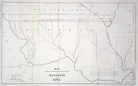
Subject: Missouri and Iowa

Period: 1839 (published)

Publication: HR Doc. #128, 25th Cong., 3rd Session

Color: Black & White

Size:
29.1 x 17.8 inches
73.9 x 45.2 cm
Download High Resolution Image
(or just click on image to launch the Zoom viewer)

Includes the northern half of Missouri. Shows four versions of disputed boundaries between Missouri and Iowa, including a related dispute over the Half Breeds boundary for a tract of land between the Mississippi & Des Moines Rivers. Various versions of the two major lines, namely Brown's Line or Line claimed by Missouri and Old Indian Boundary or Sullivan's Line, are detailed. The Platt District annexation of 1836 is also delineated. Drawn by George A. Leakin.

References: Koepp #347; Karrow No. 8-0636; Claussen & Friis #300.

Condition: A

Folding as issued. Small area of light foxing, else clean and bright.

Estimate: $150 - $200

Unsold

Closed on 12/4/2002

Archived