Catalog Archive
Auction 101, Lot 117

"United States", Findlay, Alexander
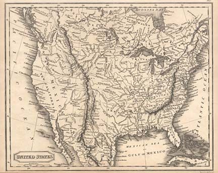
Subject: United States

Period: 1825 (circa)

Publication:

Color: Black & White

Size:
9.4 x 7.5 inches
23.9 x 19.1 cm
Download High Resolution Image
(or just click on image to launch the Zoom viewer)

Interesting small map actually covering most of North America. It shows the United States in control of present-day British Columbia with the "Boundary by Treaty of the U.S. with Russia, 1824." The boundary with Mexico is per the Treaty of 1819. Both Illinois and Indiana are oddly shaped and incorrectly located. The large Arkansas Territory is shown with its capital at Arkopolis. The colony of New Santander is located on the Gulf coast of Mexico. The whole map is filled with the locations of forts, settlements and Indian tribes.

References:

Condition: A

Tiny tear in margin, repaired with archival tape.

Estimate: $100 - $130

Sold for: $120

Closed on 12/4/2002

Archived