Catalog Archive
Auction 101, Lot 100

"Novissima Tabula Regionis Ludovicianae Gallice dicta la Louisiane…", Weigel, Christopher

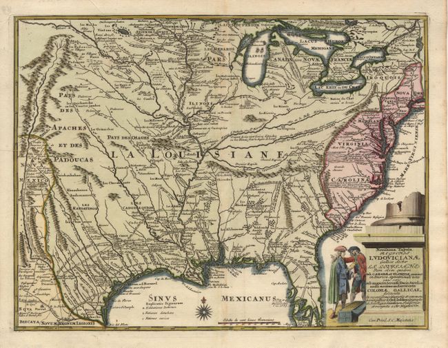
Subject: Colonial Louisiana

Period: 1734 (circa)

Publication:

Color: Hand Color

Size:
16.5 x 12.5 inches
41.9 x 31.8 cm
Download High Resolution Image
(or just click on image to launch the Zoom viewer)

Based on Delisle's seminal map of the French possession of Louisiana that drew together the cartographic work of the previous half century. It presents a detailed view of the Gulf region and the Mississippi, and the exploration routes of De Soto, Cavelier, Tonty, Moscoso and Denis. Numerous forts including Mission de los Teijas are shown throughout. Large figurative cartouche with two gentlemen negotiating over a large chest of gold coins.

References:

Condition: B

Slight unobtrusive damp stain on centerfold.

Estimate: $1,800 - $1,900

Sold for: $1,300

Closed on 12/4/2002

Archived