Catalog Archive
Auction 100, Lot 77

"America", Magini and Porro

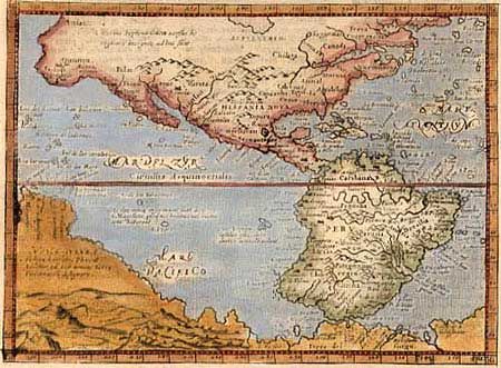
Subject: Western Hemisphere

Period: 1713 (published)

Publication: Universus Terrarum Orbis Scriptorum

Color: Hand Color

Size:
6.9 x 5 inches
17.5 x 12.7 cm
Download High Resolution Image
(or just click on image to launch the Zoom viewer)

This finely engraved map is derived from Giovanni Lorenzo d'Anania's 1582 map of the Americas and further based on the geography of Ortelius. Most notable is the characteristic bulge to the west coast of South America and the huge Southern Continent that attaches to Nova Guinea. The map was engraved by Girolamo Porro for Magini's edition of Ptolemy's Geography. The plate made its last appearance in this work published by Raphael Savonarola. On a full sheet with text above the map.

References: Burden #93.

Condition: A

Later color. Slightly light impression.

Estimate: $500 - $600

Sold for: $375

Closed on 9/12/2002

Archived