Catalog Archive
Auction 100, Lot 418
"Chart of Discoveries, made in 1787, in the Seas of China and Tartary, by the Boussole and Astrolabe… Sheet II", La Perouse, Comte Jean F. Galoup, de
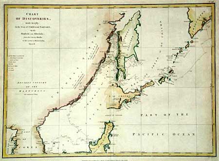
Subject: Northeast Asia
Period: 1798 (circa)
Publication:
Color: Hand Color
Size:
19.5 x 14.1 inches
49.5 x 35.8 cm
Download High Resolution Image
(or just click on image to launch the Zoom viewer)
(or just click on image to launch the Zoom viewer)