Catalog Archive
Auction 100, Lot 372

"Disegno Topografico Del Canale di Cattaro", Coronelli, Vincenzo Maria
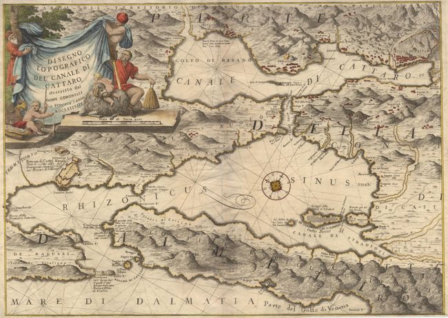
Subject: Montenegro

Period: 1688 (dated)

Publication: Atlante Veneto…

Color: Hand Color

Size:
23.5 x 16.8 inches
59.7 x 42.7 cm
Download High Resolution Image
(or just click on image to launch the Zoom viewer)

This map of Gulf of Kotor is a splendid example of Coronelli's style with the topographical features graphically depicted. The towns of Kotor and Castel Nuovo are shown with superb detail - right down to the location of individual houses. The large flourishing cartouche is engraved on a canvas held up by workmen while naked children play in the foreground. The chart is oriented with a beautiful and unusual compass rose with north to the upper left. Coronelli established the society of geographers "Accademia degli Argonauta", one of the oldest in the world, and became the official geographer of the Venetian Republic. His maps of the Adriatic Sea were of particular strategic and economical importance and were also often used as to glorify Venice and its victories over the Turks.

References: Phillips (A) #5950.

Condition: A

Tissue re-enforcement on centerfold. Horizontal printer's crease.

Estimate: $475 - $550

Sold for: $350

Closed on 9/12/2002

Archived