Catalog Archive
Auction 100, Lot 328

"Carte des Comtez de Hainaut de Namur et de Cambresis", Delisle/Covens & Mortier

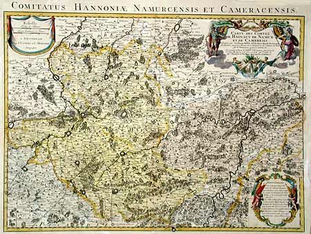
Subject: Belgium and France

Period: 1730 (circa)

Publication:

Color: Hand Color

Size:
25 x 18.2 inches
63.5 x 46.2 cm
Download High Resolution Image
(or just click on image to launch the Zoom viewer)

Detailed map of southern Belgium and northeast France from Douai in the west to the area east of Namur, including Brussels, Mons and Cambrai. Densely engraved with forests, hills, rivers, cities, fortifications, villages, and roads. Decorated with three elaborate cartouches; title, distance scale, and advertisement.

References:

Condition: B

Fine original color. Minor uneven toning with a few marginal tears repaired with tissue.

Estimate: $200 - $240

Sold for: $180

Closed on 9/12/2002

Archived