Catalog Archive
Auction 100, Lot 224

"Wyoming Compiled by permission from official records in U.S. Land Office", Holt, G.L.
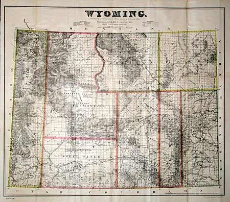
Subject: Wyoming

Period: 1886 (circa)

Publication: HR Exec Doc 1, 49th Congress 1st Session

Color: Printed Color

Size:
24 x 20.5 inches
61 x 52.1 cm
Download High Resolution Image
(or just click on image to launch the Zoom viewer)

This rarely seen map was originally published in Cheyenne, Wyoming. A very fine map with only eight counties issued four years before it achieved statehood. Shows well developed topography and hydrology, Yellowstone National Park, Shoshone Indian Reservation, towns, railroads, telegraph lines, common roads and areas containing coal and gypsum. In 1883 the cattle industry comprised 90% of all commerce, but the winter of 1886-87 dealt a disastrous setback to this limited economy and delayed statehood.

References:

Condition: A

Estimate: $250 - $300

Sold for: $275

Closed on 9/12/2002

Archived