Catalog Archive
Auction 100, Lot 221

"Colton's Washington and Oregon", Colton, Joseph Hutchins

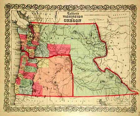
Subject: Washington and Oregon

Period: 1859 (dated)

Publication:

Color: Hand Color

Size:
15.5 x 12.5 inches
39.4 x 31.8 cm
Download High Resolution Image
(or just click on image to launch the Zoom viewer)

A great map of the Pacific Northwest showing Washington Territory encompassing all of present-day Idaho and parts of Montana and Wyoming. Of specific interest on the map is the notation of all the major exploration routes, wagon trails and the proposed routes for the transcontinental railways. This map was issued, by Johnson and Browning, shortly after Oregon became a state in 1859. The organized counties of both Oregon and Washington are confined west of the mountain ranges. Decorative border.

References:

Condition: A

Lovely color. Slight damp stain at paper edge, well away from image.

Estimate: $150 - $200

Sold for: $300

Closed on 9/12/2002

Archived