Catalog Archive
Auction 100, Lot 153

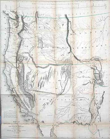
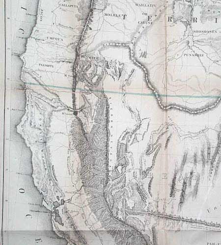
"Map of Oregon and Upper California from the Surveys of John Charles Fremont and other Authorities", Fremont/Preuss

Subject: United States - Western

Period: 1848 (dated)

Publication: 30th Congress, [Senate], 1st Session, Misc. Doc No. 148

Color: Hand Color

Size:
26.5 x 33.3 inches
67.3 x 84.6 cm
Download High Resolution Image
(or just click on image to launch the Zoom viewer)

This map and the accompanying "Geographic Memoir" has been accorded two-fold importance in the development of the westward expansion. First, as a major contribution to the geographical and cartographical knowledge and second, as a historic documentation of Fremont's Third Expedition. The map is a remarkable graphic depiction of Fremont's Expedition. Among the most interesting features is the appearance of the term Golden Gate at the entrance to Bay of San Francisco, the markings of the California Gold Fields, a hypothetical east-west mountain range near the 42nd parallel and a notation identifying the location of Mormon settlements. Complete with the Senate Document 148 "Geographical Memoir Upon Upper California, in Illustration of His Map of Oregon and California by John Charles Fremont…", 67 pp.

References: Wheat (TMW) 559; Goss (NA) #177; Schwartz & Ehrenberg plt.. 171.

Condition: B

Good, dark impression. Toned along folds, three tiny intersection splits, close trimmed at binding side to neatline. A fine example of this most desirable map as it is usually found in much worse condition.

Estimate: $1,400 - $1,800

Sold for: $1,900

Closed on 9/12/2002

Archived