Catalog Archive
Auction 100, Lot 146

"Carte de la Partie Meridionale des Etats-Unis", Crevecoeur, Michel Guillaume De

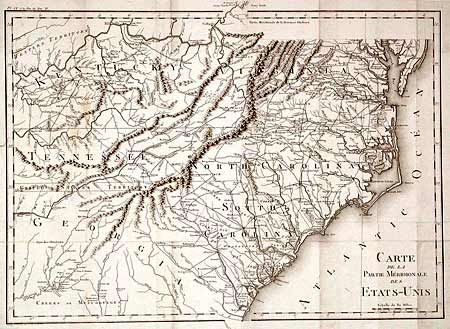
Subject: United States - Southeastern

Period: 1801 (published)

Publication: Voyage dans la Haute Pennsylvanie…

Color: Black & White

Size:
19.8 x 14.1 inches
50.3 x 35.8 cm
Download High Resolution Image
(or just click on image to launch the Zoom viewer)

Fine, detailed map covering all of the Carolinas with parts of Virginia, Kentucky, Tennessee and Georgia. Great detail of early roads and settlements. Between Tennessee and Georgia is a long strip of land labeled United States Territory. This land originally belonged to South Carolina but was ceded back to the United States. Numerous Indian villages are shown, especially in the region of present-day Alabama.

References:

Condition: B

Folding as issued with minor soil and light stain on folds. Professional repair on tiny binding tear and a few fold splits.

Estimate: $400 - $450

Unsold

Closed on 9/12/2002

Archived