Showing Unsold Lots(remove filter)
Current Auction
398 lots
Page 1 of 8
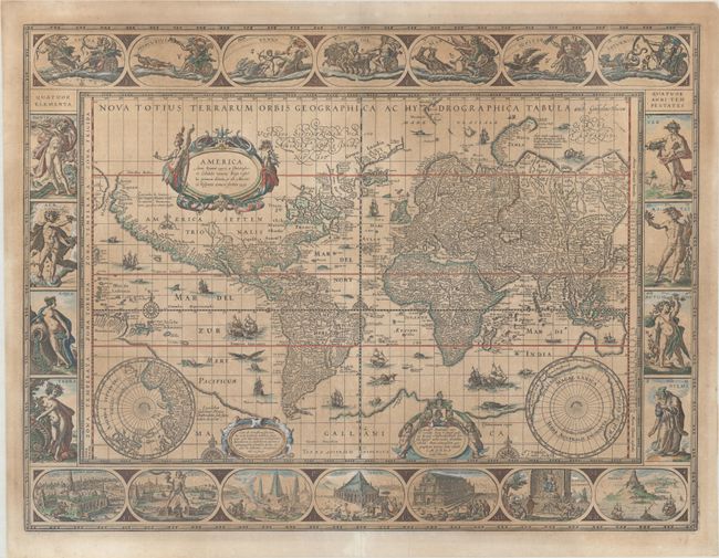
Lot 2
Subject: World
Blaeu, Willem
Nova Totius Terrarum Orbis Geographica ac Hydrographica Tabula, 1635
Size: 21.3 x 16.1 inches (54.1 x 40.9 cm)
Estimate: $10,000 - $12,000
Blaeu's Magnificent Carte-a-Figures World Map
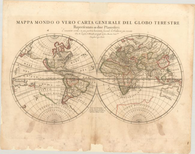
Lot 4
Subject: World
Rossi, Giamcomo Giovanni
Mappa Mondo o Vero Carta Generale del Globo Terestre Rapresentato in Due Planisferi..., 1674
Size: 21.6 x 11.3 inches (54.9 x 28.7 cm)
Estimate: $400 - $475
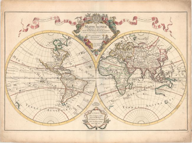
Lot 9
Subject: World
Delisle, Guillaume
Mappe-Monde Dressee sur les Observations de Mrs. de l'Academie Royale des Sciences et Quelques Autres et sur les Memoires les Plus Recens..., 1700
Size: 26 x 16.9 inches (66 x 42.9 cm)
Estimate: $1,000 - $1,300
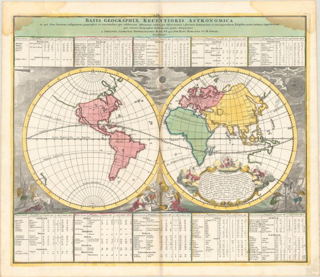
Lot 10
Subject: World
Doppelmayr/Homann
Basis Geographiae Recentioris Astronomica in qua Situs Locorum Insigniorum Geographici ea Exactitudine, qua Celeberrimi Astronomi Eosdem per Observationes..., 1720
Size: 22.8 x 19.1 inches (57.9 x 48.5 cm)
Estimate: $550 - $700
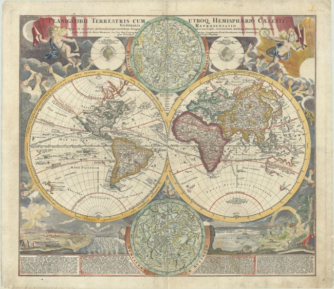
Lot 11
Subject: World
Homann, Johann Baptist
Planiglobii Terrestris cum Utroq Hemisphaerio Caelesti Generalis Repraesentatio quam ex Novissimis Probatissimisque Recentum Geographorum..., 1720
Size: 21.5 x 18.9 inches (54.6 x 48 cm)
Estimate: $1,400 - $1,700
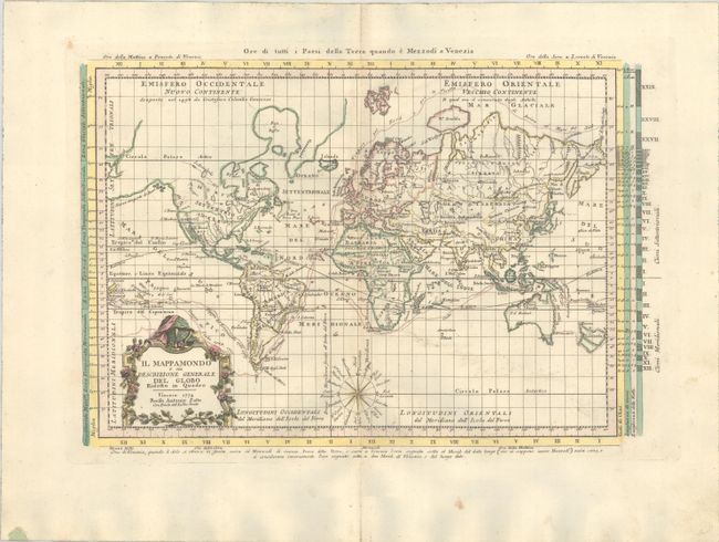
Lot 12
Subject: World
Zatta, Antonio
Il Mappamondo o sia Descrizione Generale del Globo Ridotto in Quadro, 1774
Size: 16 x 10.7 inches (40.6 x 27.2 cm)
Estimate: $475 - $600
Lot 14
Subject: World
Bowles & Carver
A Map of the World, According to the Latest Discoveries, 1785
Size: 11.1 x 7 inches (28.2 x 17.8 cm)
Estimate: $325 - $400
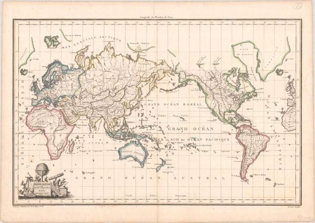
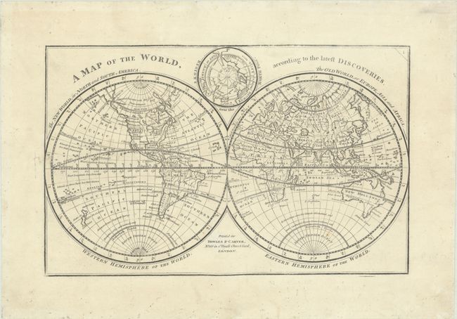
Lot 17
Subject: World
Chamouin, Jean Baptiste Marie
Mappe-Monde sur la Projection Reduite de Mercator, 1809
Size: 17.7 x 11.4 inches (45 x 29 cm)
Estimate: $140 - $170
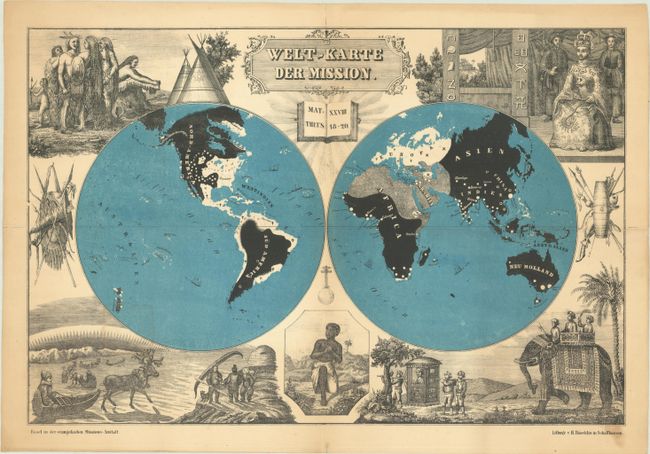
Lot 19
Subject: World
Welt-Karte der Mission, 1850
Size: 18.1 x 12 inches (46 x 30.5 cm)
Estimate: $325 - $400
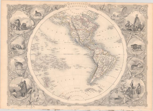
Lot 20
Subject: World
Tallis, John
[Lot of 2] Western Hemisphere [and] Eastern Hemisphere, 1850
Size: 13.6 x 10 inches (34.5 x 25.4 cm)
Estimate: $325 - $400
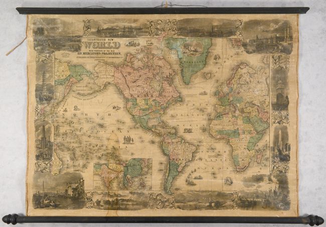
Lot 21
Subject: World
Phelps & Watson
Illustrated New World with Portions of the Old on Mercator's Projection, 1860
Size: 34.4 x 25.6 inches (87.4 x 65 cm)
Estimate: $1,400 - $1,700
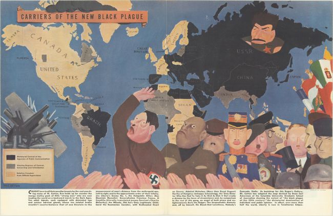
Lot 23
Subject: World, World War II
Carriers of the New Black Plague, 1938
Size: 20.7 x 11.8 inches (52.6 x 30 cm)
Estimate: $200 - $230
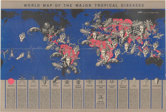
Lot 25
Subject: World
World Map of the Major Tropical Diseases, 1944
Size: 20.8 x 14 inches (52.8 x 35.6 cm)
Estimate: $200 - $230
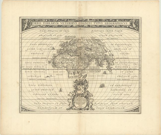
Lot 26
Subject: Ancient World
Jansson, Jan
Orbis Terrarum Veteribus Cogniti Typus Geographicus, 1680
Size: 19.9 x 15.9 inches (50.5 x 40.4 cm)
Estimate: $400 - $475
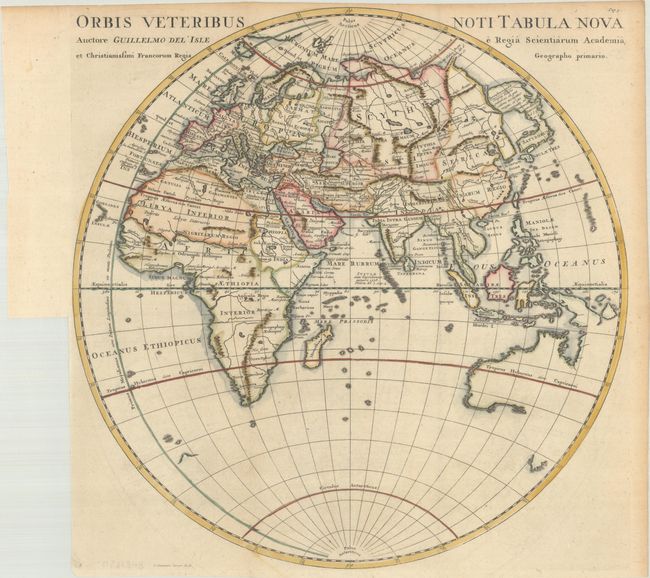
Lot 30
Subject: Eastern Hemisphere
Cluver, Philipp
Orbis Veteribus Noti Tabula Nova Auctore Guillelmo del' Isle..., 1729
Size: 15 x 15.1 inches (38.1 x 38.4 cm)
Estimate: $200 - $230
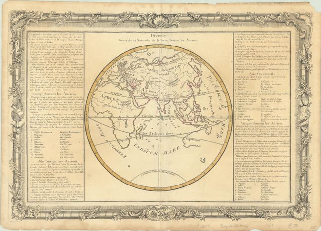
Lot 31
Subject: Eastern Hemisphere
Buy de Mornas, Claude
[Lot of 2] Division Generale et Naturelle de la Terre, Suivant les Anciens [and] Zones une Zone est un Espace de Terre, Diversement Appelle de la Differente Temperature de l'Air..., 1761
Size: 20.9 x 14.3 inches (53.1 x 36.3 cm)
Estimate: $140 - $170
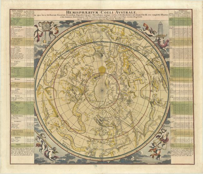
Lot 36
Subject: Celestial
Doppelmayr/Homann
Hemisphaerium Coeli Australe in quo Loca Stellarum Fixarum Secundum Aequatorem, per Ascensiones Nempe Rectas et Declinationes ad Anum Christi 1730..., 1742
Size: 22.6 x 19.1 inches (57.4 x 48.5 cm)
Estimate: $900 - $1,100
Lot 37
Subject: Celestial Atlas
Goldbach, Christian Friedrich
Neuester Himmels-Atlas zum Gebrauche sur Schul- und Akademischen Unterricht, nach Flamsteed, Bradley, Tob. Mayer, De la Caille, Le Francais de la Lande und v. Zach..., 1803
Size: 11.5 x 10 inches (29.2 x 25.4 cm)
Estimate: $2,000 - $2,400
Unique Celestial Atlas with Stars in Relief Against a Black Sky
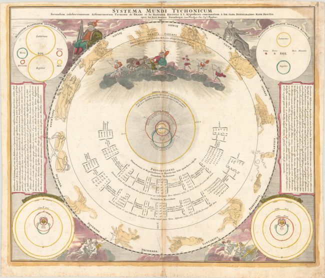
Lot 39
Subject: Solar System
Doppelmayr/Homann
Systema Mundi Tychonicum Secundum Celeberrimorum Astronomorum Tychonis de Brahe et Io. Baptistae Riccioli..., 1742
Size: 22.6 x 19.1 inches (57.4 x 48.5 cm)
Estimate: $400 - $475
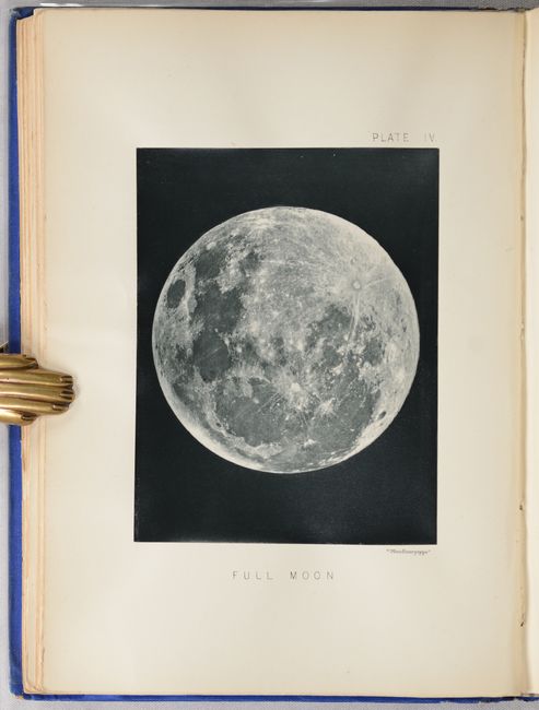
Lot 41
Subject: Moon
The Moon: Considered as a Planet, a World, and a Satellite, 1885
Size: 6.6 x 9.3 inches (16.8 x 23.6 cm)
Estimate: $1,000 - $1,300
Selenology with 25 Woodburytypes
Lot 42
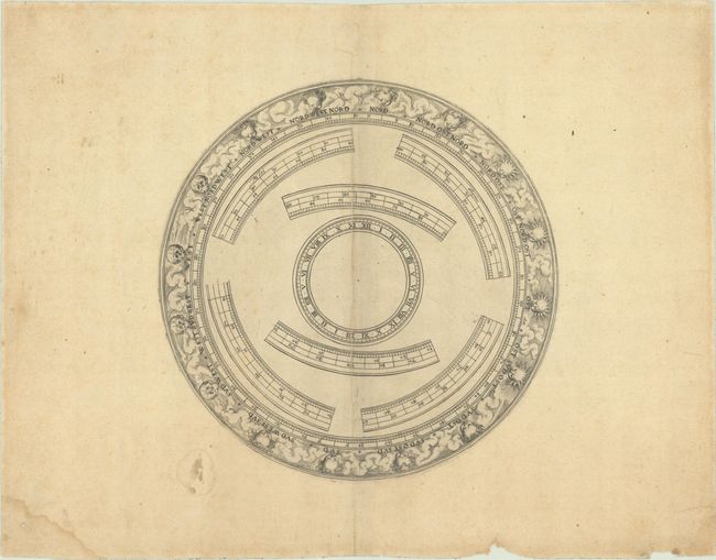
Subject: Cartographic Miscellany, Globe
Anon.
[Globe Horizon Ring], 1750
Size: 8.6 x 8.6 inches (21.8 x 21.8 cm)
Estimate: $325 - $400
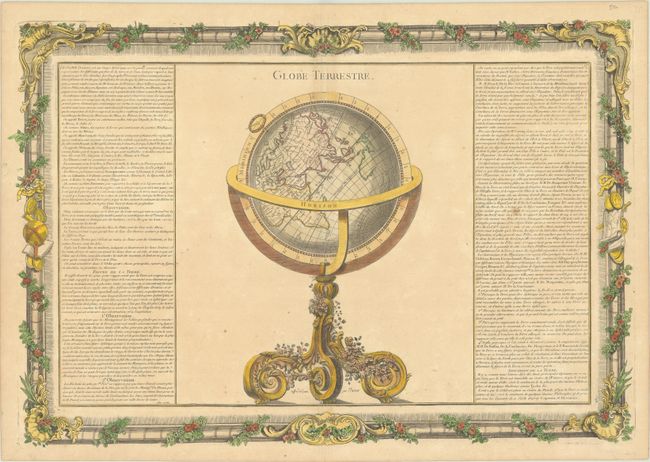
Lot 43
Subject: Cartographic Miscellany, Globe
Brion de la Tour/Martinet
Globe Terrestre, 1761
Size: 20.8 x 14.3 inches (52.8 x 36.3 cm)
Estimate: $160 - $190
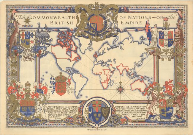
Lot 46
Subject: Cartographic Miscellany, World
The Commonwealth of Nations - or the British Empire, 1937
Size: 21.6 x 15.1 inches (54.9 x 38.4 cm)
Estimate: $180 - $220
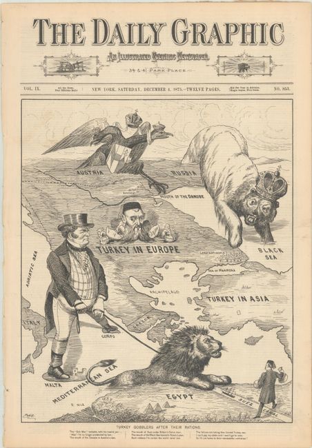
Lot 47
Subject: Cartographic Miscellany, Ottoman Empire
Daily Graphic
Turkey Gobblers After Their Rations, 1875
Size: 12.4 x 14.8 inches (31.5 x 37.6 cm)
Estimate: $500 - $700
12-Page Issue with Satiric Image of Great Eastern Crisis
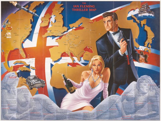
Lot 50
Subject: Cartographic Miscellany, Literary Map
The Ian Fleming Thriller Map, 1987
Size: 27.1 x 20.6 inches (68.8 x 52.3 cm)
Estimate: $140 - $170
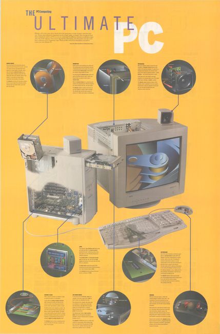
Lot 51
Subject: Cartographic Miscellany, Technology
The Ultimate PC [on verso] The Ultimate Specs, 1995
Size: 24.8 x 37.5 inches (63 x 95.3 cm)
Estimate: $1,000 - $1,300
Scarce Map of the Inner Workings of a PC
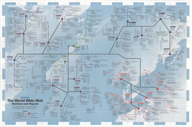
Lot 52
Subject: Cartographic Miscellany, Internet
Road Map to the World Wide Web - The World Wide Web Business and Beyond, 1995
Size: 36.5 x 24 inches (92.7 x 61 cm)
Estimate: $2,000 - $2,300
Scarce Map of the Early World Wide Web
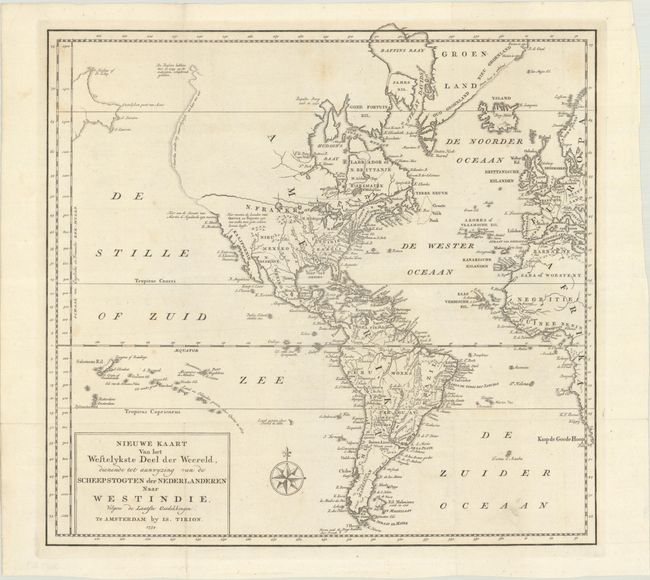
Lot 58
Subject: Western Hemisphere - America
Tirion, Isaac
Nieuwe Kaart van het Wesetlykste Deel der Weereld, Dienende tot Aanwyzing van de Scheepstogten der Nederlanderen naar Westindie…, 1754
Size: 14.2 x 13.5 inches (36.1 x 34.3 cm)
Estimate: $180 - $220
Lot 59
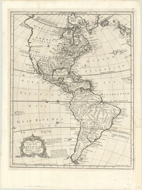
Subject: Western Hemisphere - America
Pazzi, Giuseppe
Nuova ed Esatta Carta della America Ricavata dalle Mappe, e Carte Piu Approvate, 1763
Size: 10.9 x 13.7 inches (27.7 x 34.8 cm)
Estimate: $190 - $220
Lot 61
Subject: Western Hemisphere - America
Walch, Johannes
Charte von America nach den Neuesten u. Zwerlassigsten Astronomischen Ortsbestinungen Reisebeschreibungen und Charten Entworfen, 1818
Size: 20.3 x 24 inches (51.6 x 61 cm)
Estimate: $475 - $600
Lot 64
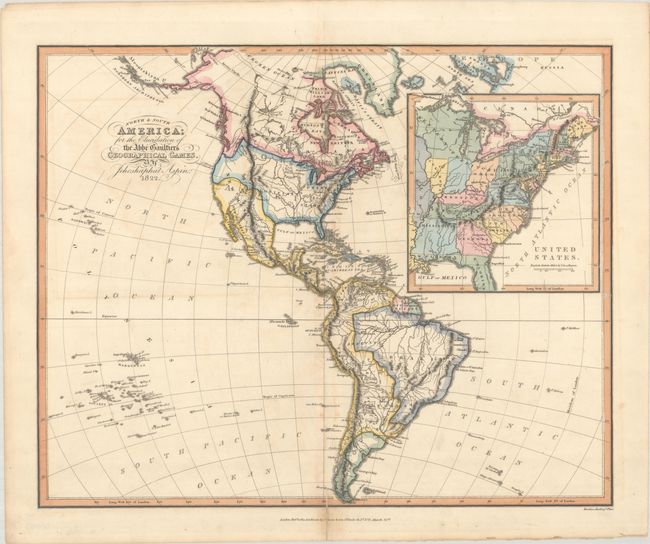
Subject: Western Hemisphere - America, Franklin
Aspin, Jehoshaphat
North & South America; for the Elucidation of the Abbe Gaultier's Geographical Games, 1823
Size: 16.8 x 13.4 inches (42.7 x 34 cm)
Estimate: $475 - $600
Map Depicting "State of Franklin"
Lot 65
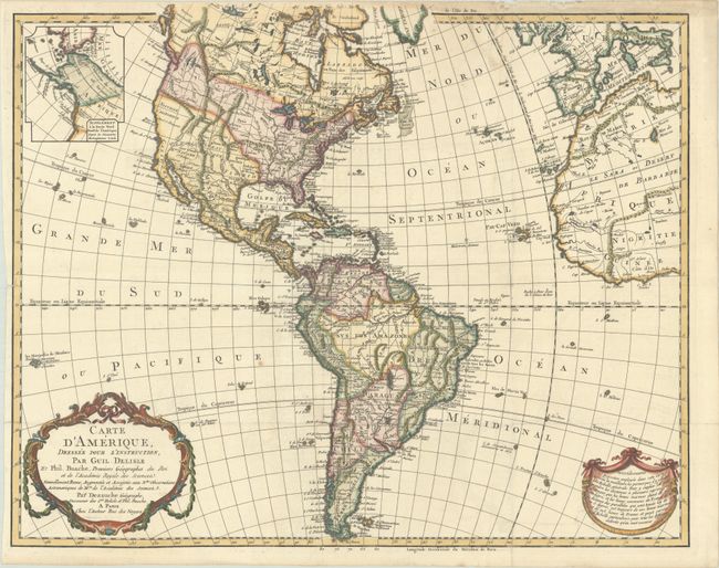
Subject: Western Hemisphere - America
Delisle/Dezauche
Carte d'Amerique, Dressee pour l'Instruction, part Guil. Delisle et Phil. Buache, Premiers Geographes du Roi..., 1826
Size: 23.9 x 19.3 inches (60.7 x 49 cm)
Estimate: $475 - $600
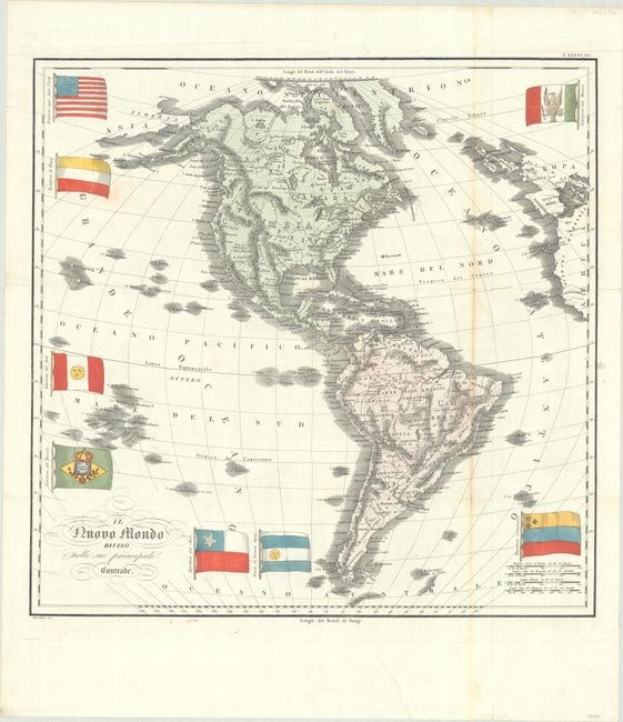
Lot 66
Subject: Western Hemisphere - America
Marmocchi, Francesco
Il Nuovo Mondo Diviso Nelle sue Principali Contrade, 1838
Size: 20.1 x 19.8 inches (51.1 x 50.3 cm)
Estimate: $400 - $475
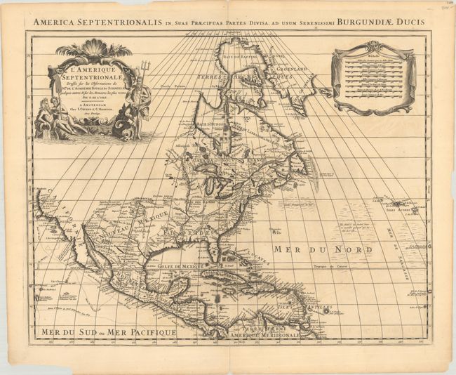
Lot 70
Subject: Colonial North America
Delisle/Covens & Mortier
L'Amerique Septentrionale Dressee sur les Observations de Mrs. de l'Academie Royale des Sciences. & Quelques Autres, & sur les Memoires les Plus Recens, 1730
Size: 22.6 x 17.7 inches (57.4 x 45 cm)
Estimate: $750 - $900
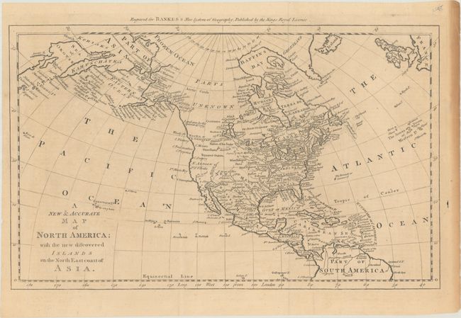
Lot 74
Subject: North America
Bowen, Thomas
A New & Accurate Map of North America; with the New Discovered Islands on the North East Coast of Asia, 1787
Size: 17.1 x 10.6 inches (43.4 x 26.9 cm)
Estimate: $275 - $350
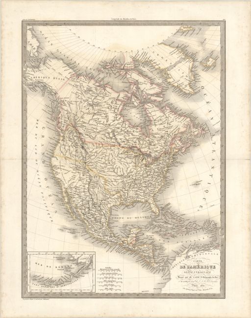
Lot 77
Subject: North America
Lapie, Alexander Emile & Pierre
Carte de l'Amerique Septentrionale, 1830
Size: 15.5 x 21.2 inches (39.4 x 53.8 cm)
Estimate: $110 - $140
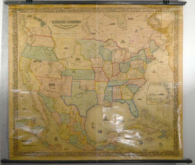
Lot 80
Subject: North America
Colton, Joseph Hutchins
Colton's Map of the United States of America, the British Provinces, Mexico and the West Indies. Showing the Country from the Atlantic to the Pacific Ocean , 1856
Size: 58 x 51.8 inches (147.3 x 131.6 cm)
Estimate: $1,600 - $2,000
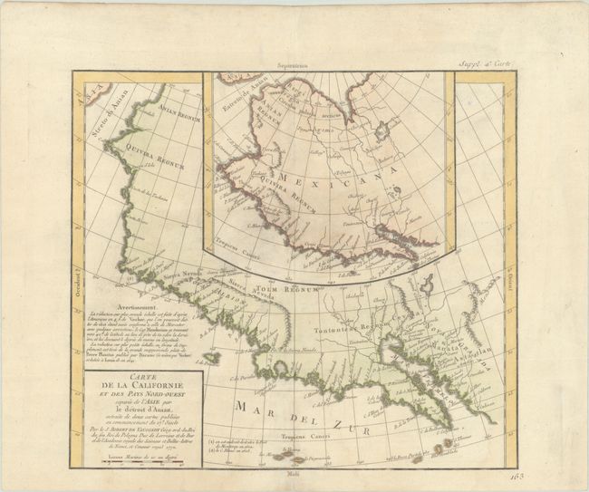
Lot 83
Subject: Western North America
Robert de Vaugondy/Diderot
Carte de la Californie et des Pays Nord-Ouest Separes de l'Asie par le Detroit d'Anian..., 1772
Size: 12.9 x 11.4 inches (32.8 x 29 cm)
Estimate: $150 - $180
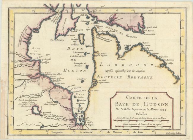
Lot 87
Subject: Eastern Canada, Hudson Bay
Bellin, Jacques Nicolas
Carte de la Baye de Hudson, 1744
Size: 11.5 x 8.5 inches (29.2 x 21.6 cm)
Estimate: $110 - $140
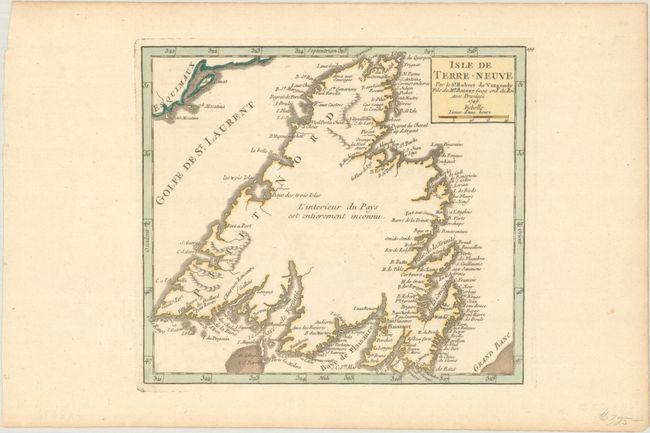
Lot 89
Subject: Newfoundland, Canada
Robert de Vaugondy
Isle de Terre-Neuve, 1749
Size: 7.6 x 6.8 inches (19.3 x 17.3 cm)
Estimate: $140 - $170
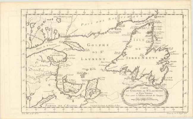
Lot 90
Subject: St. Lawrence Bay, Canada
Bellin, Jacques Nicolas
Carte du Golphe de St. Laurent et Pays Voisins pour Servir a l'Histoire Generale des Voyages, 1780
Size: 14.2 x 8.8 inches (36.1 x 22.4 cm)
Estimate: $95 - $120
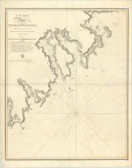
Lot 91
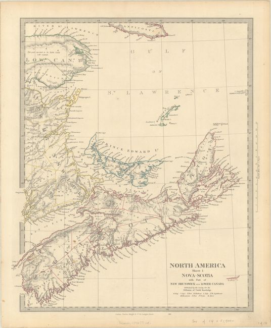
Subject: Nova Scotia, Canada
British Admiralty
Chart of Part of the Coast of Nova Scotia. From Documents in the Hydographical Office of the Admiralty. April 1824. Sheet III, 1831
Size: 24.8 x 30.4 inches (63 x 77.2 cm)
Estimate: $240 - $300
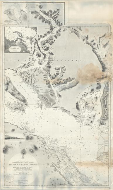
Lot 93
Subject: Strait of Georgia
British Admiralty
North America - West Coast Strait of Georgia - Sheet I. Between Vancouver I. & British Columbia - Fraser R, to N.E. Pt. of Texada I. Including Howe Sound & Jervis Inlet..., 1865
Size: 26.4 x 44.5 inches (67.1 x 113 cm)
Estimate: $275 - $350
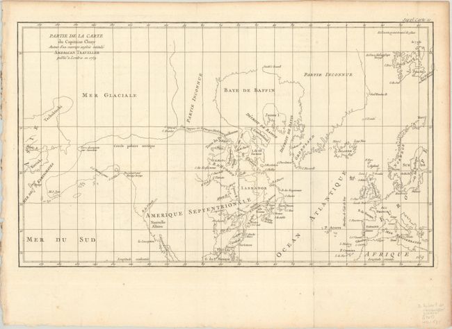
Lot 95
Subject: Colonial United States & Canada, Arctic
Robert de Vaugondy, Didier
Partie de la Carte du Capitaine Cluny Auteur d'un Ouvrage Anglois Intitule American Traveller Publie a Londres en 1769, 1773
Size: 19.6 x 11.6 inches (49.8 x 29.5 cm)
Estimate: $120 - $150
Lot 101
Subject: Eastern United States & Canada, Texas
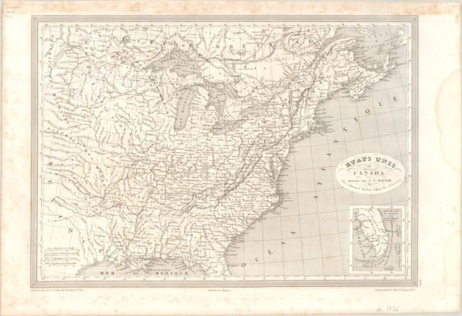
Monin, Charles V.
Etats Unis et Canada , 1830
Size: 18.1 x 12.6 inches (46 x 32 cm)
Estimate: $120 - $150
Lot 102
Subject: Eastern United States & Canada
SDUK Society for the Diffusion of Useful Knowledge
[Lot of 14 - United States & Canada], 1835
Size: See Description
Estimate: $1,000 - $1,300
Lot 103
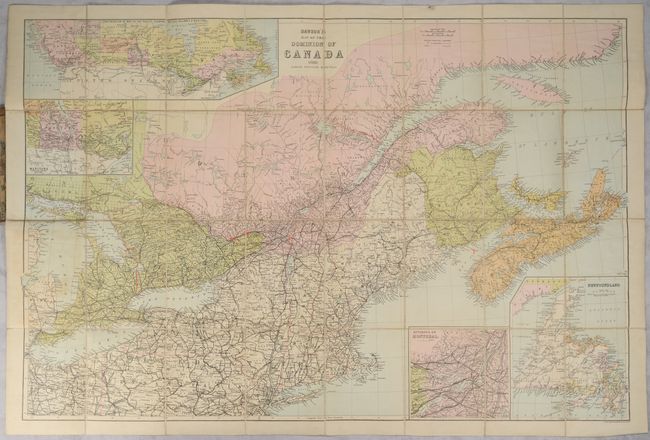
Subject: Eastern United States & Canada
Dawson's Map of the Dominion of Canada, 1888
Size: 32.5 x 21.6 inches (82.6 x 54.9 cm)
Estimate: $160 - $190
Lot 105
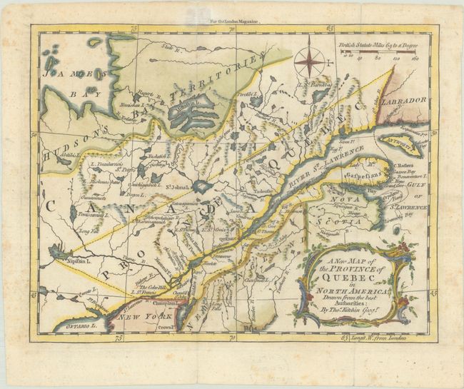
Subject: Colonial Northeastern United States & Canada
Kitchin, Thomas
A New Map of the Province of Quebec in North America; Drawn from the Best Authorities, 1764
Size: 8.7 x 6.8 inches (22.1 x 17.3 cm)
Estimate: $220 - $250
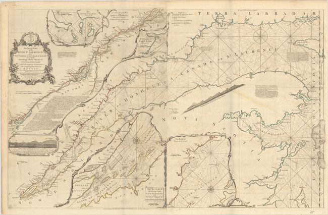
Lot 106
Subject: Colonial Northeastern United States & Canada
Jefferys/Sayer
An Exact Chart of the River St. Laurence, from Fort Frontenac to the Island of Anticosti Shewing the Soundings, Rocks, Shoals &c with Views of the Lands and All Necessary Instructions for Navigating that River to Quebec..., 1775
Size: 37.5 x 23.8 inches (95.3 x 60.5 cm)
Estimate: $600 - $750
Lot 107
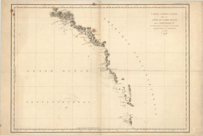
Subject: Western United States & Canada, Alaska
La Perouse, Comte Jean F. Galoup, de
[Lot of 2] Carte Particuliere de la Cote du Nord-Ouest de l'Amerique Reconnue par les Fregates Francaises la Boussole et l'Astrolabe en 1786. 1e Feuille [and] ... 2e Feuille, 1797
Size: 27.1 x 19.5 inches (68.8 x 49.5 cm)
Estimate: $300 - $375
398 lots
Page 1 of 8