Filtered by Category:United States(Show All Categories)
Current Auction
220 lots
Page 1 of 5
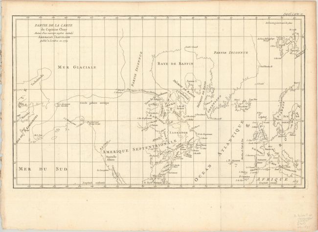
Lot 95
Subject: Colonial United States & Canada, Arctic
Robert de Vaugondy, Didier
Partie de la Carte du Capitaine Cluny Auteur d'un Ouvrage Anglois Intitule American Traveller Publie a Londres en 1769, 1773
Size: 19.6 x 11.6 inches (49.8 x 29.5 cm)
Estimate: $120 - $150
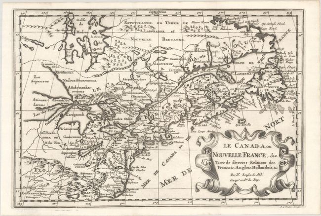
Lot 96
Subject: Colonial Eastern United States & Canada, Great Lakes
Sanson, Nicolas
Le Canada, ou Nouvelle France, &c. Tiree de Diverses Relations des Francois, Anglois, Hollandois, &c, 1700
Size: 11.9 x 8.1 inches (30.2 x 20.6 cm)
Estimate: $475 - $600
Small Version of a Keystone Map for Great Lakes Collections
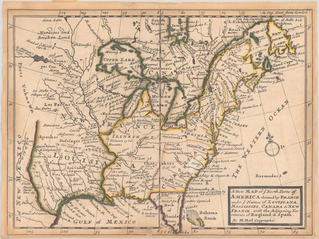
Lot 97
Subject: Colonial Eastern United States & Canada
Moll, Herman
A New Map of ye North Parts of America Claimed by France Under ye Names of Louisiana, Mississipi, Canada & New France. With the Adjoyning Territories of England & Spain, 1736
Size: 10.7 x 7.9 inches (27.2 x 20.1 cm)
Estimate: $400 - $475
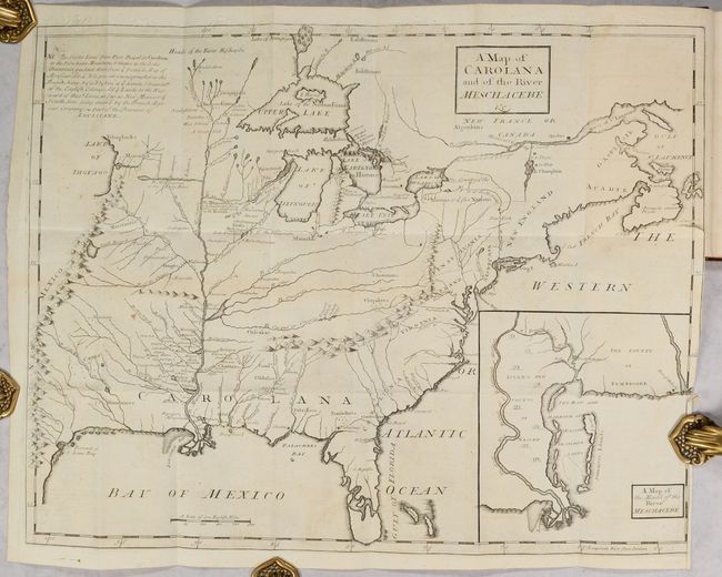
Lot 98
Subject: Colonial Eastern United States & Canada
Coxe, Daniel
[Map in Book] A Map of Carolana and of the River Meschacebe &c. [in] A Description of the English Province of Carolana. By the Spaniards Call'd Florida, and by the French, la Louisiane, 1741
Size: 21.5 x 16.8 inches (54.6 x 42.7 cm)
Estimate: $8,000 - $9,500
First English Depiction of the Mississippi Valley
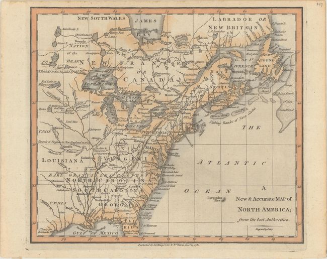
Lot 99
Subject: Colonial Eastern United States & Canada
Cary, John
A New & Accurate Map of North America; from the Best Authorities, 1780
Size: 8.8 x 7.6 inches (22.4 x 19.3 cm)
Estimate: $200 - $230
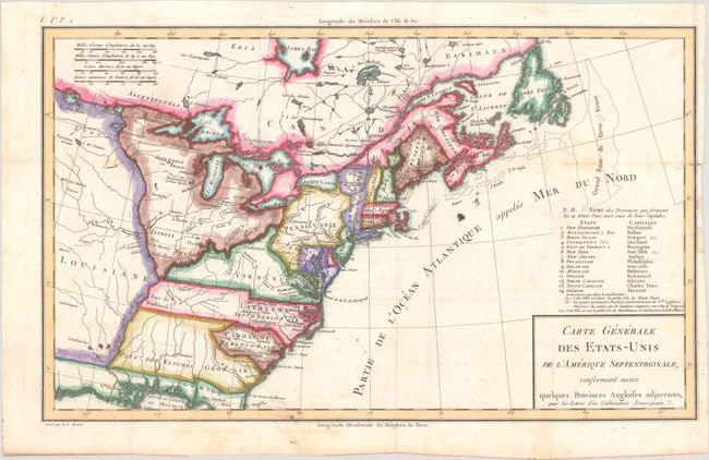
Lot 100
Subject: Eastern United States & Canada, Franklin
Crevecoeur, Michel Guillaume De
Carte Generale des Etats-Unis de l'Amerique Septentrionale, Renfermant Aussi Quelques Provinces Angloises Adjacentes, pour les Lettres d'un Cultivateur Ameriquain, 1787
Size: 16.9 x 10.2 inches (42.9 x 25.9 cm)
Estimate: $600 - $750
One of the Earliest Maps to Name Franklinia
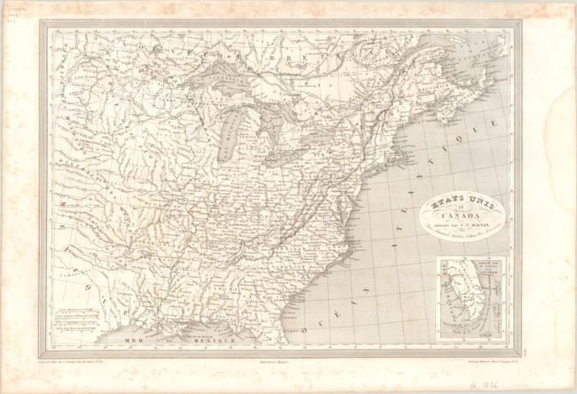
Lot 101
Subject: Eastern United States & Canada, Texas
Monin, Charles V.
Etats Unis et Canada , 1830
Size: 18.1 x 12.6 inches (46 x 32 cm)
Estimate: $120 - $150
Lot 102
Subject: Eastern United States & Canada
SDUK Society for the Diffusion of Useful Knowledge
[Lot of 14 - United States & Canada], 1835
Size: See Description
Estimate: $1,000 - $1,300
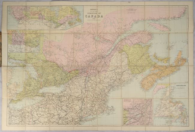
Lot 103
Subject: Eastern United States & Canada
Dawson's Map of the Dominion of Canada, 1888
Size: 32.5 x 21.6 inches (82.6 x 54.9 cm)
Estimate: $160 - $190
Lot 104
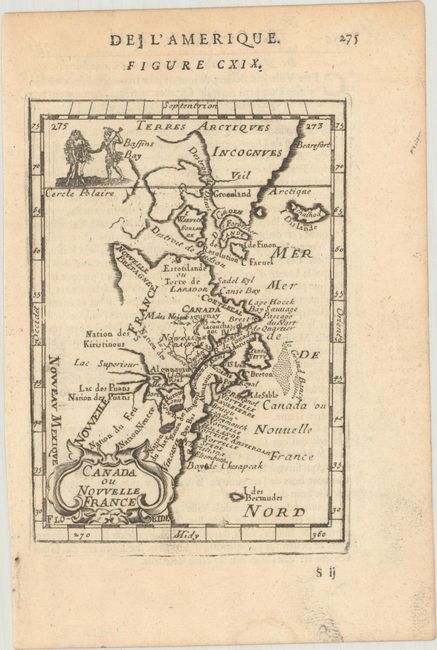
Subject: Colonial Northeastern United States & Canada
Mallet, Alain Manesson
Canada ou Nouvelle France, 1683
Size: 4 x 5.6 inches (10.2 x 14.2 cm)
Estimate: $180 - $220
Lot 105
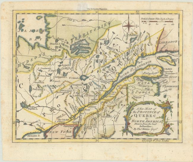
Subject: Colonial Northeastern United States & Canada
Kitchin, Thomas
A New Map of the Province of Quebec in North America; Drawn from the Best Authorities, 1764
Size: 8.7 x 6.8 inches (22.1 x 17.3 cm)
Estimate: $220 - $250
Lot 106
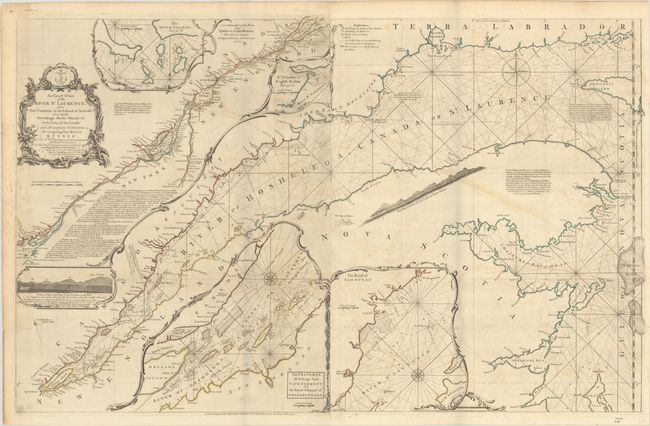
Subject: Colonial Northeastern United States & Canada
Jefferys/Sayer
An Exact Chart of the River St. Laurence, from Fort Frontenac to the Island of Anticosti Shewing the Soundings, Rocks, Shoals &c with Views of the Lands and All Necessary Instructions for Navigating that River to Quebec..., 1775
Size: 37.5 x 23.8 inches (95.3 x 60.5 cm)
Estimate: $600 - $750
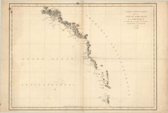
Lot 107
Subject: Western United States & Canada, Alaska
La Perouse, Comte Jean F. Galoup, de
[Lot of 2] Carte Particuliere de la Cote du Nord-Ouest de l'Amerique Reconnue par les Fregates Francaises la Boussole et l'Astrolabe en 1786. 1e Feuille [and] ... 2e Feuille, 1797
Size: 27.1 x 19.5 inches (68.8 x 49.5 cm)
Estimate: $300 - $375
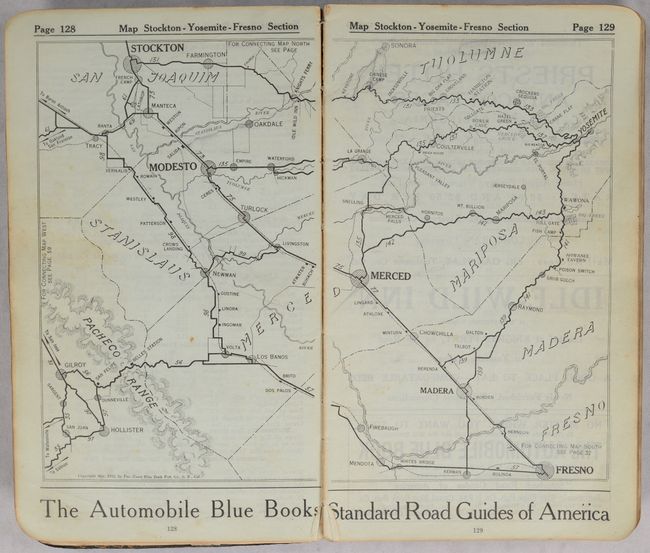
Lot 108
Subject: Western United States & Canada
The Pacific Coast Automobile Blue Book - 1915-1916 - California Washington Oregon British Columbia, 1915
Size: 5.4 x 9.3 inches (13.7 x 23.6 cm)
Estimate: $200 - $250
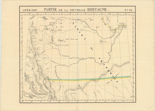
Lot 109
Subject: Northwestern United States & Canada
Vandermaelen, Philippe Marie Guillaume
Amer. Sep. Partie de la Nouvelle Bretagne. No. 32, 1825-27
Size: 22.2 x 18.4 inches (56.4 x 46.7 cm)
Estimate: $275 - $350
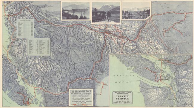
Lot 110
Subject: Northwestern United States & Canada
Railroad Companies, (Various)
The Triangle Tour of British Columbia - Jasper National Park Mount Robson Park Canadian Rockies and the Scenic Seas of the North Pacific Coast [on verso] Alaska and the Yukon, 1930
Size: 29.8 x 16.8 inches (75.7 x 42.7 cm)
Estimate: $150 - $180
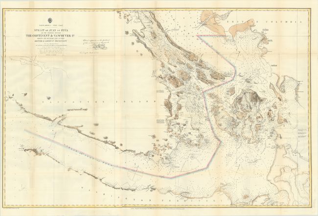
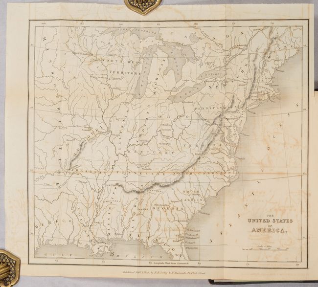
Lot 111
Subject: Washington & British Columbia
U.S. Hydrographic Office
Strait of Juan de Fuca and the Channels Between the Continent & Vancouver Id. Showing the Boundary Line Between British & American Possessions, 1872
Size: 44.4 x 28.9 inches (112.8 x 73.4 cm)
Estimate: $400 - $475
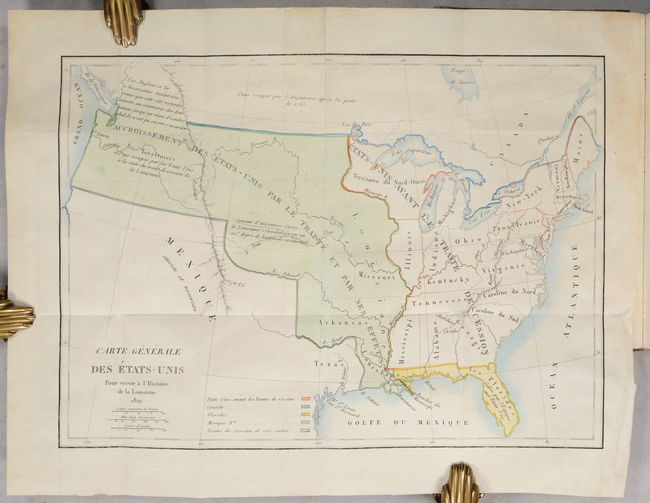
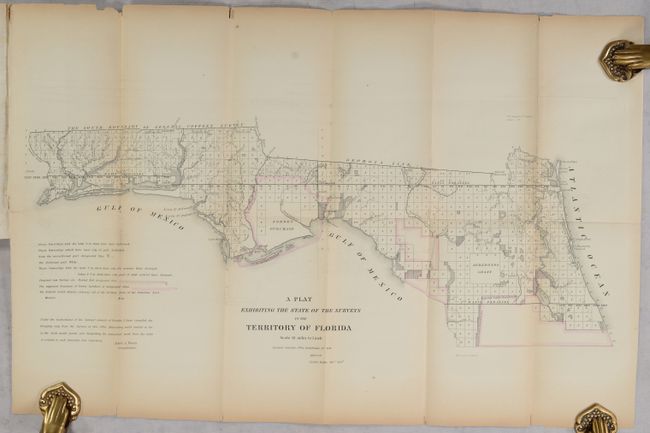
Lot 112
Subject: United States, Louisiana Purchase
Barbe-Marbois, Francois
[Map in Book] Carte Generale des Etats-Unis pour Servir a l'Histoire de la Louisiane [in] Histoire de la Louisiane et de la Cession de Cette Colonie par la France aux Etats-Unis de l'Amerique Septentrionale..., 1829
Size: 13.3 x 9.4 inches (33.8 x 23.9 cm)
Estimate: $800 - $1,000
History of the Louisiana Purchase
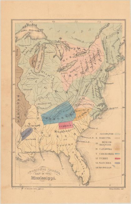
Lot 113
Subject: United States
[Lot of 3] Aboriginal America, East of the Mississippi [and] Map of the Indian Colonies West of Missouri and Arkansas [and] Outline Map of Indian Localities in 1833, 1844-87
Size: See Description
Estimate: $180 - $220
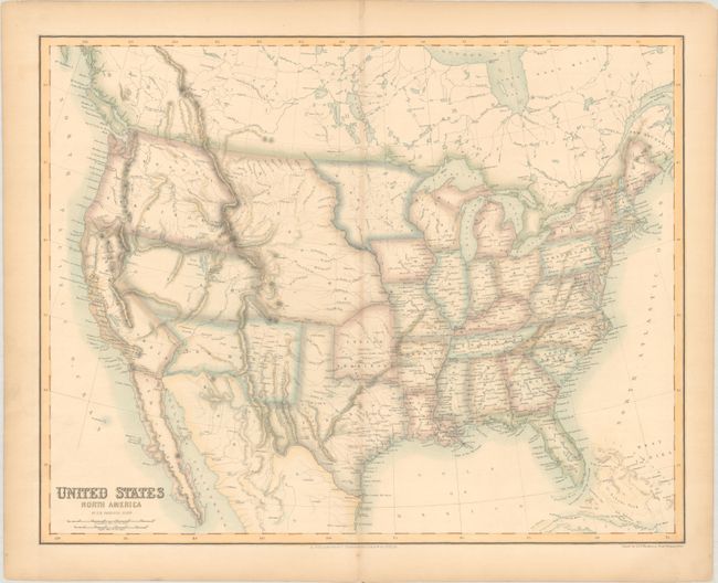
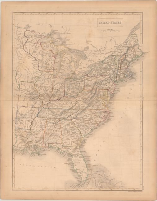
Lot 114
Subject: United States
Swanston/Fullarton
United States North America, 1852
Size: 20.8 x 16.4 inches (52.8 x 41.7 cm)
Estimate: $160 - $190
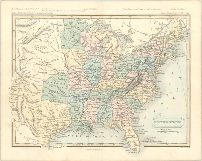
Lot 115
Subject: United States
Johnson & Browning
Colton's Map of the United States of America, 1855
Size: 26.5 x 15.9 inches (67.3 x 40.4 cm)
Estimate: $400 - $475
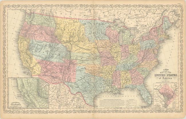
Lot 116
Subject: United States
Desilver, Charles
A New Map of the United States of America by J.H. Young, 1857
Size: 26.4 x 15.9 inches (67.1 x 40.4 cm)
Estimate: $275 - $350
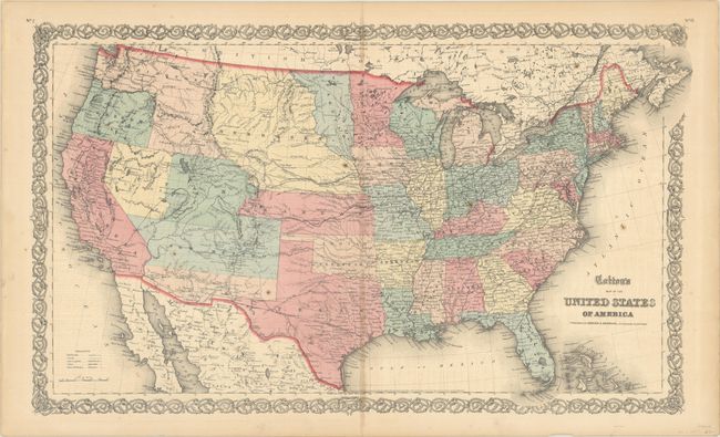
Lot 117
Subject: United States
Phelps & Watson
Phelps' New National Map of the United States, 1859
Size: 36.5 x 37.8 inches (92.7 x 96 cm)
Estimate: $2,200 - $2,500
Attractive Wall Map Issued at the Onset of the Civil War
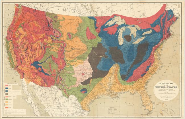
Lot 118
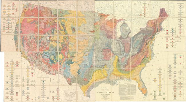
Subject: United States
Hitchcock, Charles Henry
Geological Map of the United States Compiled for the 9th Census by C.H. Hitchcock and W.P. Blake, 1872
Size: 33.5 x 21.6 inches (85.1 x 54.9 cm)
Estimate: $300 - $375
First Edition
Lot 119
Subject: United States
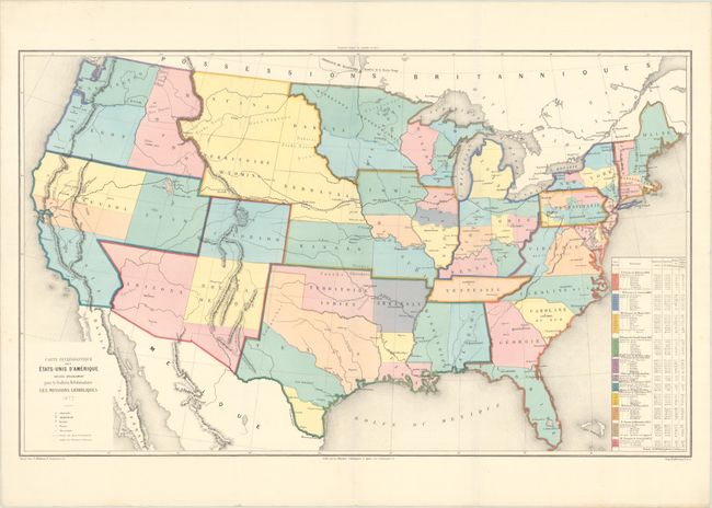
Carte Ecclesiastique des Etats-Unis d'Amerique Dressee Specialement pour le Bulletin Hebdomadaire les Missions Catholiques, 1877
Size: 30.1 x 18.2 inches (76.5 x 46.2 cm)
Estimate: $275 - $350
Thematic Map Showing the Boom in American Catholicism in the Late 19th Century
Lot 120
Subject: United States
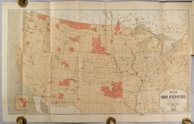
U.S. Bureau of Indian Affairs
[Map in Book] Map of the Indian Reservations Within the Limits of the United States [in] Annual Report of the Commissioner of Indian Affairs to the Secretary of the Inferior for the Year 1883 , 1883
Size: 30.3 x 17.4 inches (77 x 44.2 cm)
Estimate: $180 - $220
Lot 121
Subject: United States
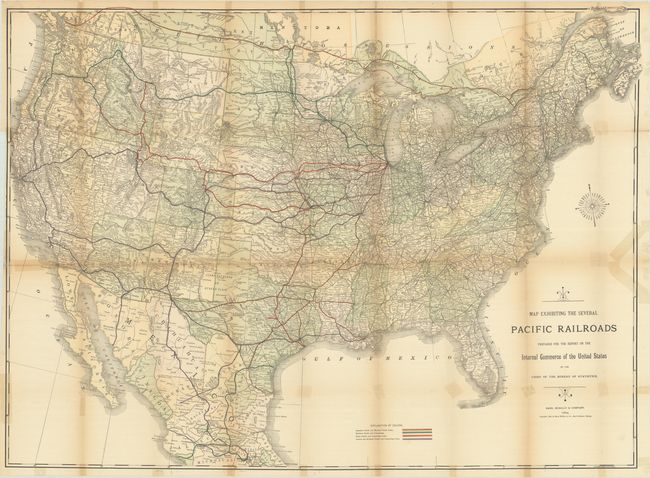
Rand McNally & Co.
Map Exhibiting the Several Pacific Railroads Prepared for the Report on the Internal Commerce of the United States by the Chief of the Bureau of Statistics, 1884
Size: 43 x 31.3 inches (109.2 x 79.5 cm)
Estimate: $200 - $230
Lot 122
Subject: United States
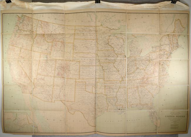
U.S. Geological Survey (USGS)
United States Compiled Under the Direction of Henry Gannett, Chief Topographer..., 1898
Size: 77.1 x 48.8 inches (195.8 x 124 cm)
Estimate: $300 - $375
Lot 123
Subject: United States
U.S. Geological Survey (USGS)
[On 4 Sheets] Geologic Map of the United States, 1932
Size: 46 x 24.8 inches (116.8 x 63 cm)
Estimate: $550 - $700
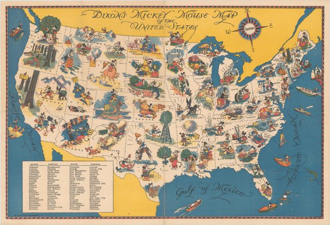
Lot 124
Subject: United States
Dixon's Mickey Mouse Map of the United States, 1932
Size: 13.8 x 9.3 inches (35.1 x 23.6 cm)
Estimate: $275 - $350
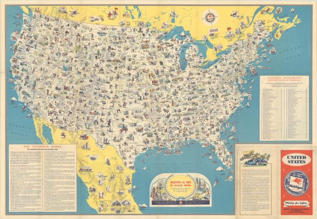
Lot 125
Subject: United States
Sights to See in Every State - And There Are Ever So Many More That Could Never Be Shown on a Map of This Size, 1936
Size: 30.8 x 21.3 inches (78.2 x 54.1 cm)
Estimate: $140 - $170
Early Version of a Popular Pictorial Map
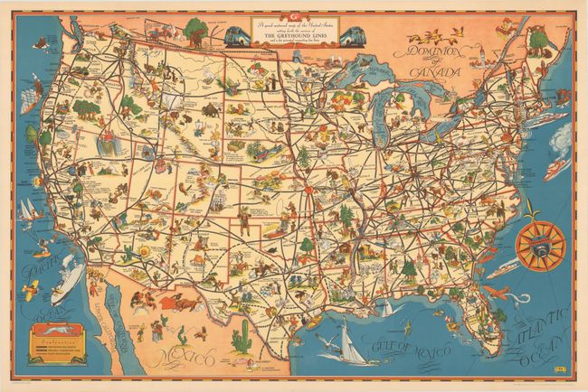
Lot 126
Subject: United States
A Good-Natured Map of the United States Setting Forth the Services of the Greyhound Lines and a Few Principal Connecting Bus Lines, 1939
Size: 29 x 19.1 inches (73.7 x 48.5 cm)
Estimate: $160 - $190
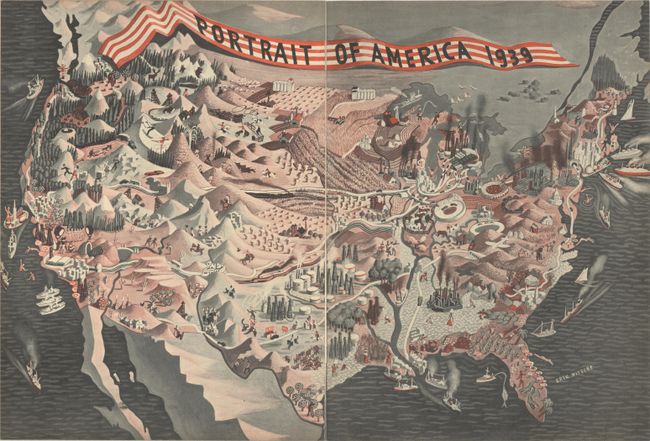
Lot 127
Subject: United States, World War II
Portrait of America 1939, 1939
Size: 20.8 x 14.1 inches (52.8 x 35.8 cm)
Estimate: $90 - $110
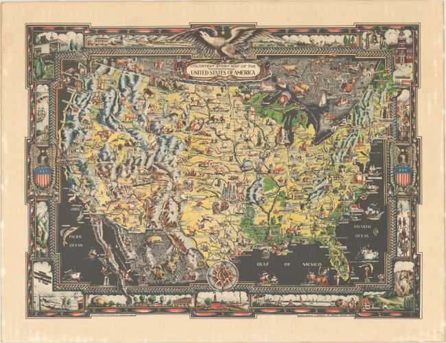
Lot 128
Subject: United States
Colortext Story Map of the United States of America [on verso] The Colortext World in Black and White Mercator Projection, 1944
Size: 20 x 14.9 inches (50.8 x 37.8 cm)
Estimate: $200 - $230
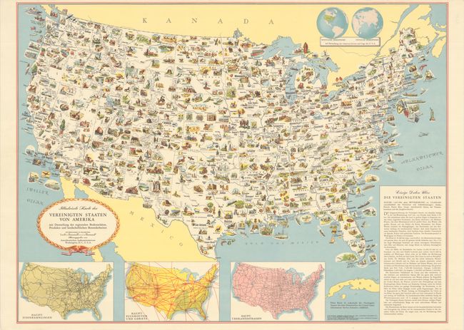
Lot 129
Subject: United States
Illustrierte Karte der Vereinigten Staaten von Amerika mit Darstellung der Regionalen Bodenschatze, Produckte und Landschaftlichen Besonderheiten, 1952
Size: 31.3 x 23.3 inches (79.5 x 59.2 cm)
Estimate: $120 - $150
NO RESERVE
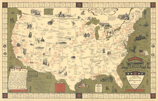
Lot 130
Subject: United States
United States of America - A Map of History and Other Best Pleasures and Treasures, 1953
Size: 25.8 x 16.3 inches (65.5 x 41.4 cm)
Estimate: $160 - $190
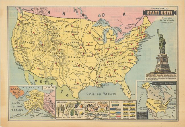
Lot 131
Subject: United States
Stati Uniti - Grande Atlante dei Paesi d'America Seconda Tavola, 1958
Size: 21 x 14.3 inches (53.3 x 36.3 cm)
Estimate: $120 - $150
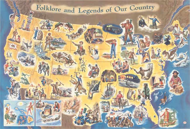
Lot 132
Subject: United States
Folklore and Legends of Our Country, 1960
Size: 35.5 x 24 inches (90.2 x 61 cm)
Estimate: $160 - $190
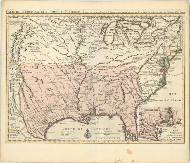
Lot 133
Subject: Colonial Eastern United States, Louisiana Territory
Delisle/Covens & Mortier
Carte de la Louisiane et du Cours du Mississipi Dressee sur un Grand Nombre de Memoires Entr' Autres sur ceux de Mr. le Maire, 1730
Size: 23.5 x 17.2 inches (59.7 x 43.7 cm)
Estimate: $2,200 - $2,500
Delisle's Influential Map of the Louisiana Territory
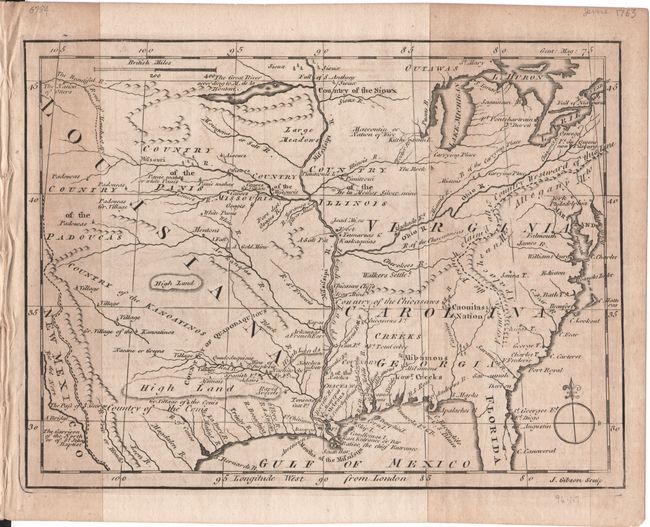
Lot 134
Subject: Colonial Eastern United States
Gibson, John
[Untitled - North America, Louisiana, Virginia & Carolina] [in] The Gentleman's Magazine ... For June 1763, 1763
Size: 9.6 x 7.1 inches (24.4 x 18 cm)
Estimate: $160 - $190
Lot 135
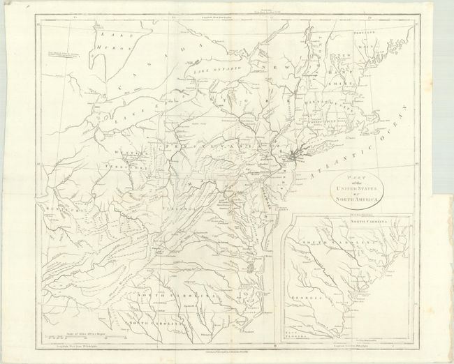
Subject: Eastern United States
Stockdale, John
Part of the United States of North America, 1798
Size: 18.5 x 16.2 inches (47 x 41.1 cm)
Estimate: $200 - $230
Lot 136
Subject: Eastern United States, Revolutionary War
Marshall, John
[Atlas Volume] The Life of George Washington. Maps and Subscribers' Names, 1807
Size: 9.2 x 11.3 inches (23.4 x 28.7 cm)
Estimate: $1,000 - $1,300
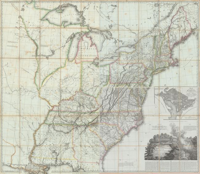
Lot 137
Subject: Eastern United States
Tardieu, Pierre Francois
[On 4 Sheets] United States of Nth America - Carte des Etats-Unis de l'Amerique Septentrionale Copiee et Gravee sur celle d'Arrowsmith..., 1812
Size: 27.9 x 23.9 inches (70.9 x 60.7 cm)
Estimate: $3,500 - $4,500
Rare French Edition of Arrowsmith's Influential Map of the United States
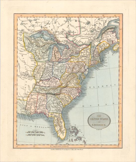
Lot 138
Subject: Eastern United States
Cary, John
The United States of America, 1819
Size: 9.1 x 11.1 inches (23.1 x 28.2 cm)
Estimate: $350 - $425
Lot 139
Subject: Eastern United States
[Map in Book] The United States of America [in] The Rambler in North America (Volume 1), 1836
Size: 11.5 x 9.8 inches (29.2 x 24.9 cm)
Estimate: $140 - $170
Lot 140
Subject: Eastern United States
General Land Office
[12 Maps in Report] Report from the Commissioner of the General Land Office, Showing the Operations of that Office since the 17th December, 1838, 1839
Size: 5.5 x 9 inches (14 x 22.9 cm)
Estimate: $140 - $170
NO RESERVE
Lot 141
Subject: Eastern United States
Black, Adam & Charles
United States, 1840
Size: 15.3 x 19.8 inches (38.9 x 50.3 cm)
Estimate: $110 - $140
Lot 142
Subject: Eastern United States
Hall, Sidney
United States, 1849
Size: 10.4 x 8.1 inches (26.4 x 20.6 cm)
Estimate: $150 - $180
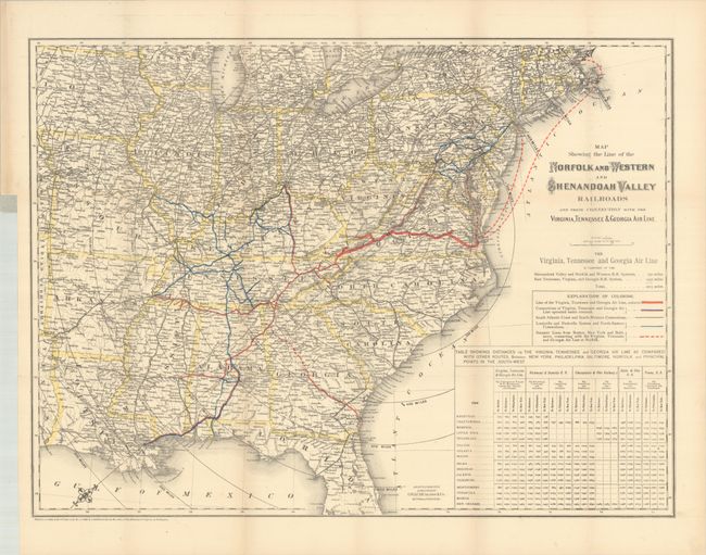
Lot 143
Subject: Eastern United States
Colton, G.W. & C.B.
Map Showing the Line of the Norfolk and Western and Shenandoah Valley Railroads and Their Connection with the Virginia, Tennessee & Georgia Air Line [with report] First Annual Report of the President and Directors of the Norfolk & Western Railroad Company, 1881
Size: 25.7 x 19.2 inches (65.3 x 48.8 cm)
Estimate: $120 - $150
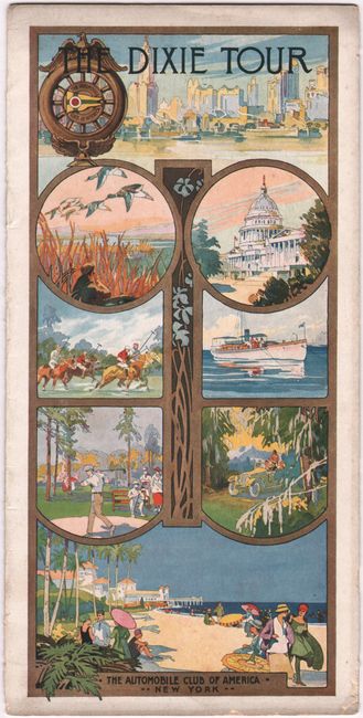
Lot 144
Subject: Eastern United States
The Automobile Club of America
The Dixie Tour, 1917
Size: 4.6 x 9.3 inches (11.7 x 23.6 cm)
Estimate: $140 - $170
Unrecorded Early Motor Guide to Florida
220 lots
Page 1 of 5