Filtered by Category:Atlantic & Arctic(Show All Categories)
Current Auction
13 lots
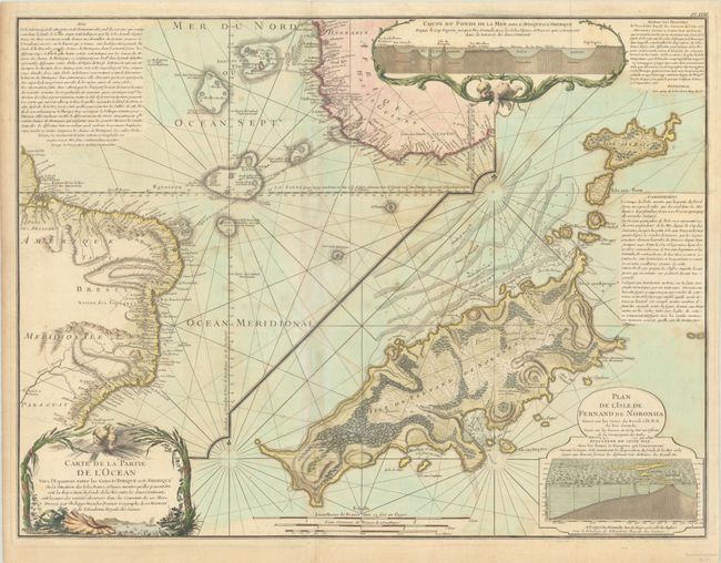
Lot 392
Subject: Atlantic Ocean
Buache/Dezauche
Carte de la Partie de l'Ocean Vers l'Equateur Entre les Cotes d'Afrique et d'Amerique... [on sheet with] Plan de l'Isle de Fernand de Noronha…, 1780
Size: 25.1 x 19.1 inches (63.8 x 48.5 cm)
Estimate: $350 - $425
Map Promoting Theory of Undersea Mountains
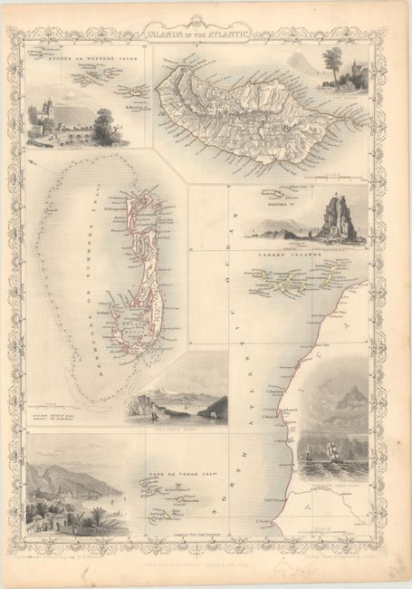
Lot 393
Subject: Atlantic Islands
Tallis, John
Islands in the Atlantic, 1851
Size: 9.9 x 13.9 inches (25.1 x 35.3 cm)
Estimate: $75 - $95
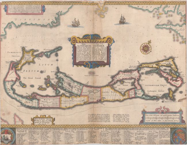
Lot 394
Subject: Bermuda
Speed, John
Mappa Aestivarum Insularum Alias Bermudas Dictarum... / A Mapp of the Sommer Islands Once Called the Bermudas..., 1626
Size: 20.4 x 15.7 inches (51.8 x 39.9 cm)
Estimate: $1,400 - $1,700
Speed's Foundation Map of Bermuda
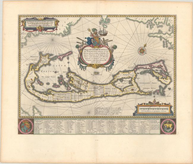
Lot 395
Subject: Bermuda
Blaeu, Willem
Mappa Aestivarum Insularum, Alias Barmudas Dictarum, ad Ostia Mexicani Aestuary..., 1642
Size: 21 x 15.9 inches (53.3 x 40.4 cm)
Estimate: $1,600 - $1,900
Map of Bermuda Based on Richard Norwood's Famous Survey in Full Contemporary Color
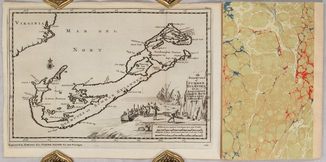
Lot 396
Subject: Bermuda
Aa, Pieter van der
[Map in Disbound Book] De Bermudes of Summer Eylanden tot de Reystogten... [in] Kort Berigt van Mr. Ellis, een der Kapiteynen van d'Heer Richard Hawkins ... Reys door de Straat van Magellanes in 't Jaar 1593... , 1706
Size: 9.1 x 6.1 inches (23.1 x 15.5 cm)
Estimate: $1,200 - $1,500
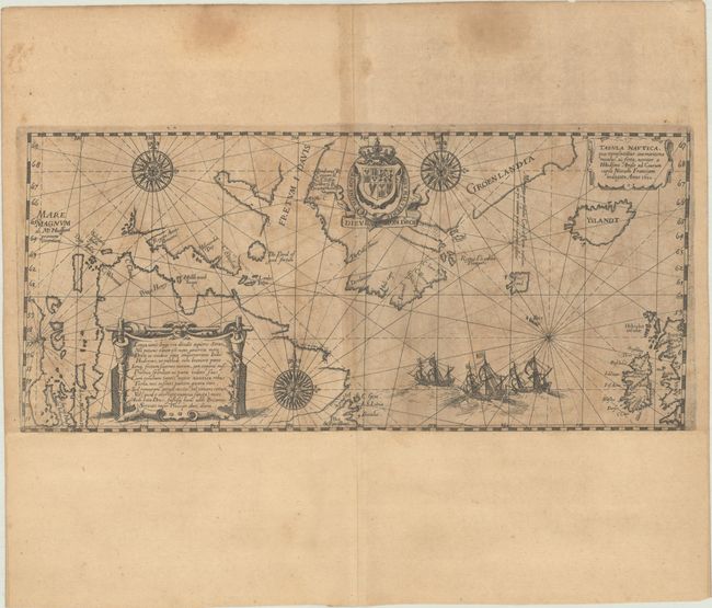
Lot 397
Subject: North Atlantic
Bry, Johann Theodore de
Tabula Nautica, qua Repraesentatur Orae Maritimae Meatus, ac Freta, Noviter a H Hudsono Anglo ad Caurum Supra Novam Franciam Indagata Anno 1612, 1613
Size: 13.1 x 5.9 inches (33.3 x 15 cm)
Estimate: $1,400 - $1,700
De Bry's Scarce and Decorative Chart Showing Hudson's Search for a Northwest Passage
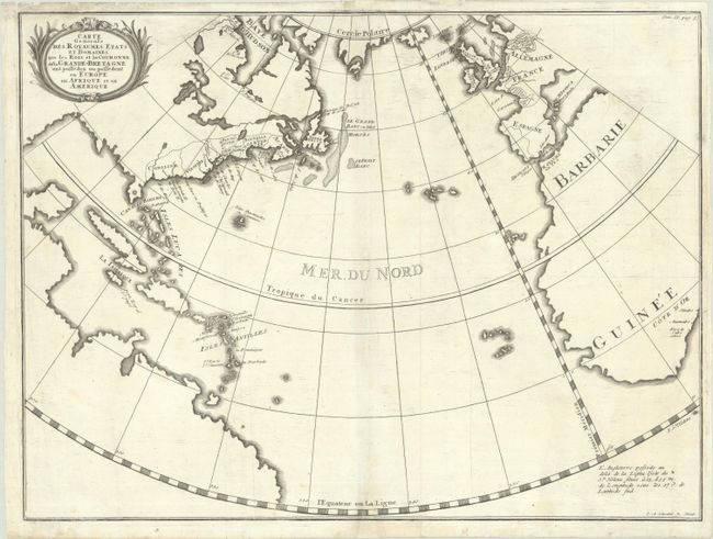
Lot 398
Subject: North Atlantic
Carte Generale des Royaumes, Etats et Domaines, que les Rois et la Couronne de la Grande-Bretagne ont Possedez ou Possedent en Europe eb Afrique et en Amerique, 1740
Size: 19.2 x 14.4 inches (48.8 x 36.6 cm)
Estimate: $350 - $425
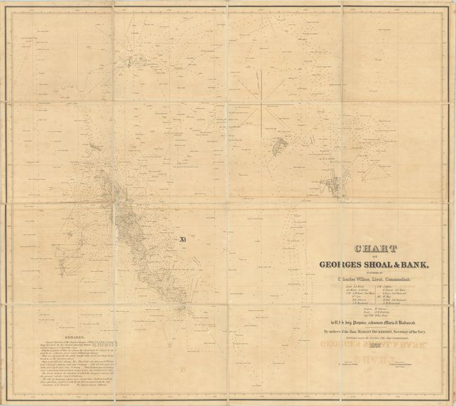
Lot 399
Subject: North Atlantic
Wilkes, Charles
Chart of Georges Shoal & Bank, Surveyed by Charles Wilkes, Lieut. Commandant..., 1837
Size: 43.9 x 39 inches (111.5 x 99.1 cm)
Estimate: $550 - $700
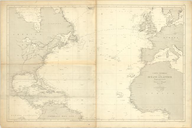
Lot 400
Subject: North Atlantic
Robiquet, Aime
Carte Generale l'Ocean Atlantique Septentrional Dressee d'Apres les Documents les Plus Recents, 1855
Size: 39.5 x 27.2 inches (100.3 x 69.1 cm)
Estimate: $300 - $375
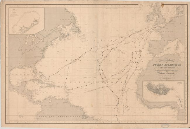
Lot 401
Subject: North Atlantic
Direccion de Hidrografia
Carta General del Oceano Atlantico Septentrional, 1872
Size: 36.6 x 23.8 inches (93 x 60.5 cm)
Estimate: $240 - $300
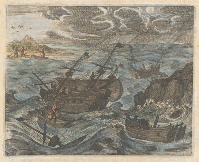
Lot 402
Subject: Bay of Biscay
Bry, Theodore de
[Untitled - John Smith Is Caught by the French], 1631
Size: 6.8 x 5.4 inches (17.3 x 13.7 cm)
Estimate: $110 - $140
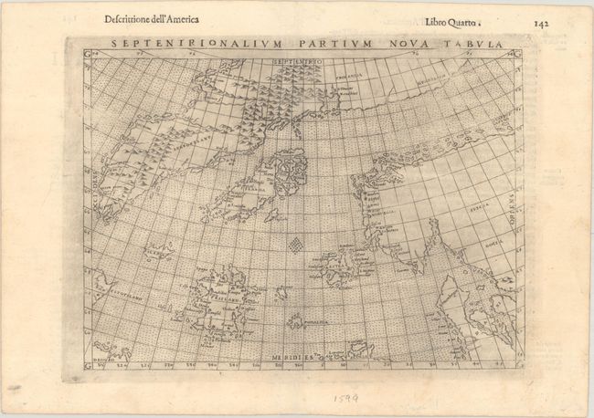
Lot 403
Subject: Arctic & Scandinavia
Ruscelli, Girolamo
Septenirionalium Partium Nova Tabula, 1599
Size: 9.4 x 6.9 inches (23.9 x 17.5 cm)
Estimate: $600 - $750
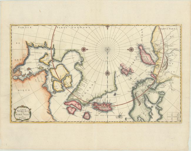
Lot 404
Subject: Arctic
Bernard, Jean Frederic
Carte du Nord Est & du Nord West du Pole, 1717
Size: 22.8 x 13.1 inches (57.9 x 33.3 cm)
Estimate: $550 - $700
13 lots