Filtered by Category:Books, Atlases, Travel Guides, Geography & Reference Books(Show All Categories)
Current Auction
59 lots
Page 1 of 2
Lot 37
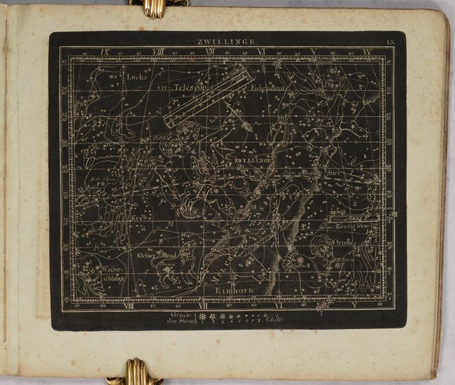
Subject: Celestial Atlas
Goldbach, Christian Friedrich
Neuester Himmels-Atlas zum Gebrauche sur Schul- und Akademischen Unterricht, nach Flamsteed, Bradley, Tob. Mayer, De la Caille, Le Francais de la Lande und v. Zach..., 1803
Size: 11.5 x 10 inches (29.2 x 25.4 cm)
Estimate: $2,000 - $2,400
Unique Celestial Atlas with Stars in Relief Against a Black Sky
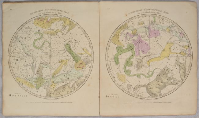
Lot 38
Subject: Celestial Atlas
Burritt, Elijah H.
Atlas, Designed to Illustrate the Geography of the Heavens, Comprising the Following Maps or Plates..., 1835
Size: 14.3 x 16.5 inches (36.3 x 41.9 cm)
Estimate: $475 - $600
Sold for: $350
Closed on 4/24/2024
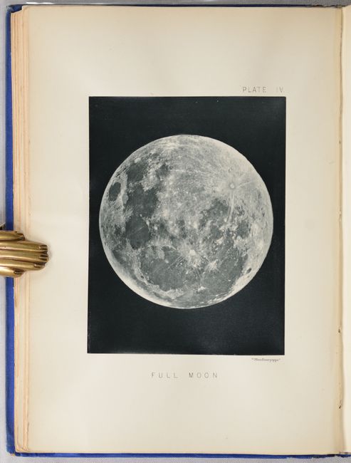
Lot 41
Subject: Moon
The Moon: Considered as a Planet, a World, and a Satellite, 1885
Size: 6.6 x 9.3 inches (16.8 x 23.6 cm)
Estimate: $1,000 - $1,300
Selenology with 25 Woodburytypes
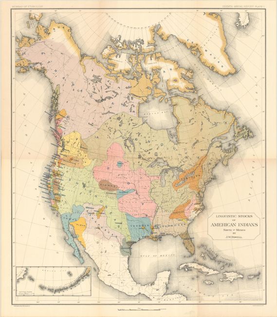
Lot 81
Subject: North America
Powell, John Wesley
[Map with Book] Linguistic Stocks of American Indians North of Mexico [with] Seventh Annual Report of the Bureau of Ethnology to the Secretary of the Smithsonian Institution 1885-'86, 1891
Size: 17.6 x 20.4 inches (44.7 x 51.8 cm)
Estimate: $200 - $230
Sold for: $650
Closed on 4/24/2024
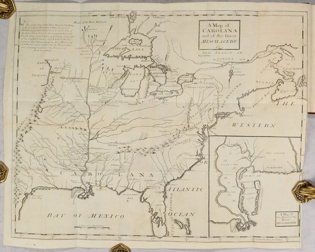
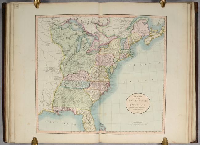
Lot 98
Subject: Colonial Eastern United States & Canada
Coxe, Daniel
[Map in Book] A Map of Carolana and of the River Meschacebe &c. [in] A Description of the English Province of Carolana. By the Spaniards Call'd Florida, and by the French, la Louisiane, 1741
Size: 21.5 x 16.8 inches (54.6 x 42.7 cm)
Estimate: $8,000 - $9,500
First English Depiction of the Mississippi Valley
Sold for: $7,500
Closed on 4/24/2024
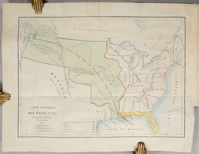
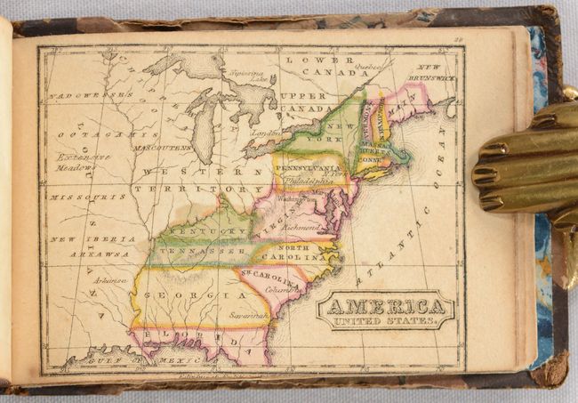
Lot 112
Subject: United States, Louisiana Purchase
Barbe-Marbois, Francois
[Map in Book] Carte Generale des Etats-Unis pour Servir a l'Histoire de la Louisiane [in] Histoire de la Louisiane et de la Cession de Cette Colonie par la France aux Etats-Unis de l'Amerique Septentrionale..., 1829
Size: 13.3 x 9.4 inches (33.8 x 23.9 cm)
Estimate: $800 - $1,000
History of the Louisiana Purchase
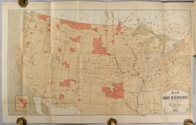
Lot 120
Subject: United States
U.S. Bureau of Indian Affairs
[Map in Book] Map of the Indian Reservations Within the Limits of the United States [in] Annual Report of the Commissioner of Indian Affairs to the Secretary of the Inferior for the Year 1883 , 1883
Size: 30.3 x 17.4 inches (77 x 44.2 cm)
Estimate: $180 - $220
Sold for: $170
Closed on 4/24/2024
Lot 136
Subject: Eastern United States, Revolutionary War
Marshall, John
[Atlas Volume] The Life of George Washington. Maps and Subscribers' Names, 1807
Size: 9.2 x 11.3 inches (23.4 x 28.7 cm)
Estimate: $1,000 - $1,300
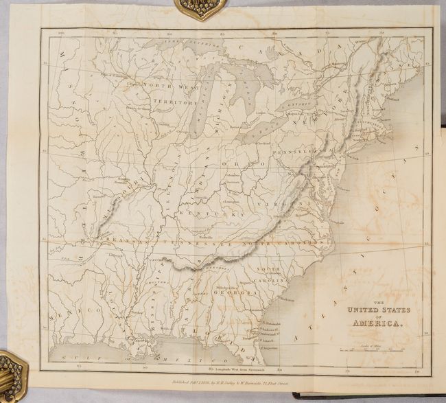
Lot 139
Subject: Eastern United States
[Map in Book] The United States of America [in] The Rambler in North America (Volume 1), 1836
Size: 11.5 x 9.8 inches (29.2 x 24.9 cm)
Estimate: $140 - $170
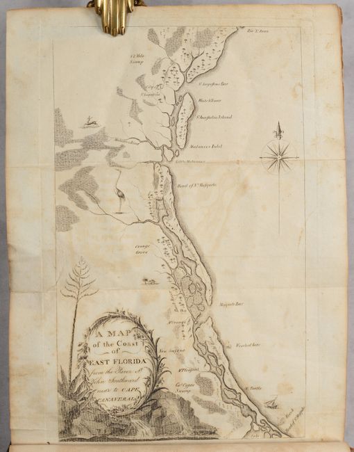
Lot 157
Subject: Southeastern United States
Bartram, William
Travels Through North & South Carolina, Georgia, East & West Florida, the Cherokee Country, the Extensive Territories of the Muscogulges, or Creek Confederacy, and the Country of the Chactaws..., 1791
Size: 5.9 x 9.8 inches (15 x 24.9 cm)
Estimate: $10,000 - $12,000
Complete First Edition of Bartram's Work on the American Southeast
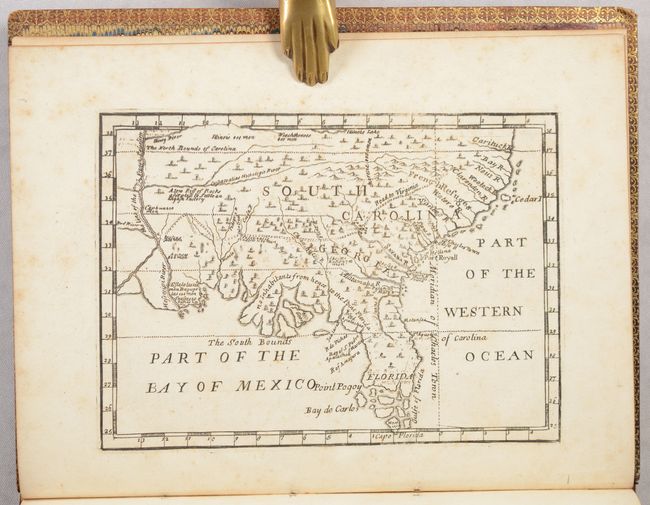
Lot 162
Subject: Colonial Southern United States
[Map in Book] [New Map of Georgia] [in] Reasons for Establishing the Colony of Georgia, with Regard to the Trade of Great Britain..., 1733
Size: 7.3 x 5.3 inches (18.5 x 13.5 cm)
Estimate: $5,500 - $6,500
First Printed Map to Name Georgia
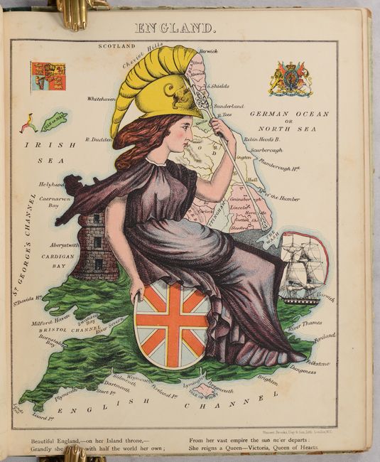
Lot 417
Subject: European Countries
Aleph
Geographical Fun: Being Humorous Outlines of Various Countries. With an Introduction and Descriptive Lines, 1869
Size: 9.3 x 11.1 inches (23.6 x 28.2 cm)
Estimate: $2,000 - $2,500
Book with 12 Satirical Maps of European Countries
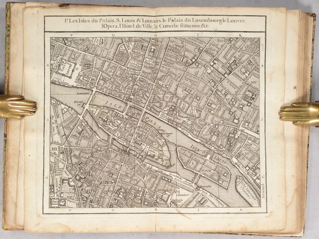
Lot 496
Subject: Paris, France
Robert de Vaugondy, Didier
Tablettes Parisiennes qui Contiennent le Plan de la Ville & des Faubourgs de Paris Divise en Vingt Quartiers..., 1760
Size: 5.8 x 8.8 inches (14.7 x 22.4 cm)
Estimate: $600 - $750
Sold for: $450
Closed on 4/24/2024
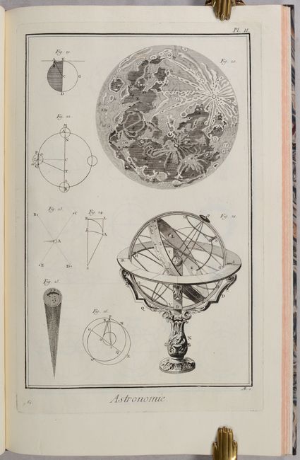
Lot 719
Subject: Prints - Astronomy
Diderot, Denis
Recueil de Planches sur les Sciences, les Arts Liberaux, et les Arts Mechaniques..., 1767
Size: 10.5 x 16.4 inches (26.7 x 41.7 cm)
Estimate: $800 - $950
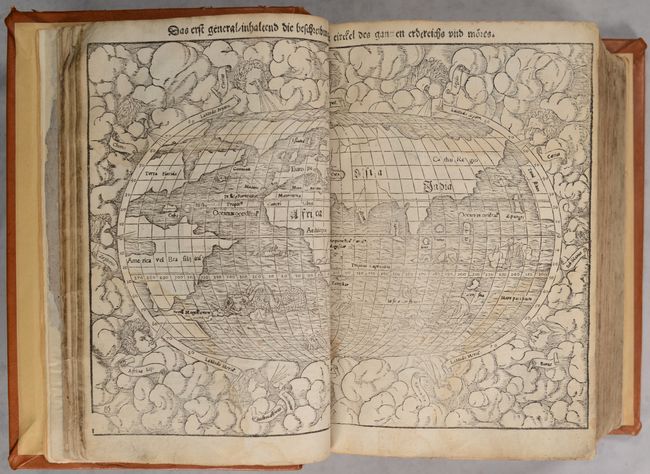
Lot 756
Subject: Atlases
Munster, Sebastian
[Cosmographey oder Beschreibung aller Länder], 1567
Size: 8.8 x 12.5 inches (22.4 x 31.8 cm)
Estimate: $12,000 - $15,000
Superbly Bound Edition of Cosmographia with 115 Maps & Views
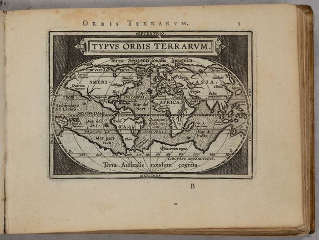
Lot 757
Subject: Atlases
Ortelius/Vrients
Epitome Theatri Orteliani, Praecipuarum Orbis Regionum Delineationes..., 1601
Size: 6.5 x 5 inches (16.5 x 12.7 cm)
Estimate: $7,000 - $8,500
Complete, Rare Miniature Atlas Based on Ortelius with 126 Maps
Sold for: $5,000
Closed on 4/24/2024
Lot 758
Subject: Atlases
Cary, John
Cary's New Universal Atlas, Containing Distinct Maps of All the Principal States and Kingdoms Throughout the World. From the Latest and Best Authorities Extant, 1808
Size: 14.6 x 21.6 inches (37.1 x 54.9 cm)
Estimate: $5,500 - $6,500
One of the Finest English Atlases of the Period
Sold for: $5,500
Closed on 4/24/2024
Lot 759
Subject: Atlases
Murphy, William
Atlas Minima, Comprehended in 30 Maps, 1824
Size: 4.1 x 2.7 inches (10.4 x 6.9 cm)
Estimate: $700 - $850
Sold for: $500
Closed on 4/24/2024
Lot 760
Subject: Atlases
Mitchell, Samuel Augustus
A New Universal Atlas Containing Maps of the Various Empires, Kingdoms, States and Republics of the World..., 1848
Size: 14.3 x 17.6 inches (36.3 x 44.7 cm)
Estimate: $3,500 - $4,250
Mitchell's Desirable Atlas Complete with 73 Plates
Sold for: $2,500
Closed on 4/24/2024
Lot 761
Subject: Atlases
Colton, Joseph Hutchins
Colton's General Atlas, Containing One Hundred and Seventy Steel Plate Maps and Plans, on One Hundred Imperial Folio Sheets..., 1860
Size: 15.3 x 18 inches (38.9 x 45.7 cm)
Estimate: $2,750 - $3,500
Colton's Impressive General Atlas with 103 Maps
Sold for: $2,100
Closed on 4/24/2024
Lot 762
Subject: Atlases
Hardesty, Hiram H.
Historical Atlas of the World Illustrated Giving Histories and Maps of All the Countries in Their Geographical Statistical and Commercial Aspects..., 1875
Size: 14.8 x 20 inches (37.6 x 50.8 cm)
Estimate: $475 - $600
Sold for: $350
Closed on 4/24/2024
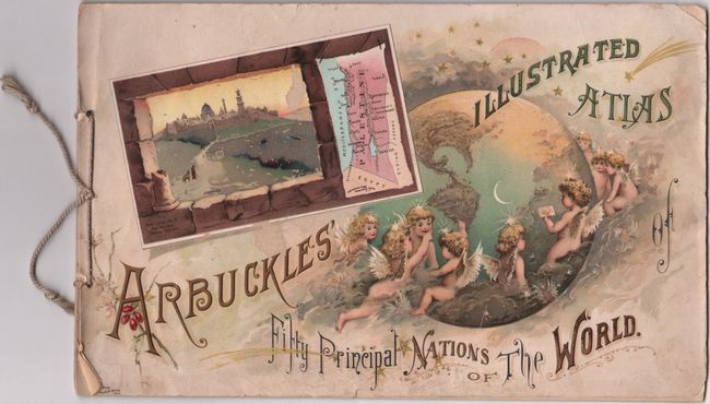
Lot 763
Subject: Atlases
Arbuckle Bros. Coffee Co.
Arbuckles' Illustrated Atlas of Fifty Principal Nations of the World, 1889
Size: 11 x 6.9 inches (27.9 x 17.5 cm)
Estimate: $350 - $425
Sold for: $250
Closed on 4/24/2024
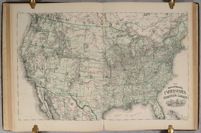
Lot 764
Subject: Atlases
Walker, Henry B.
Walker's International Atlas Containing Over One Hundred and Twenty New Maps..., 1891
Size: 13.8 x 18 inches (35.1 x 45.7 cm)
Estimate: $475 - $600
Unusual Atlas Featuring Both Hand-Colored and Printed Maps
Sold for: $350
Closed on 4/24/2024
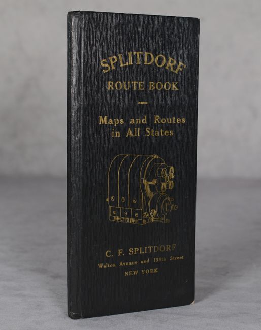
Lot 765
Subject: Road Atlas
Splitdorf Route Book - Maps and Routes in All States, 1910
Size: 4.4 x 9.4 inches (11.2 x 23.9 cm)
Estimate: $150 - $180
One of the Earliest U.S. Road Atlases
Sold for: $170
Closed on 4/24/2024
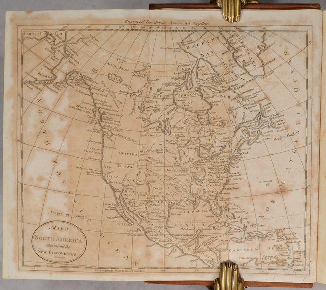
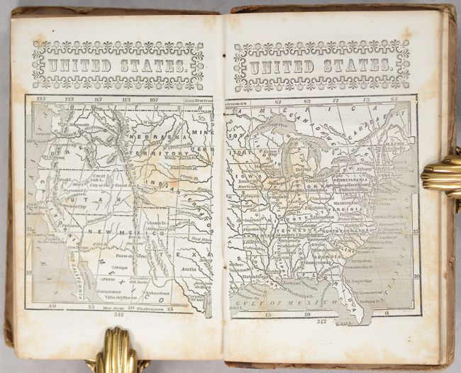
Lot 766
Subject: Geography Books
Morse, Jedidiah (Rev.)
[2 Volumes] The American Gazetteer, Exhibiting a Full Account of the Civil Divisions, Rivers, Harbours, Indian Tribes, &c. of the American Continent... [and] A New Gazetteer of the Eastern Continent..., 1802-04
Size: 5.3 x 8.6 inches (13.5 x 21.8 cm)
Estimate: $900 - $1,100
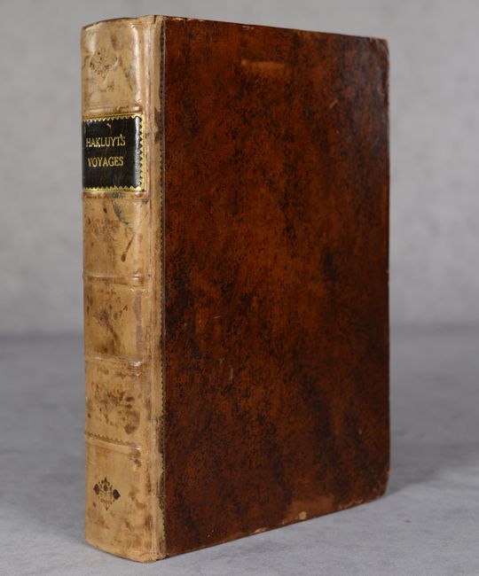
Lot 767
Subject: Exploration & Surveys
Hakluyt, Richard
The Principall Navigations, Voiages and Discoveries of the English Nation, Made by Sea or Ouer Land..., 1589
Size: 7.3 x 10.9 inches (18.5 x 27.7 cm)
Estimate: $10,000 - $13,000
First Edition of Hakluyt's Voyages with Sir Francis Drake Insert
Sold for: $9,000
Closed on 4/24/2024
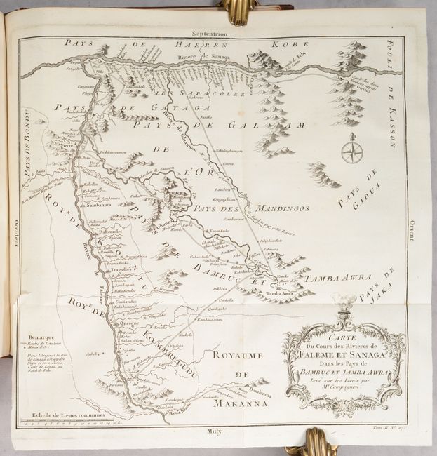
Lot 768
Subject: Exploration & Surveys, East Indies, Japan & Africa
Prevost, Anton Francois
Histoire Generale des Voyages, ou Nouvelle Collection de Toutes les Relations de Voyages par Mer et par Terre ... Tome Second, 1746
Size: 8.3 x 10.4 inches (21.1 x 26.4 cm)
Estimate: $800 - $950
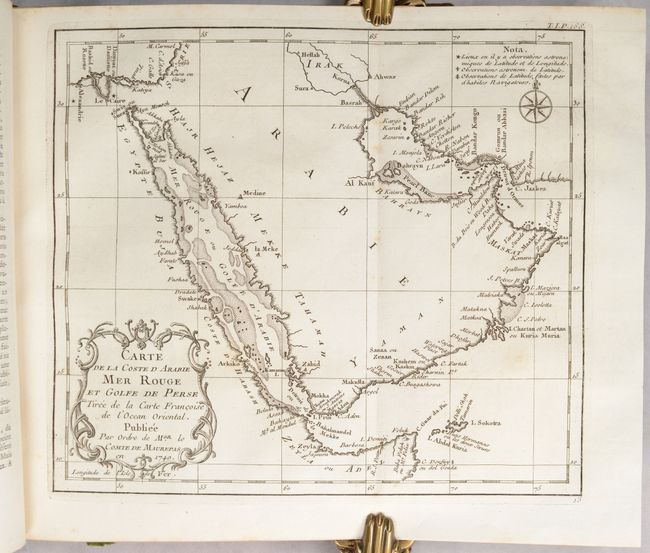
Lot 769
Subject: Exploration & Surveys, Africa & Arabia
Prevost, Anton Francois
Histoire Generale des Voyages, ou Nouvelle Collection de Toutes les Relations de Voyages par Mer et par Terre ... Tome Premier, 1746
Size: 8.3 x 10.4 inches (21.1 x 26.4 cm)
Estimate: $550 - $700
Lot 770
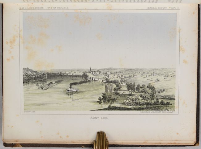
Subject: Exploration & Surveys, Railroads
U.S. Railroad Surveys
[Pacific Railroad Surveys - Volume XII Book I] Reports of Explorations and Surveys, to Ascertain the Most Practicable and Economical Route for a Railroad from the Mississippi River to the Pacific Ocean ... Volume XII. Book I, 1860
Size: 9.3 x 11.8 inches (23.6 x 30 cm)
Estimate: $160 - $190
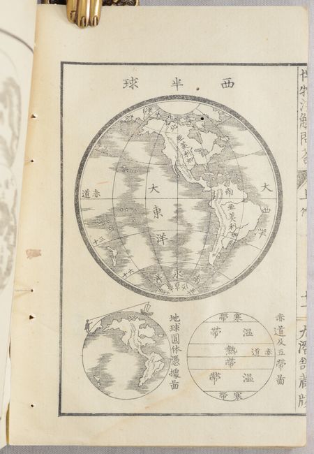
Lot 771
Subject: History Books
[Japanese Book - Hakubutsu Senkai], 1869
Size: 5 x 7.3 inches (12.7 x 18.5 cm)
Estimate: $275 - $350
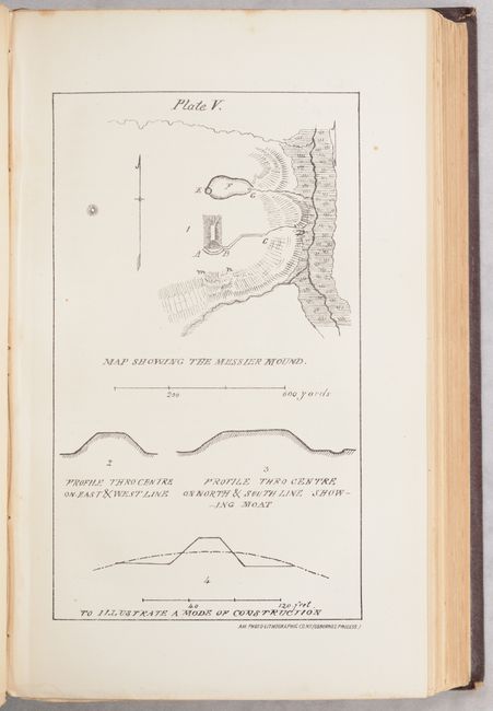
Lot 772
Subject: History Books, Native Americans
Appleton & Company
Antiquities of the Southern Indians, Particularly of the Georgia Tribes, 1873
Size: 6.3 x 9.9 inches (16 x 25.1 cm)
Estimate: $650 - $800
Lot 773
Subject: Miscellaneous Books
Beadle, D. W.
The American Lawyer, and Business-Man's Form-Book; Containing Forms and Instructions..., 1851
Size: 5 x 7.9 inches (12.7 x 20.1 cm)
Estimate: $80 - $100
NO RESERVE
Sold for: $33
Closed on 4/24/2024

Lot 774
Subject: References, Facsimile Atlas
Blaeu, Johannes
[Lot of 12 - Facsimile Atlas] The Third Centenary Edition of Johan Blaeu Le Grand Atlas ou Cosmographie Blaviane, 1967-70
Size: 13 x 22.5 inches (33 x 57.2 cm)
Estimate: $3,000 - $3,750
Magnificent Limited Facsimile Edition of Blaeu's Atlas Maior - Previously Owned by R.A. Skelton
Sold for: $2,200
Closed on 4/24/2024
Lot 775
Subject: References, Facsimile Atlas
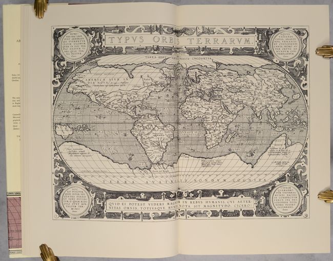
Ortelius, Abraham
[Facsimile Atlas] The Theatre of the Whole World, 1968
Size: 12.3 x 18.5 inches (31.2 x 47 cm)
Estimate: $550 - $700
Lot 776
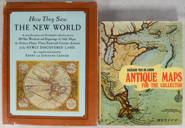
Subject: References
[Lot of 2] How They Saw the New World [and] Antique Maps for the Collector, 1966-73
Size: See Description
Estimate: $70 - $90
NO RESERVE
Sold for: $25
Closed on 4/24/2024
Lot 777
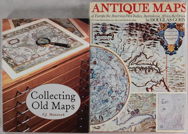
Subject: References
[Lot of 2] Collecting Old Maps [and] Antique Maps of Europe, the Americas, West Indies, Australasia, Africa, the Orient, 1972-2002
Size: See Description
Estimate: $70 - $85
NO RESERVE
Sold for: $31
Closed on 4/24/2024
Lot 778
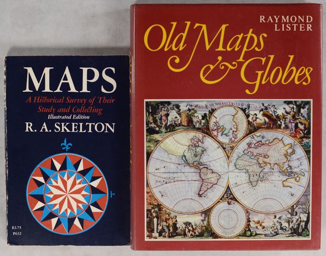
Subject: References
[Lot of 2] Maps - A Historical Survey of Their Study and Collecting [and] Old Maps and Globes..., 1975-79
Size: See Description
Estimate: $50 - $70
NO RESERVE
Sold for: $35
Closed on 4/24/2024
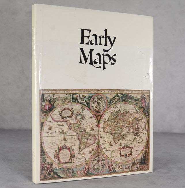
Lot 779
Subject: References
Campbell, Tony
Early Maps, 1981
Size: 12.3 x 15.3 inches (31.2 x 38.9 cm)
Estimate: $40 - $55
NO RESERVE
Sold for: $7
Closed on 4/24/2024
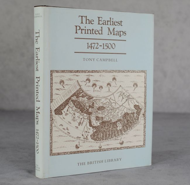
Lot 780
Subject: References
Campbell, Tony
The Earliest Printed Maps 1472-1500, 1987
Size: 8.3 x 10.5 inches (21.1 x 26.7 cm)
Estimate: $60 - $80
NO RESERVE
Sold for: $41
Closed on 4/24/2024
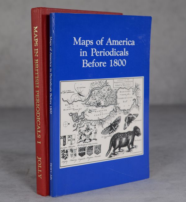
Lot 781
Subject: References
Jolly, David C.
[Lot of 2] Maps in British Periodicals Part I Major Monthlies Before 1800 [and] Maps of America in Periodicals Before 1800, 1989-90
Size: See Description
Estimate: $150 - $180
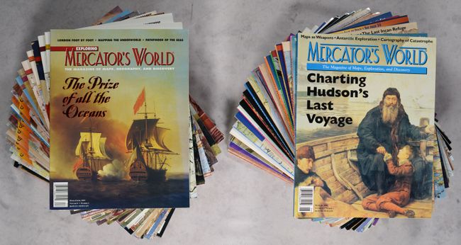
Lot 782
Subject: References, Magazines
[Lot of 42] Mercator's World - The Magazine of Maps, Geography, and Discovery, 1996-2003
Size: 8.5 x 10.9 inches (21.6 x 27.7 cm)
Estimate: $200 - $230
Nearly Complete Run of Mercator's World
Lot 783
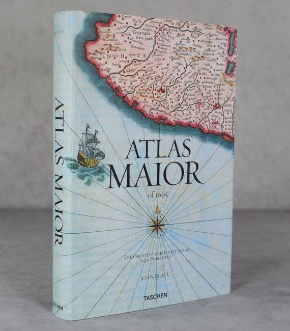
Subject: References, Blaeu
Krogt, Peter van der
Atlas Maior - "The Greatest and Finest Atlas Ever Published", 2006
Size: 9 x 13.5 inches (22.9 x 34.3 cm)
Estimate: $120 - $150
Sold for: $100
Closed on 4/24/2024

Lot 784
Subject: References, Incunabula
Wilson, Adrian
The Making of the Nuremberg Chronicle, 1978
Size: 9.8 x 14 inches (24.9 x 35.6 cm)
Estimate: $140 - $170
Sold for: $100
Closed on 4/24/2024

Lot 785
Subject: References, Cartographic Miscellany
An Atlas of Fantasy, 1974
Size: 8.8 x 11.4 inches (22.4 x 29 cm)
Estimate: $45 - $65
NO RESERVE
Sold for: $42
Closed on 4/24/2024
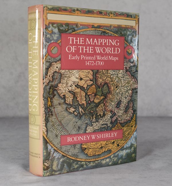
Lot 786
Subject: References, World
Shirley, Rodney W.
The Mapping of the World - Early Printed World Maps 1472-1700, 1987
Size: 9.7 x 13.8 inches (24.6 x 35.1 cm)
Estimate: $350 - $425
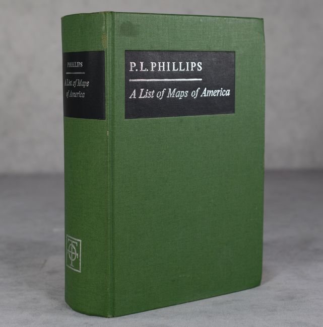
Lot 787
Subject: References, America
Phillips, P. Lee
A List of Maps of America in the Library of Congress Preceded by a List of Works Relating to Cartography, 1967
Size: 6.2 x 9.2 inches (15.7 x 23.4 cm)
Estimate: $80 - $100
NO RESERVE
Sold for: $27
Closed on 4/24/2024
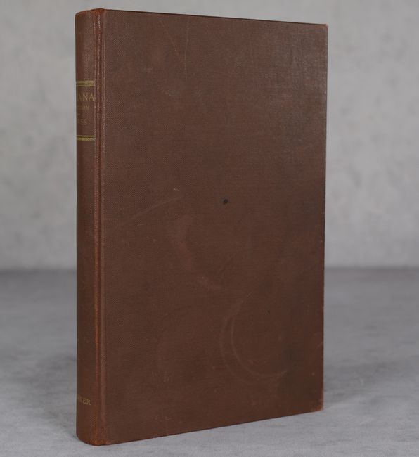
Lot 788
Subject: References, Americana
U.S. Iana (1650-1950) - A Selective Bibliography in Which Are Described 11,620 Uncommon and Significant Books Relating to the Continental Portion of the United States, 1963
Size: 6.6 x 10.3 inches (16.8 x 26.2 cm)
Estimate: $35 - $55
NO RESERVE
Sold for: $1
Closed on 4/24/2024
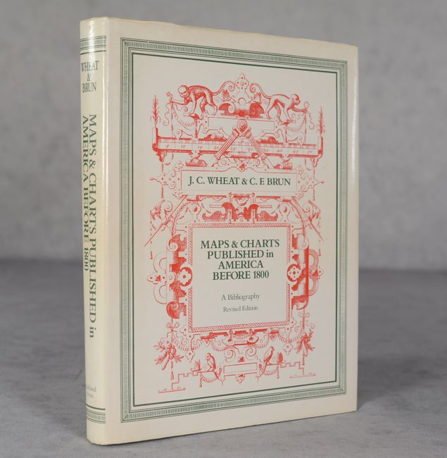
Lot 789
Subject: References, United States
Wheat and Brun
Maps and Charts Published in America Before 1800: A Bibliography - Second Revised Edition, 1985
Size: 7.8 x 10.1 inches (19.8 x 25.7 cm)
Estimate: $120 - $150
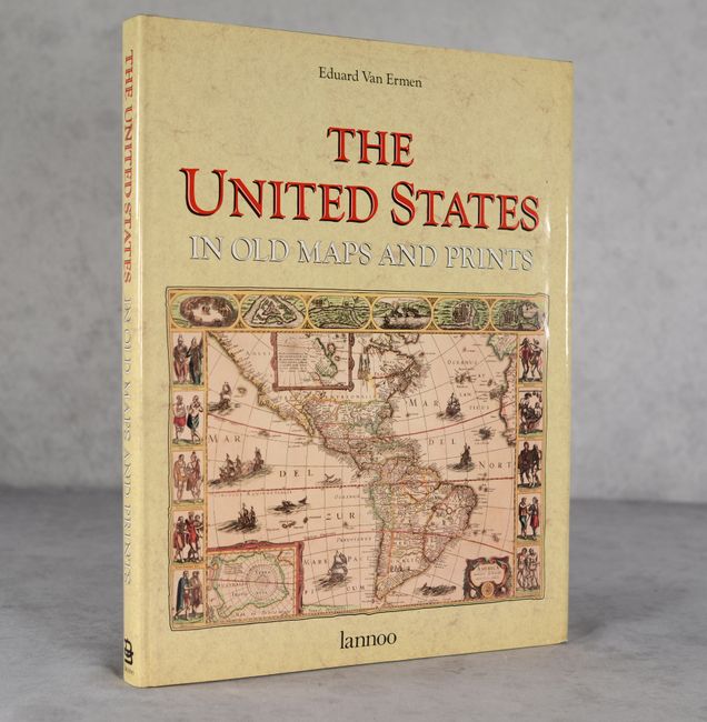
Lot 790
Subject: References, United States
Ermen, Eduard, van
The United States in Old Maps and Prints, 1990
Size: 12 x 15.2 inches (30.5 x 38.6 cm)
Estimate: $25 - $45
NO RESERVE
Sold for: $26
Closed on 4/24/2024
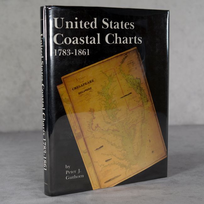
Lot 791
Subject: References, Coastal Charts
United States Coastal Charts 1783-1861, 1984
Size: 9.5 x 12.4 inches (24.1 x 31.5 cm)
Estimate: $40 - $55
NO RESERVE
Sold for: $50
Closed on 4/24/2024
59 lots
Page 1 of 2