Filtered by Category:United States(Show All Categories)
Showing results for:Auction 96
Catalog Archive
117 lots
Page 1 of 3
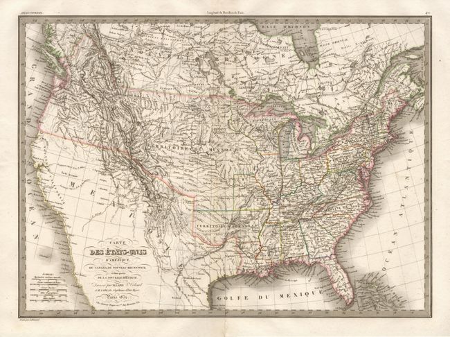
Auction 96, Lot 89
Subject: North America
Lapie, Alexander Emile & Pierre
Carte des Etats-Unis d'Amerique, du Canada, du Nouveau Brunswick et d'une partie de la Nouvelle Bretagne, 1832
Size: 21.1 x 15.2 inches (53.6 x 38.6 cm)
Estimate: $300 - $400
Sold for: $220
Closed on 9/12/2001
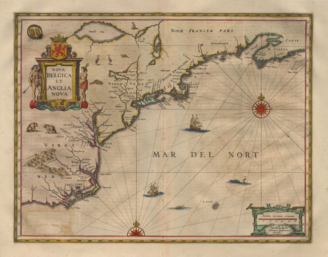
Auction 96, Lot 100
Subject: Colonial New England
Jansson, Jan
Nova Belgica et Anglia Nova, 1653-58
Size: 20 x 15.2 inches (50.8 x 38.6 cm)
Estimate: $2,300 - $2,400
Sold for: $2,200
Closed on 9/12/2001
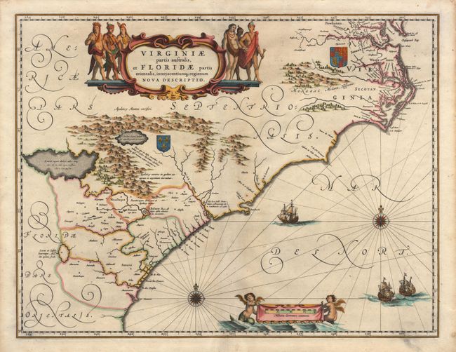
Auction 96, Lot 101
Subject: Colonial Southeast
Blaeu, Willem
Virginiae partis australis, et Floridae parties orientalis, interjacentiumq regionum Nova Descriptio, 1680
Size: 20 x 15.2 inches (50.8 x 38.6 cm)
Estimate: $1,900 - $2,100
Sold for: $1,400
Closed on 9/12/2001
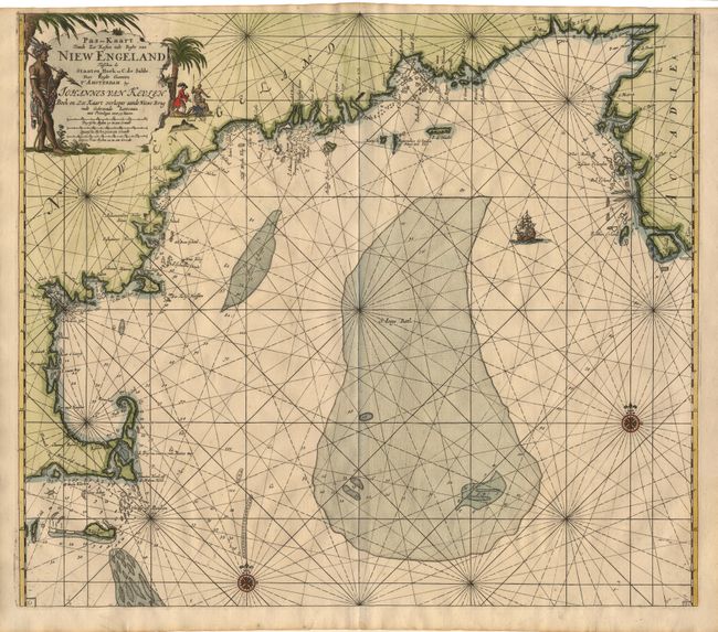
Auction 96, Lot 102
Subject: Colonial New England and Nova Scotia
Keulen, Johannes van
Pas-kaart Vande Zee Kusten inde Boght van Niew Engeland Tusschen de Staaten Hoek en C. de Sable…, 1684
Size: 22.9 x 19.7 inches (58.2 x 50 cm)
Estimate: $4,000 - $4,500
Sold for: $4,000
Closed on 9/12/2001
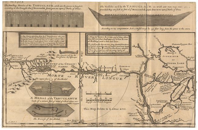
Auction 96, Lot 103
Subject: Colonial Midwest
Lahontan, Louis Armand
A Map of ye Long River and of some others that fall into that part of ye Great River of Missisipi which is here laid down, 1703
Size: 13.2 x 8.5 inches (33.5 x 21.6 cm)
Estimate: $1,500 - $1,700
Sold for: $1,700
Closed on 9/12/2001
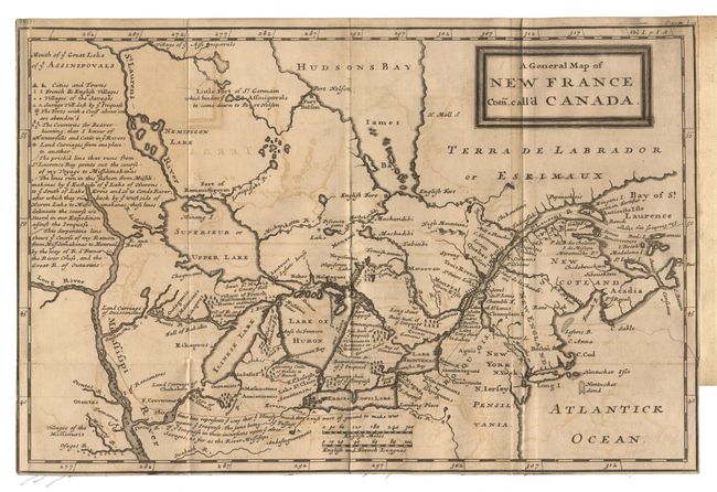
Auction 96, Lot 104
Subject: Colonial North America
Lahontan, Louis Armand
A General Map of New France com. Call'd Canada, 1703
Size: 13.2 x 8.8 inches (33.5 x 22.4 cm)
Estimate: $1,500 - $1,800
Sold for: $1,500
Closed on 9/12/2001
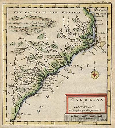
Auction 96, Lot 105
Subject: Colonial Carolinas
Moll, Herman
Carolina, 1721
Size: 6 x 6.6 inches (15.2 x 16.8 cm)
Estimate: $400 - $450
Sold for: $325
Closed on 9/12/2001
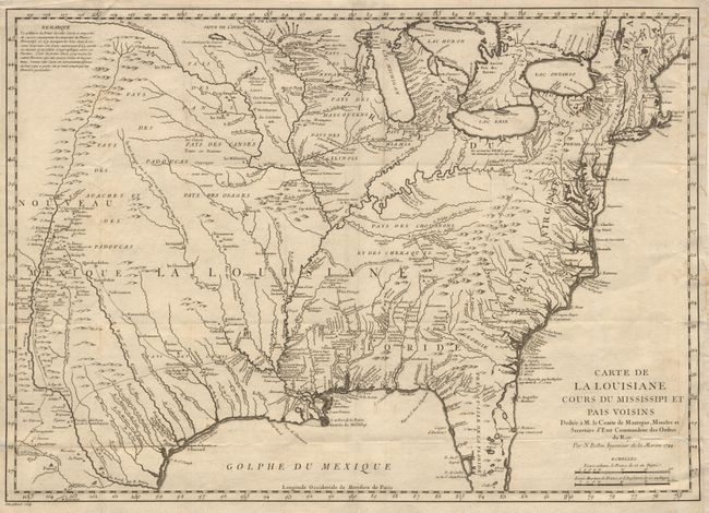
Auction 96, Lot 106
Subject: Colonial United States
Bellin, Jacques Nicolas
Carte de la Louisiane Cours du Mississipi et Pais Voisins…, 1744
Size: 22 x 15.5 inches (55.9 x 39.4 cm)
Estimate: $1,200 - $1,300
Sold for: $750
Closed on 9/12/2001
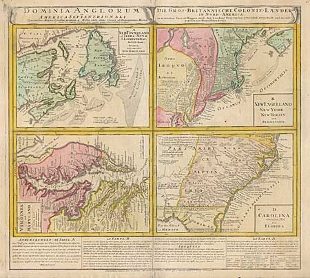
Auction 96, Lot 109
Subject: Colonial United States and Canada
Homann Heirs
Dominia Anglorum in America Septentrionali, 1740
Size: 21.8 x 17.2 inches (55.4 x 43.7 cm)
Estimate: $600 - $800
Sold for: $700
Closed on 9/12/2001
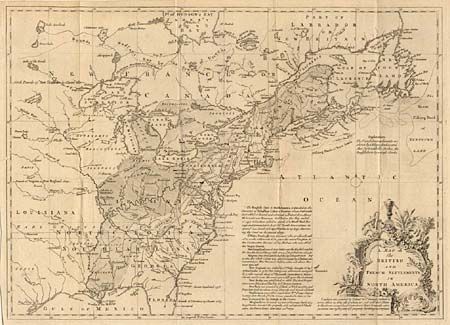
Auction 96, Lot 110
Subject: Colonial United States and Canada
Lodge, John
A Map of the British and French Settlements in North America, 1755
Size: 15.2 x 11 inches (38.6 x 27.9 cm)
Estimate: $250 - $300
Sold for: $375
Closed on 9/12/2001
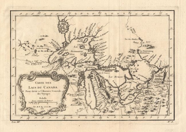
Auction 96, Lot 111
Subject: Great Lakes
Bellin, Jacques Nicolas
Carte des Lacs du Canada Pour servir a l'Histoire Generale des Voyages, 1757
Size: 11.4 x 7.6 inches (29 x 19.3 cm)
Estimate: $400 - $500
Sold for: $350
Closed on 9/12/2001
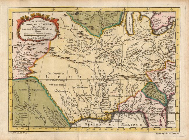
Auction 96, Lot 112
Subject: Colonial United States
Bellin, Jacques Nicolas
Carte de la Floride, de la Louisiane, et Pays Voisins, 1757
Size: 11.8 x 8.7 inches (30 x 22.1 cm)
Estimate: $500 - $600
Sold for: $600
Closed on 9/12/2001

Auction 96, Lot 113
Subject: Colonial Central United States
Bellin, Jacques Nicolas
Carte de la Louisiane et Pays Voisins pour servir a l'Histoire des Etablissemens Europeens, 1760
Size: 11.6 x 8.4 inches (29.5 x 21.3 cm)
Estimate: $325 - $375
Sold for: $200
Closed on 9/12/2001
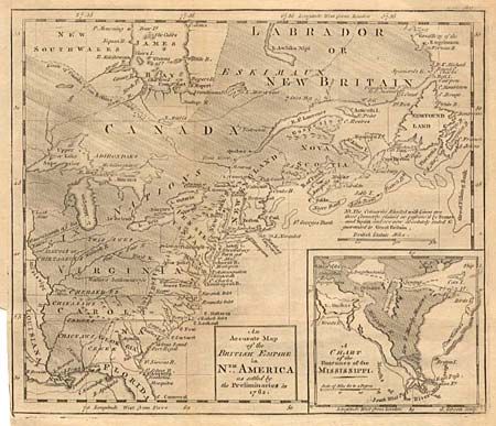
Auction 96, Lot 114
Subject: Colonial United States and Canada
Gibson, John
An Accurate Map of the British Empire in Nth. America as settled by the Preliminaries in 1762, 1765
Size: 9.6 x 8.2 inches (24.4 x 20.8 cm)
Estimate: $200 - $250
Sold for: $200
Closed on 9/12/2001
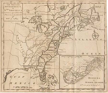
Auction 96, Lot 115
Subject: Colonial North America
Gibson, John
The British Governments in Nth. America laid down agreeable to the Proclamation of Oct. 7, 1763, 1763
Size: 9.2 x 8 inches (23.4 x 20.3 cm)
Estimate: $300 - $350
Sold for: $300
Closed on 9/12/2001
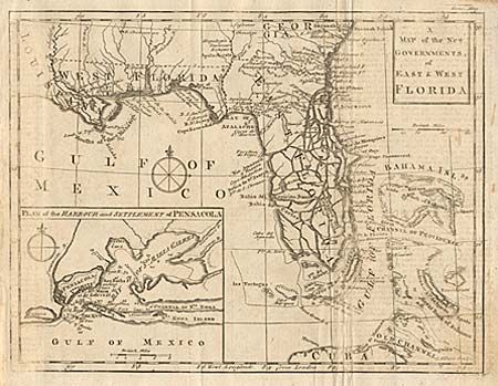
Auction 96, Lot 116
Subject: Colonial Florida
Gibson, John
A Map of the New Governments, of East & West Florida, 1763
Size: 9.8 x 7.5 inches (24.9 x 19.1 cm)
Estimate: $300 - $400
Sold for: $450
Closed on 9/12/2001
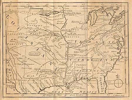
Auction 96, Lot 117
Subject: Colonial Midwest
Gibson, John
[Map of the Mississippi River Valley], 1763
Size: 9.4 x 7.1 inches (23.9 x 18 cm)
Estimate: $400 - $450
Sold for: $325
Closed on 9/12/2001
Auction 96, Lot 118
Subject: Colonial United States
Kalm, Peter
A New and Accurate Map of Part of North America, Comprehending the Provinces of New England, New York, Pensilvania, New Yersey, Connecticut, Rhode Island, & part of Virginia, Canada, and Hallifax, 1771
Size: 29.8 x 22.2 inches (75.7 x 56.4 cm)
Estimate: $1,800 - $2,000
Sold for: $950
Closed on 9/12/2001
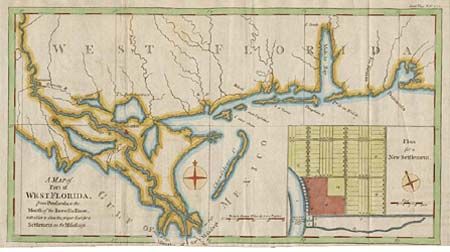
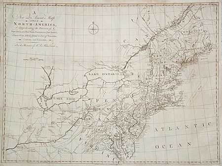
Auction 96, Lot 119
Subject: Colonial South
Lodge, John
A Map of Part of West Florida from Pensacola to the Mouth of the Iberville River, with a View to shew the proper Spot for a Settlement on the Mississipi, 1772
Size: 13.5 x 7.5 inches (34.3 x 19.1 cm)
Estimate: $150 - $200
Sold for: $130
Closed on 9/12/2001

Auction 96, Lot 120
Subject: Colonial Pennsylvania and New Jersey
Dury, Andrew
A Chart of Delaware Bay and River, Containing a full and exact description of the Shores, Creeks, Harbours, Soundings, Shoals, Sands and Bearings of the most considerable Land Marks, from the Capes to Philadelphia, 1776
Size: 27.8 x 18 inches (70.6 x 45.7 cm)
Estimate: $3,750 - $4,000
Unsold
Closed on 9/12/2001
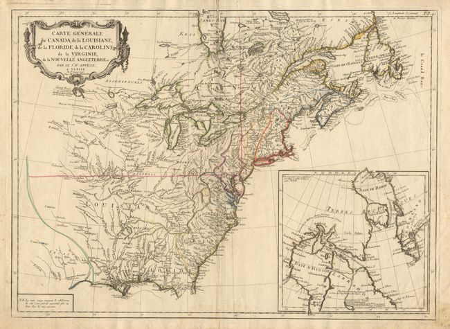
Auction 96, Lot 121
Subject: Colonial North America
D'Anville/Santini
Carte Generale du Canada, de la Louisiane, de la Floride, de la Caroline, de la Virginie, de la Nouvelle Angleterre etc. par le Sr. d'Anville, 1776
Size: 25.7 x 18.8 inches (65.3 x 47.8 cm)
Estimate: $600 - $800
Sold for: $850
Closed on 9/12/2001
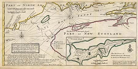
Auction 96, Lot 123
Subject: Canada and Maine
Moll, Herman
A Description of the Bay of Fundy Shewing ye Coast, Islands, Harbours, Creeks, Coves, Rocks, Sholes, Soundings & Anchorings &c. observed by Nat. Blackmore in ye years 1711 and 1712. By Her Majesties Special Command, 1745
Size: 17.2 x 8.2 inches (43.7 x 20.8 cm)
Estimate: $300 - $350
Sold for: $350
Closed on 9/12/2001
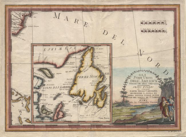
Auction 96, Lot 129
Subject: United States and Canada
Cassini, Giovanni Maria
Gli Stati Uniti dell'America Delineati sulle ultime Osservazioni - Sesto Foglio che comprende Parte Della Carolina Ed Inoltre l'Isola di Terra Nuova Colle Altre Isole del Golfo di S. Lorenzo, 1797
Size: 18.6 x 13.5 inches (47.2 x 34.3 cm)
Estimate: $450 - $500
Sold for: $450
Closed on 9/12/2001
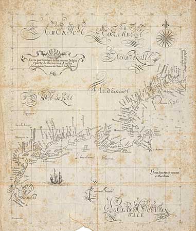
Auction 96, Lot 130
Subject: New England
Dudley, Robert (Sir)
Carta particolare della nuoa Belgia e parte della nuoua Anglia, 1850
Size: 14 x 17.5 inches (35.6 x 44.5 cm)
Estimate: $50 - $70
Sold for: $25
Closed on 9/12/2001
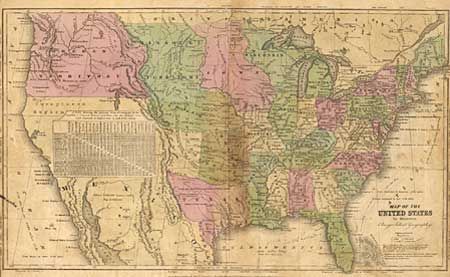
Auction 96, Lot 131
Subject: United States
Olney, A. N.
Map of the United States to Illustrate Olney's School Geography, 1840
Size: 17 x 10 inches (43.2 x 25.4 cm)
Estimate: $40 - $50
Sold for: $120
Closed on 9/12/2001
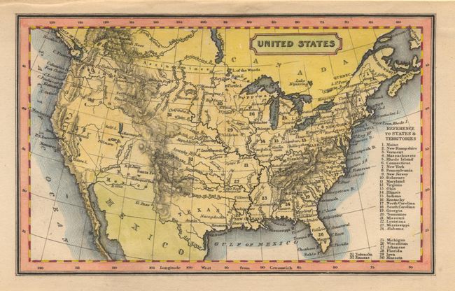
Auction 96, Lot 132
Subject: United States
Goodrich, Samuel Griswold
United States, 1855
Size: 5.7 x 3.5 inches (14.5 x 8.9 cm)
Estimate: $70 - $90
Sold for: $70
Closed on 9/12/2001
Auction 96, Lot 133
Subject: United States
Burr, David H.
Map of the United States exhibiting the several Collection Districts, 1856
Size: 49.3 x 31.2 inches (125.2 x 79.2 cm)
Estimate: $400 - $600
Sold for: $900
Closed on 9/12/2001
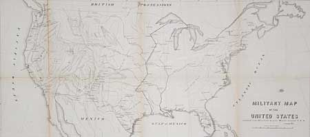
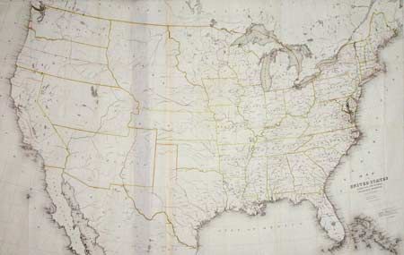
Auction 96, Lot 134
Subject: United States
U.S. War Dept.
Military map of the United States, 1857
Size: 30 x 13.5 inches (76.2 x 34.3 cm)
Estimate: $100 - $150
Sold for: $160
Closed on 9/12/2001
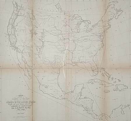
Auction 96, Lot 135
Subject: United States
U.S. War Department
Map Exhibiting the Lines of March passed over by troops of the United States during the year ending June 30th, 1858, 1858
Size: 18.8 x 17.3 inches (47.8 x 43.9 cm)
Estimate: $80 - $100
Sold for: $75
Closed on 9/12/2001
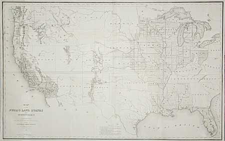
Auction 96, Lot 136
Subject: United States
General Land Office
Map of the Public Land States and Territories constructed from The Public Surveys and other official sources in the General Land Office, 1865
Size: 44.7 x 28 inches (113.5 x 71.1 cm)
Estimate: $250 - $300
Sold for: $220
Closed on 9/12/2001
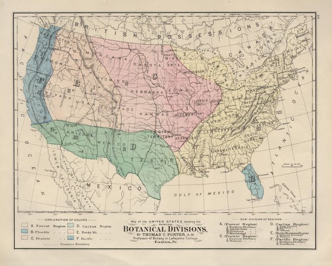
Auction 96, Lot 137
Subject: United States
Gray, O. W.
Map of the United States showing the Botanical Divisions, 1873
Size: 15 x 11.7 inches (38.1 x 29.7 cm)
Estimate: $45 - $55
Sold for: $80
Closed on 9/12/2001
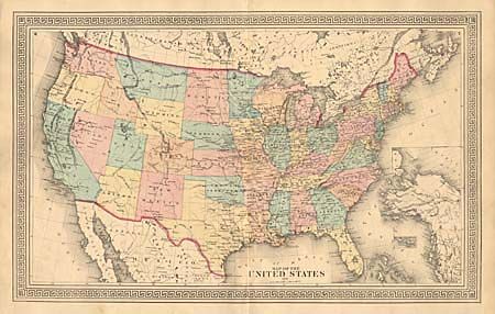
Auction 96, Lot 138
Subject: United States
Anon.
Map of the United States, 1874
Size: 23.5 x 14.5 inches (59.7 x 36.8 cm)
Estimate: $50 - $60
Sold for: $55
Closed on 9/12/2001
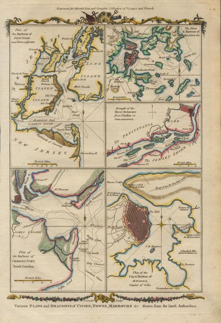
Auction 96, Lot 139
Subject: Eastern United States
Conder, Thomas
Various Plans and Draughts of Cities, Towns, Harbours &c. Drawn from the latest Authorities, 1778
Size: 7.6 x 12.4 inches (19.3 x 31.5 cm)
Estimate: $275 - $325
Sold for: $220
Closed on 9/12/2001
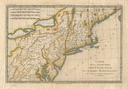
Auction 96, Lot 140
Subject: Northeastern United States
Bonne, Rigobert
Carte de la Partie Nord, des Etats Unis, de l'Amerique Septentrionale, 1782
Size: 12.7 x 8.4 inches (32.3 x 21.3 cm)
Estimate: $150 - $200
Sold for: $150
Closed on 9/12/2001
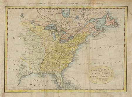
Auction 96, Lot 141
Subject: Eastern United States
Bowen, Thomas
A Correct Map of the United States of North America, Including the British and Spanish Territories, carefully laid down agreeable to the Treaty of 1784, 1787
Size: 17.4 x 12.1 inches (44.2 x 30.7 cm)
Estimate: $300 - $350
Sold for: $300
Closed on 9/12/2001
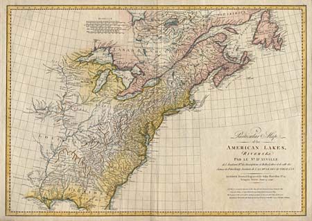
Auction 96, Lot 142
Subject: Eastern United States
Harrison/D' Anville
A Particular Map of the American Lakes, Rivers &c., 1790
Size: 28.1 x 19.7 inches (71.4 x 50 cm)
Estimate: $1,200 - $1,400
Sold for: $900
Closed on 9/12/2001
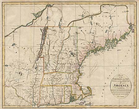
Auction 96, Lot 143
Subject: New England
Russell, John C.
Map of the Northern, or New England States of America, Comprehending Vermont, New Hampshire, District of Main, Massachusetts, Rhode-Island, and Connecticut, 1795
Size: 18.1 x 14.4 inches (46 x 36.6 cm)
Estimate: $300 - $350
Sold for: $400
Closed on 9/12/2001

Auction 96, Lot 144
Subject: Southeastern United States
Anon.
Carta delle Provincie Meridionali degli Stati-Uniti, 1790
Size: 19 x 13.2 inches (48.3 x 33.5 cm)
Estimate: $350 - $400
Unsold
Closed on 9/12/2001
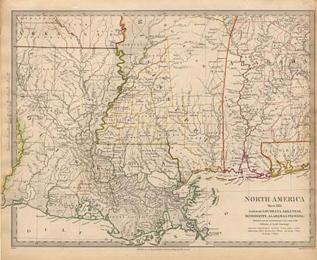
Auction 96, Lot 145
Subject: Southern United States
SDUK Society for the Diffusion of Useful Knowledge
North America Sheet XIII Parts of Louisiana, Arkansas, Mississippi, Alabama & Florida, 1833
Size: 15.5 x 12.2 inches (39.4 x 31 cm)
Estimate: $60 - $80
Sold for: $55
Closed on 9/12/2001
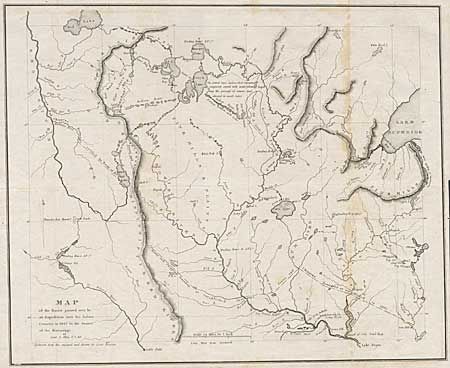
Auction 96, Lot 146
Subject: Central United States
Allen, James (Lt.)
Map of the Route Passed over by an Expedition into the Indian Country in 1832 to the Source of the Mississippi, 1834
Size: 19 x 15.5 inches (48.3 x 39.4 cm)
Estimate: $300 - $350
Sold for: $300
Closed on 9/12/2001
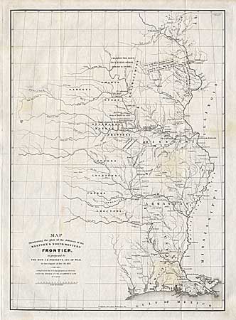
Auction 96, Lot 147
Subject: Central United States
Poinsett, J. R.
Map Illustrating the plan of the defences of the Western & North-Western Frontier, as proposed by the Hon: J.R. Poinsett, Sec. of War, in his report of Dec. 30, 1837, 1837
Size: 15.5 x 21.5 inches (39.4 x 54.6 cm)
Estimate: $450 - $550
Sold for: $250
Closed on 9/12/2001
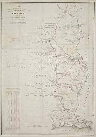
Auction 96, Lot 148
Subject: Central United States
Gratiot, Charles
Map Illustrating the Plan of the Defences of the Western & North-Western Frontier, as proposed by Charles Gratiot, in his report of Oct. 31, 1837, 1838
Size: 15.2 x 21.5 inches (38.6 x 54.6 cm)
Estimate: $450 - $550
Sold for: $250
Closed on 9/12/2001
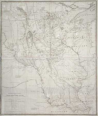
Auction 96, Lot 149
Subject: Central United States
U.S. War Department
Hydrographical Basin of the Upper Mississippi River from Astronomical and Barometrical Observations Surveys and Information…, 1843
Size: 30.2 x 36 inches (76.7 x 91.4 cm)
Estimate: $450 - $500
Sold for: $325
Closed on 9/12/2001
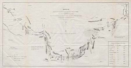
Auction 96, Lot 150
Subject: Western United States
U.S. War Dept.
Sketch of part of the march & wagon road of Lt. Colonel Cooke, from Santa Fe to the Pacific Ocean 1846-47, 1847
Size: 22.8 x 11.6 inches (57.9 x 29.5 cm)
Estimate: $200 - $250
Sold for: $200
Closed on 9/12/2001
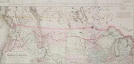
Auction 96, Lot 151
Subject: Western United States
Colton, G.W. & C.B.
Map of the country from Lake Superior to the Pacific Ocean. From the latest Explorations and Surveys to accompany the report of Edwin F. Johnson Chf. Engr. Northern Pacific RR., 1867
Size: 44.5 x 21.8 inches (113 x 55.4 cm)
Estimate: $600 - $800
Sold for: $550
Closed on 9/12/2001
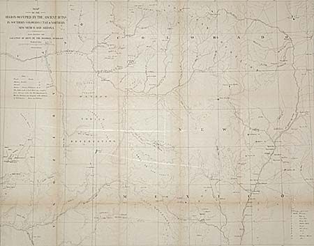
Auction 96, Lot 152
Subject: Southwestern United States
Wheeler, George (Lt)
Map of the Region Occupied by the Ancient Ruins in Southern Colorado, Utah and Northern New Mexico and Arizona Also Showing the Locations of Most of the Modern Pueblos, 1876
Size: 24.5 x 19.1 inches (62.2 x 48.5 cm)
Estimate: $75 - $100
Sold for: $70
Closed on 9/12/2001

Auction 96, Lot 153
Subject: California
U.S. Government
[Lot of 4 - Mexican-American War], 1847
Size: See Description
Estimate: $200 - $240
Sold for: $190
Closed on 9/12/2001
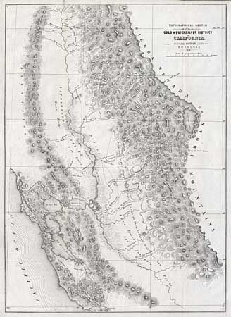
Auction 96, Lot 154
Subject: California
Ord, E. O. C.
Topographical Sketch of the Gold & Quicksilver District of California, 1848
Size: 15.5 x 21.5 inches (39.4 x 54.6 cm)
Estimate: $400 - $500
Sold for: $550
Closed on 9/12/2001
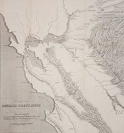
Auction 96, Lot 155
Subject: California
Derby, George Horatio (Lt)
Sketch of General Riley's Route Through the Mining Districts July and Aug. 1849, 1850
Size: 19.8 x 21 inches (50.3 x 53.3 cm)
Estimate: $400 - $500
Sold for: $240
Closed on 9/12/2001
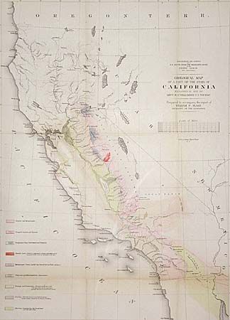
Auction 96, Lot 156
Subject: California
Williamson, R. S. (Lt.)
Geological Map of a Part of the State of California, 1855
Size: 16.1 x 22.2 inches (40.9 x 56.4 cm)
Estimate: $120 - $150
Sold for: $100
Closed on 9/12/2001
117 lots
Page 1 of 3