Filtered by Category:United States(Show All Categories)
Showing results for:Auction 162
Catalog Archive
220 lots
Page 1 of 5
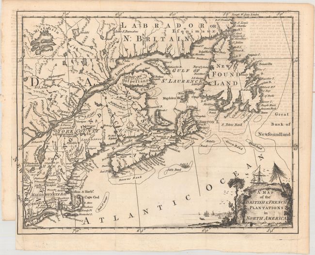
Auction 162, Lot 111
Subject: Colonial United States & Canada
Anon.
A Map of the British & French Plantations in North America, 1755
Size: 10.4 x 8.3 inches (26.4 x 21.1 cm)
Estimate: $220 - $250
Sold for: $130
Closed on 4/26/2017
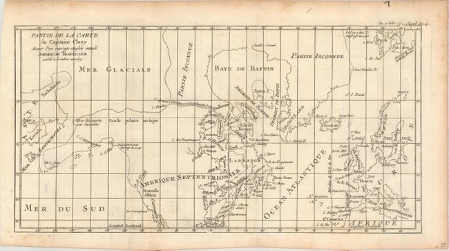
Auction 162, Lot 112
Subject: Colonial United States, Canada & Arctic
Robert de Vaugondy, Didier
Partie de la Carte du Capitaine Cluny Auteur d'un Ouvrage Anglois Intitule American Traveller Publie a Londres en 1769, 1769
Size: 16.2 x 8.5 inches (41.1 x 21.6 cm)
Estimate: $120 - $150
Sold for: $45
Closed on 4/26/2017
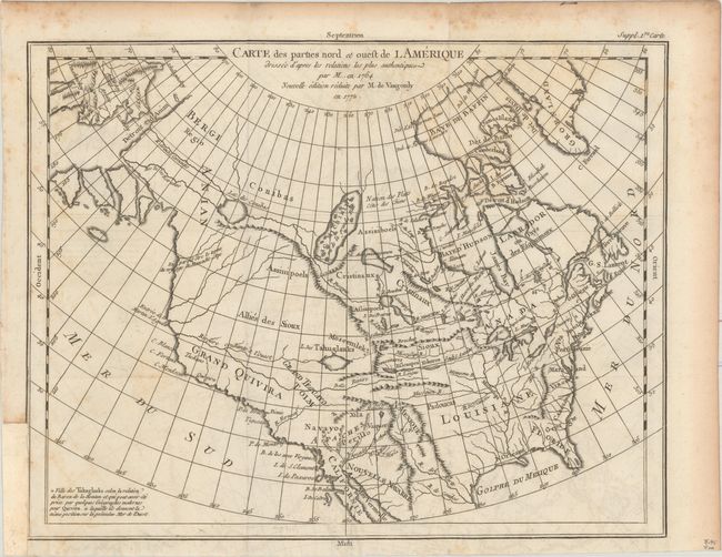
Auction 162, Lot 113
Subject: Colonial United States & Canada
Robert de Vaugondy, Didier
Carte des Parties Nord et Ouest de l Amerique Dressee d'Apres les Relations les Plus Authentiques par M... en 1764..., 1772
Size: 15.2 x 11.8 inches (38.6 x 30 cm)
Estimate: $160 - $200
Sold for: $80
Closed on 4/26/2017
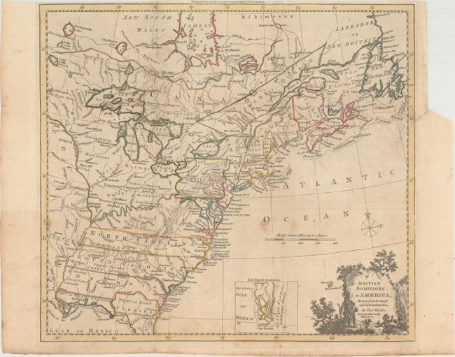
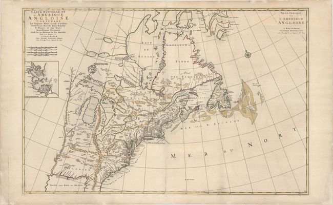
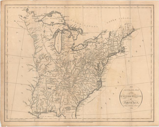
Auction 162, Lot 114
Subject: Colonial Eastern United States & Canada
Kitchin, Thomas
British Dominions in America, Drawn from the Latest and Best Authorities [with related text], 1782
Size: 14.8 x 13.4 inches (37.6 x 34 cm)
Estimate: $600 - $750
Unsold
Closed on 4/26/2017
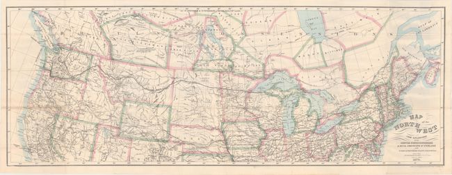
Auction 162, Lot 115
Subject: United States & Canada
Bien, Julius
Map of the Northwest from Explorations by the United States Engineers & Royal Engineers of England and Union & Northern Pacific R.R. Surveys [in] The Seat of Empire, 1870
Size: 41.1 x 15.1 inches (104.4 x 38.4 cm)
Estimate: $200 - $250
Sold for: $160
Closed on 4/26/2017
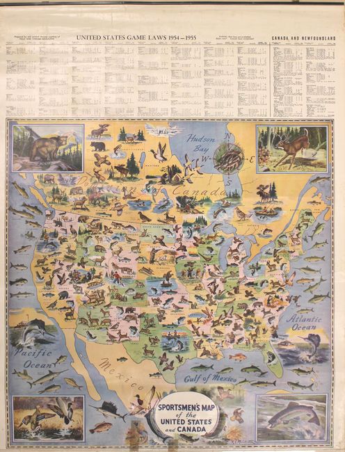
Auction 162, Lot 116
Subject: United States & Canada
Geographical Publishing Co.
[4 Sheet Wall Map] Sportsmen's Map of the United States and Canada, 1954
Size: 26 x 26.1 inches (66 x 66.3 cm)
Estimate: $150 - $180
Sold for: $250
Closed on 4/26/2017
Auction 162, Lot 117
Subject: Colonial Eastern United States & Canada
Mortier, Pierre
Carte Nouvelle de l'Amerique Angloise Contenant la Virginie, Mary-Land, Caroline, Pensylvania Nouvelle Iorck, N: Iarsey N: France, et les Terres Nouvellement Decouerte..., 1700
Size: 35.9 x 23.4 inches (91.2 x 59.4 cm)
Estimate: $2,000 - $2,300
A Map Showing Fascinating Geographic Misconceptions
Sold for: $1,500
Closed on 4/26/2017
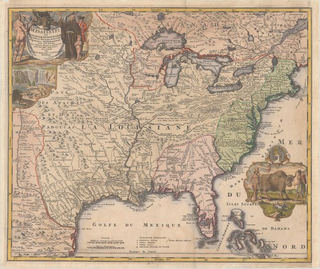
Auction 162, Lot 118
Subject: Colonial Eastern United States & Canada
Homann, Johann Baptist
Amplissimae Regionis Mississipi seu Provinciae Ludovicianae..., 1720
Size: 22.8 x 19.1 inches (57.9 x 48.5 cm)
Estimate: $2,000 - $2,300
Striking Map of Colonial America with Buffalo Vignette
Sold for: $1,300
Closed on 4/26/2017
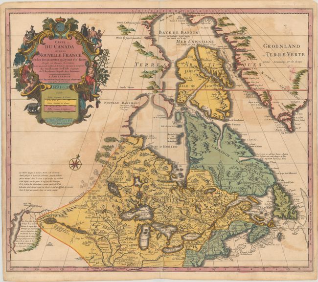
Auction 162, Lot 119
Subject: Colonial Eastern United States & Canada, Great Lakes
Delisle/Covens & Mortier
Carte du Canada ou de la Nouvelle France et des Decouvertes qui y ont ete Faites Dressee sur Plusieurs Observations et sur un Grand Nombre de Relations Imprimees ou Manuscrites, 1730
Size: 22.3 x 19.3 inches (56.6 x 49 cm)
Estimate: $900 - $1,100
One of the Most Influential Maps of Canada, the Great Lakes and Upper Midwest
Sold for: $650
Closed on 4/26/2017
Auction 162, Lot 120
Subject: Colonial Eastern United States & Canada
Kitchin, Thomas
A New Map of the British Dominions in North America; with the Limits of the Governments Annexed Thereto by the Late Treaty of Peace, and Settled by Proclamation, October 7th, 1763, 1763
Size: 11.8 x 9.5 inches (30 x 24.1 cm)
Estimate: $350 - $425
Sold for: $250
Closed on 4/26/2017
Auction 162, Lot 121
Subject: Colonial Eastern United States & Canada
Bonne/Lattre
[On 2 Sheets] Partie de l'Amerique Septentrionale, qui Comprend le Canada, la Louisiane, le Labrador, le Groenland, la Nouvelle Angleterre, la Floride &c. Projettee et Assujettie aux Observations, 1771
Size: 17.1 x 11.8 inches (43.4 x 30 cm)
Estimate: $550 - $700
Sold for: $265
Closed on 4/26/2017
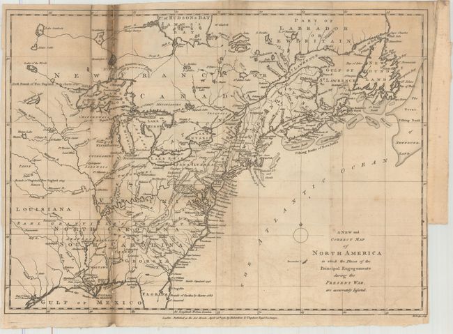
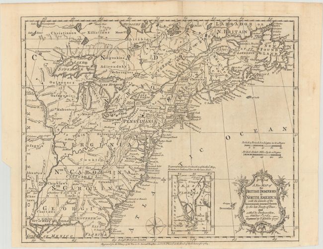
Auction 162, Lot 122
Subject: Colonial Eastern United States & Canada
Lodge, John
A New and Correct Map of North America in Which the Places of the Principal Engagements During the Present War, Are Accurately Inserted, 1780
Size: 15.1 x 10.9 inches (38.4 x 27.7 cm)
Estimate: $500 - $650
Unsold
Closed on 4/26/2017
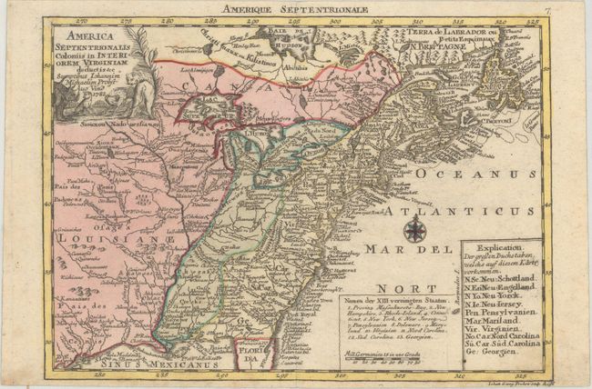
Auction 162, Lot 123
Subject: Colonial Eastern United States & Canada
Probst, Johann Michael
America Septentrionalis Coloniis in Interiorem Virginiam Deductis &c., 1782
Size: 9.4 x 6.8 inches (23.9 x 17.3 cm)
Estimate: $500 - $650
Sold for: $275
Closed on 4/26/2017
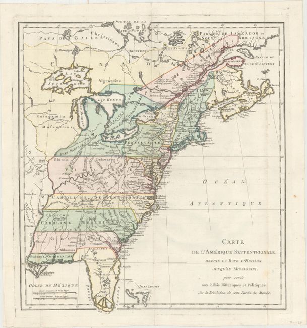
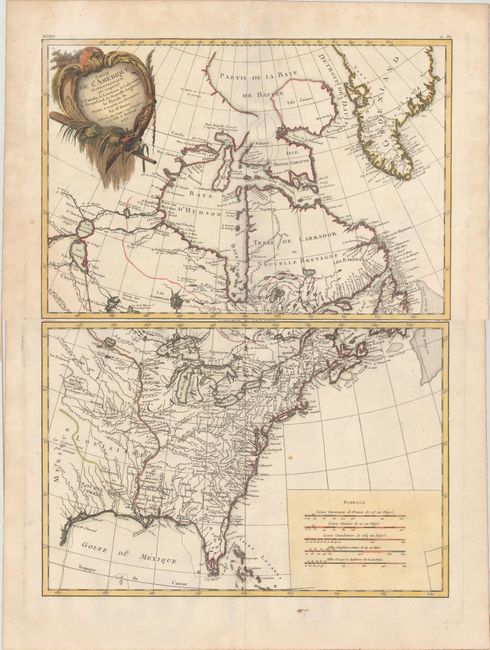
Auction 162, Lot 124
Subject: Colonial Eastern United States & Canada
Carte de l'Amerique Septentrionale, Depuis la Baye d'Hudson Jusqu'au Mississipi: pour Servir aux Essais Historiques et Politiques..., 1782
Size: 14.9 x 16.4 inches (37.8 x 41.7 cm)
Estimate: $500 - $650
Unsold
Closed on 4/26/2017
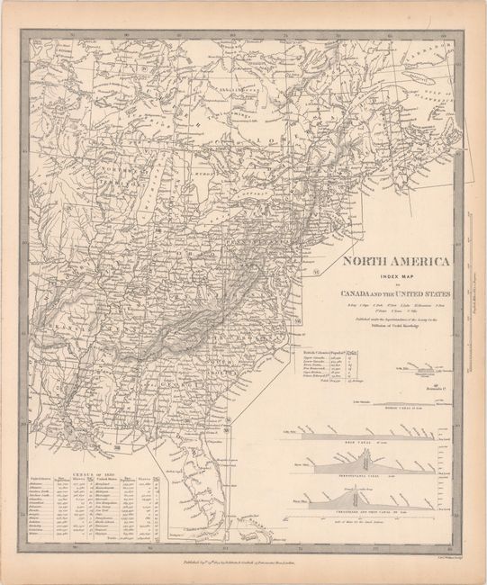
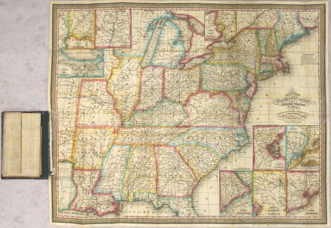
Auction 162, Lot 125
Subject: Eastern United States & Canada
SDUK Society for the Diffusion of Useful Knowledge
[Lot of 15 - United States & Canada], 1832-34
Size: See Description
Estimate: $800 - $950
Sold for: $400
Closed on 4/26/2017
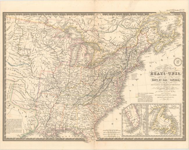
Auction 162, Lot 126
Subject: Eastern United States & Canada
Brue, Adrien Hubert
Carte Generale des Etats-Unis, des Haut et Bas-Canada, de la Nouvle. Ecosse, du Nouvau. Brunswick, de Terre-Neuve, &a. Seconde Edition, 1838
Size: 20.3 x 14.8 inches (51.6 x 37.6 cm)
Estimate: $180 - $220
Sold for: $120
Closed on 4/26/2017
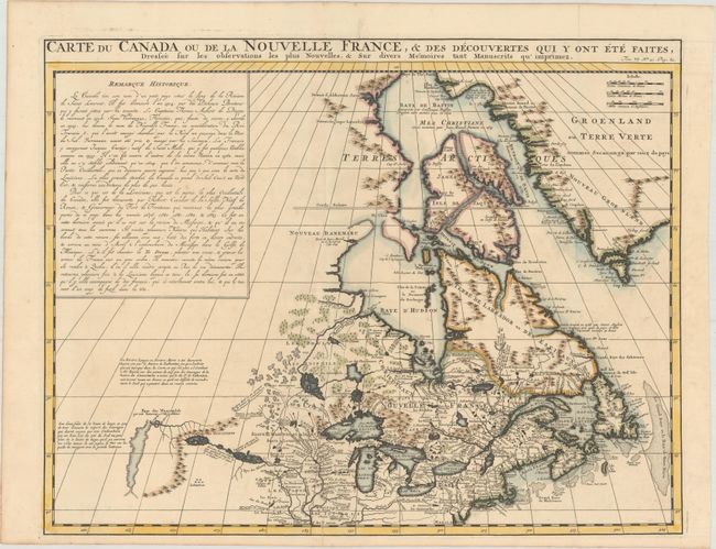
Auction 162, Lot 127
Subject: Colonial Northeastern United States & Canada
Chatelain, Henry Abraham
Carte du Canada ou de la Nouvelle France, & des Decouvertes qui y ont ete Faites, Dressee sur les Observations les Plus Nouvelles, & sur Divers Memoires tant Manuscrits qu' Imprimez, 1719
Size: 20.4 x 15.9 inches (51.8 x 40.4 cm)
Estimate: $600 - $750
Unsold
Closed on 4/26/2017
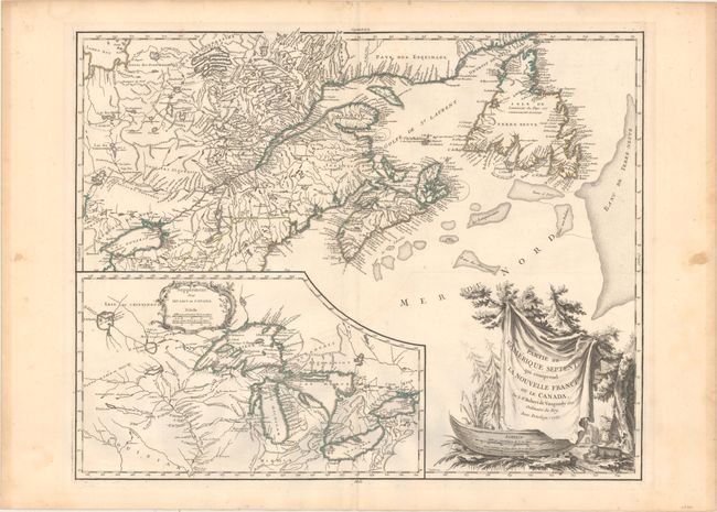
Auction 162, Lot 128
Subject: Colonial Northeastern United States & Canada, Great Lakes
Robert de Vaugondy, Didier
Partie de l'Amerique Septent? qui Comprend la Nouvelle France ou le Canada, 1755
Size: 23.8 x 19 inches (60.5 x 48.3 cm)
Estimate: $650 - $800
Uncommon First State
Unsold
Closed on 4/26/2017
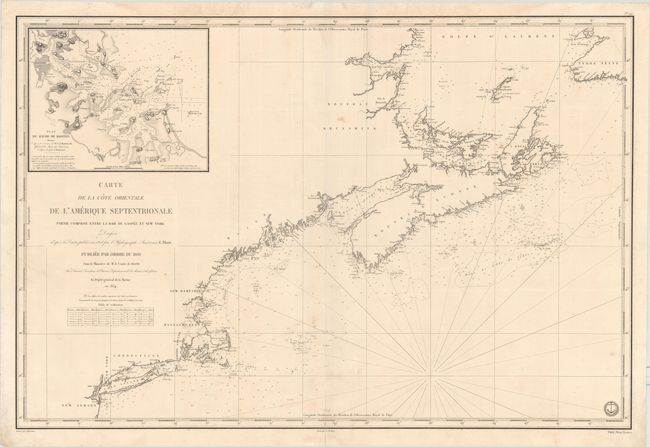
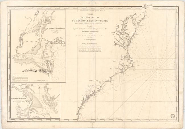
Auction 162, Lot 129
Subject: Northeastern United States & Canada
Depot de la Marine
Carte de la Cote Orientale de l'Amerique Septentrionale Partie Comprise Entre la Baie de Gaspee et New York..., 1834
Size: 34.3 x 23 inches (87.1 x 58.4 cm)
Estimate: $475 - $600
Unsold
Closed on 4/26/2017
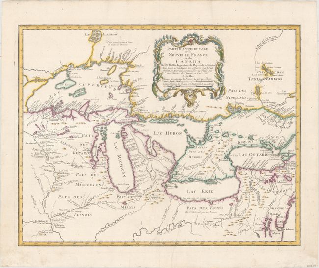
Auction 162, Lot 130
Subject: Colonial Great Lakes
Bellin/Homann Heirs
Partie Occidentale de la Nouvelle France ou du Canada par Mr. Bellin..., 1755
Size: 21.5 x 17 inches (54.6 x 43.2 cm)
Estimate: $1,800 - $2,100
Influential Map of the Great Lakes
Sold for: $975
Closed on 4/26/2017
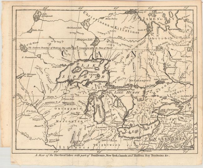
Auction 162, Lot 131
Subject: Colonial Great Lakes
A Map of the Five Great Lakes with Part of Pensilvania, New York, Canada and Hudsons Bay Territories &c., 1755
Size: 10.4 x 8.3 inches (26.4 x 21.1 cm)
Estimate: $275 - $350
Sold for: $240
Closed on 4/26/2017
Auction 162, Lot 132
Subject: United States
Cobbett, William
United States [bound in] A Year's Residence, in the United States of America..., 1819
Size: 5.6 x 9.2 inches (14.2 x 23.4 cm)
Estimate: $250 - $325
Unsold
Closed on 4/26/2017
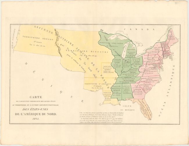
Auction 162, Lot 133
Subject: United States
Buchon, Jean Alexandre
Carte de l'Adjonction Progressive des Divers Etats au Territoire et a l'Union Constitutionnelle des Etats-Unis de l'Amerique du Nord, 1825
Size: 25.1 x 14.8 inches (63.8 x 37.6 cm)
Estimate: $200 - $230
Sold for: $170
Closed on 4/26/2017
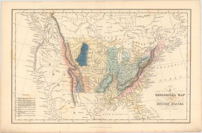
Auction 162, Lot 134
Subject: United States
Hinton, Simpkin & Marshall
A Geological Map of the United States, 1832
Size: 15.4 x 9.8 inches (39.1 x 24.9 cm)
Estimate: $250 - $325
Sold for: $180
Closed on 4/26/2017
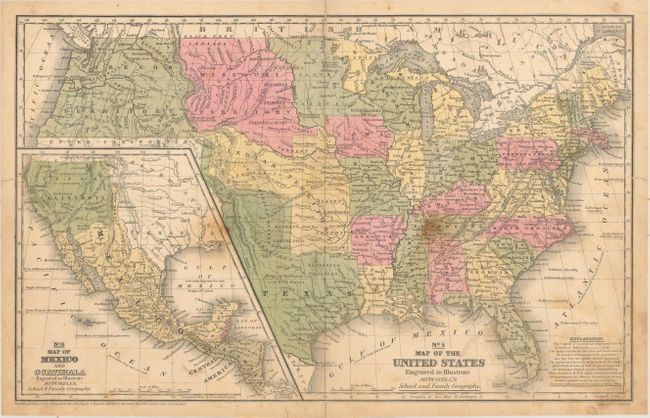
Auction 162, Lot 135
Subject: United States
Mitchell, Samuel Augustus
[Lot of 2] No. 5 Map of the United States Engraved to Illustrate Mitchell's School and Family Geography [and] No. 15 Map of Oregon and Upper California..., 1839-46
Size: See Description
Estimate: $375 - $450
Sold for: $220
Closed on 4/26/2017
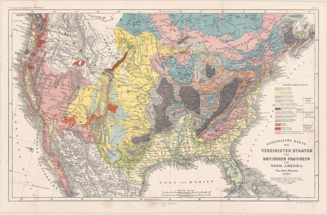
Auction 162, Lot 136
Subject: United States
Marcou, Jules
Geologische Karte der Vereinicten Staaten und Britischen Provinzen von Nord_Amerika, 1855
Size: 15 x 9.5 inches (38.1 x 24.1 cm)
Estimate: $275 - $350
Sold for: $130
Closed on 4/26/2017
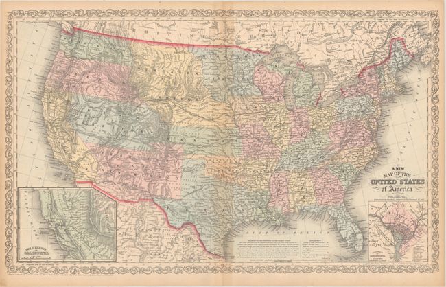
Auction 162, Lot 137
Subject: United States
Desilver, Charles
A New Map of the United States of America by J.H. Young, 1857
Size: 26.3 x 15.9 inches (66.8 x 40.4 cm)
Estimate: $250 - $325
Desilver's United States
Sold for: $170
Closed on 4/26/2017
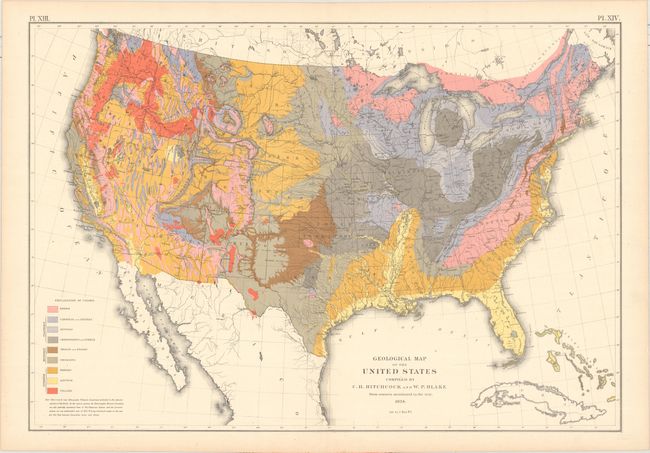
Auction 162, Lot 138
Subject: United States
Hitchcock, Charles Henry
Geological Map of the United States Compiled by C.H. Hitchcock and W. P. Blake from Sources Mentioned in the Text, 1874
Size: 28.4 x 19.7 inches (72.1 x 50 cm)
Estimate: $180 - $220
Sold for: $130
Closed on 4/26/2017
Auction 162, Lot 139
Subject: United States
U.S. Department of Interior
Map of the United States Exhibiting the Grants of Lands Made by the General Government to Aid in the Construction of Railroads and Wagon Roads, 1878
Size: 28.3 x 19.7 inches (71.9 x 50 cm)
Estimate: $275 - $350
Sold for: $200
Closed on 4/26/2017
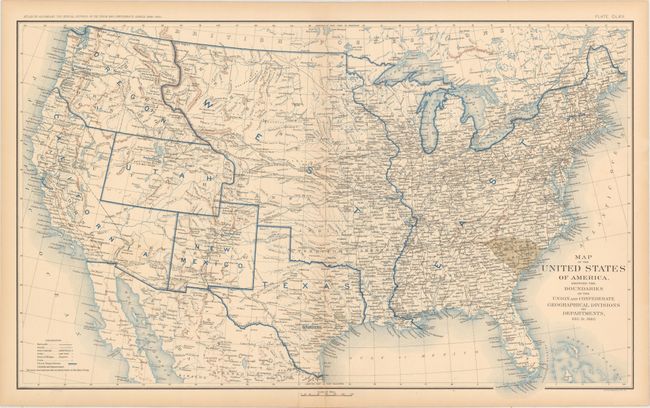
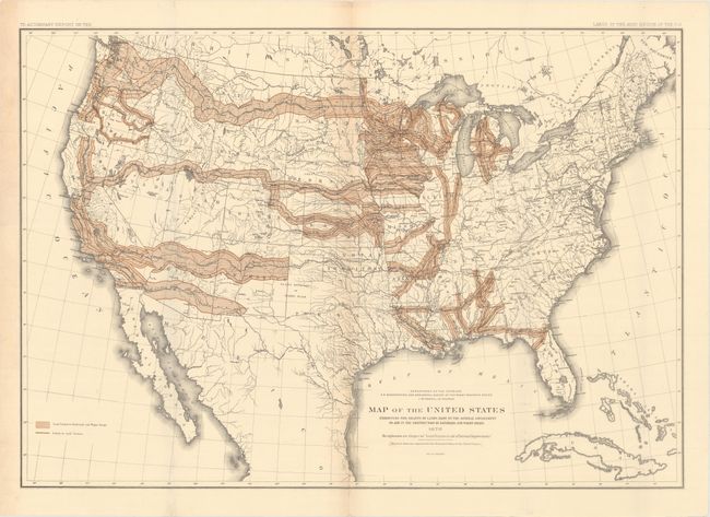
Auction 162, Lot 140
Subject: United States, Civil War
U.S. War Department
[Lot of 10] Map of the United States of America, Showing the Boundaries of the Union and Confederate Geographical Divisions and Departments Plates CLXII - CLXXI, 1891-95
Size: 27.8 x 16.9 inches (70.6 x 42.9 cm)
Estimate: $800 - $1,000
An Attractive Set Showing the Progression of the Civil War
Unsold
Closed on 4/26/2017
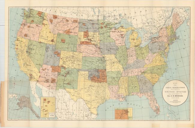
Auction 162, Lot 141
Subject: United States
U.S. Bureau of Indian Affairs
Map Showing Indian Reservations Within the Limits of the United States..., 1893
Size: 33.3 x 20.9 inches (84.6 x 53.1 cm)
Estimate: $140 - $170
Sold for: $100
Closed on 4/26/2017
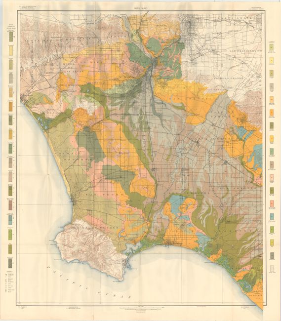
Auction 162, Lot 142
Subject: United States
U.S.D.A.
[Lot of 78 - U.S.D.A. Soil Maps], 1903
Size: 6.2 x 9.4 inches (15.7 x 23.9 cm)
Estimate: $500 - $650
Features Maps of Los Angeles and New Orleans
Sold for: $425
Closed on 4/26/2017
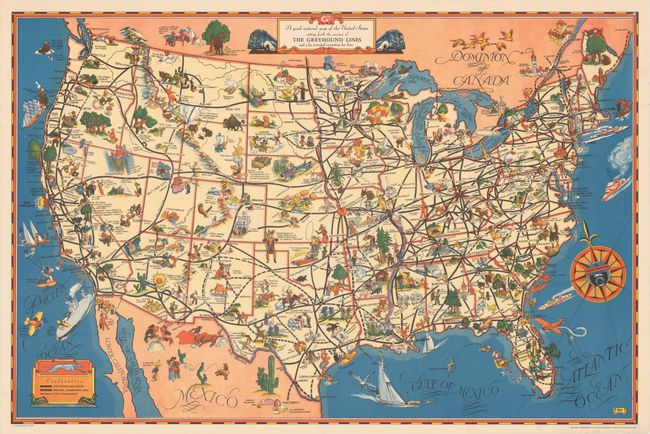
Auction 162, Lot 143
Subject: United States
A Good-Natured Map of the United States Setting Forth the Services of the Greyhound Lines and a Few Principal Connecting Bus Lines, 1938
Size: 28.9 x 19.1 inches (73.4 x 48.5 cm)
Estimate: $250 - $325
Sold for: $160
Closed on 4/26/2017
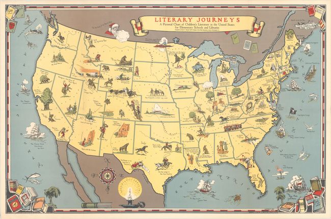
Auction 162, Lot 144
Subject: United States
Smith, J.L.
Literary Journeys - A Pictorial Chart of Children's Literature in the United States for Elementary Schools and Libraries, 1940
Size: 34 x 22.3 inches (86.4 x 56.6 cm)
Estimate: $140 - $170
Sold for: $95
Closed on 4/26/2017
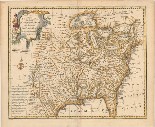
Auction 162, Lot 145
Subject: Colonial Eastern United States
Bowen, Emanuel
A New & Accurate Map of Louisiana, with Part of Florida and Canada, and the Adjacent Countries. Drawn from Surveys, Assisted by the Most Approved English & French Maps & Charts..., 1747
Size: 16.6 x 13.6 inches (42.2 x 34.5 cm)
Estimate: $800 - $950
Sold for: $600
Closed on 4/26/2017
Auction 162, Lot 146
Subject: Eastern United States
Russell, John C.
An Accurate Map of the United States of America, According to the Treaty of Peace of 1783, 1794
Size: 18.4 x 14.5 inches (46.7 x 36.8 cm)
Estimate: $400 - $475
Sold for: $300
Closed on 4/26/2017
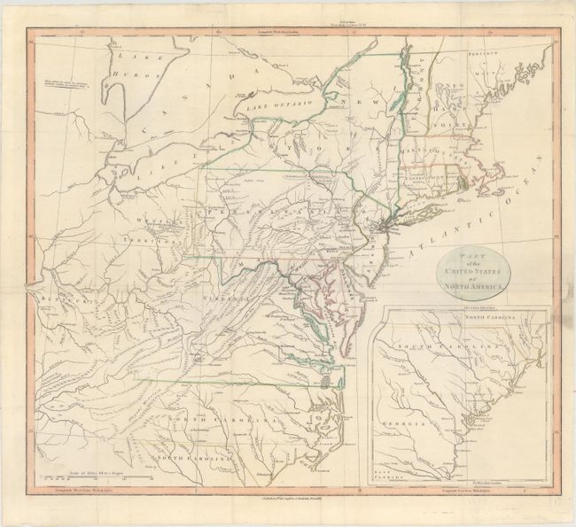
Auction 162, Lot 147
Subject: Eastern United States
Stockdale, John
Part of the United States of North America, 1798
Size: 18.4 x 16.1 inches (46.7 x 40.9 cm)
Estimate: $275 - $350
Sold for: $150
Closed on 4/26/2017
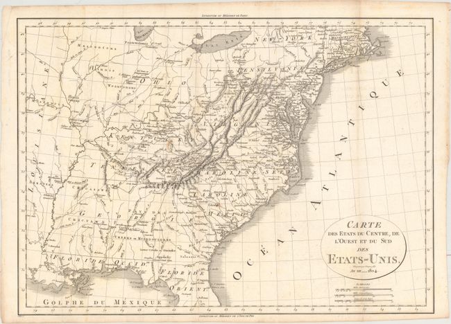
Auction 162, Lot 148
Subject: Eastern United States
Michaux, Francois A.
Carte des Etats du Centre, de l'Ouest et du Sud des Etats-Unis, 1804
Size: 19.8 x 14.2 inches (50.3 x 36.1 cm)
Estimate: $400 - $475
Unsold
Closed on 4/26/2017
Auction 162, Lot 149
Subject: Eastern United States
Melish, John
[4 City Maps] A Geographical Description of the United States, with the Contiguous British and Spanish Possessions, Intended as an Accompaniment to Melish's Map of These Countries, 1818
Size: 5.4 x 8.2 inches (13.7 x 20.8 cm)
Estimate: $200 - $230
Sold for: $150
Closed on 4/26/2017
Auction 162, Lot 150
Subject: Eastern United States
Rossi, Luigi
Stati Uniti di America, 1820
Size: 7.9 x 7 inches (20.1 x 17.8 cm)
Estimate: $200 - $230
Sold for: $120
Closed on 4/26/2017
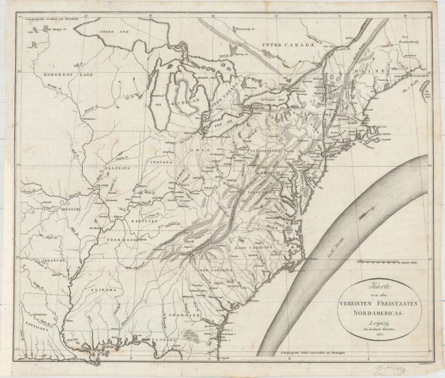
Auction 162, Lot 151
Subject: Eastern United States
Melish, John
Karte von dem Vereinten Freistaaten Nordamericas, 1821
Size: 16.6 x 13.9 inches (42.2 x 35.3 cm)
Estimate: $550 - $650
Unsold
Closed on 4/26/2017
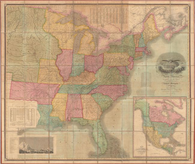
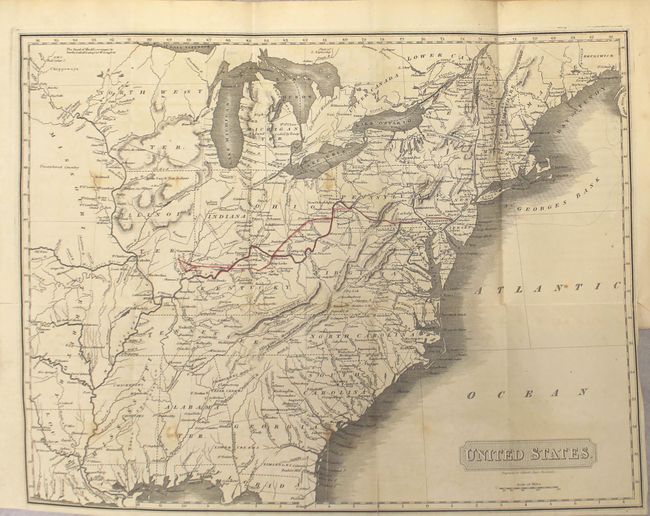
Auction 162, Lot 152
Subject: Eastern United States
Vance, David H.
Map of the United States of North America Compiled from the Latest and Most Authentic Information, 1825
Size: 61.6 x 51.8 inches (156.5 x 131.6 cm)
Estimate: $8,000 - $10,000
First Edition of Vance's Scarce, Large Map of the United States
Unsold
Closed on 4/26/2017
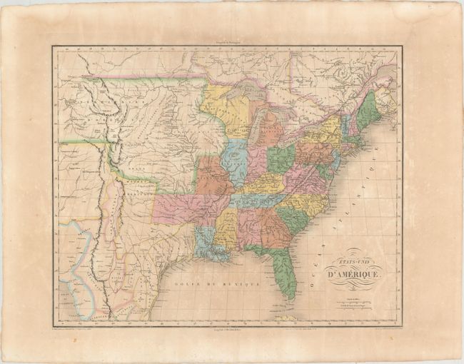
Auction 162, Lot 153
Subject: Eastern United States
Buchon, Jean Alexandre
Etats-Unis d'Amerique, 1825
Size: 20.8 x 16.7 inches (52.8 x 42.4 cm)
Estimate: $400 - $475
Sold for: $200
Closed on 4/26/2017
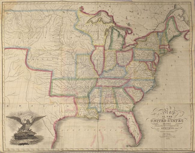
Auction 162, Lot 154
Subject: Eastern United States
Schoyer, Solomon
Map of the United States Drawn from the Most Approved Surveys, 1826
Size: 20.8 x 16.3 inches (52.8 x 41.4 cm)
Estimate: $500 - $650
Sold for: $350
Closed on 4/26/2017
Auction 162, Lot 155
Subject: Eastern United States
Mitchell, Samuel Augustus
Mitchell's Travellers Guide Through the United States. A Map of the Roads, Distances, Steam Boat & Canal Routes &c., 1834
Size: 21.8 x 17.3 inches (55.4 x 43.9 cm)
Estimate: $750 - $900
Unsold
Closed on 4/26/2017
Auction 162, Lot 156
Subject: Eastern United States
Depot de la Marine
Carte de la Cote Orientale de l'Amerique Septentrionale Partie Comprise Entre New-York et la Riviere Saint Jean..., 1834
Size: 34.2 x 23.7 inches (86.9 x 60.2 cm)
Estimate: $600 - $750
Unsold
Closed on 4/26/2017
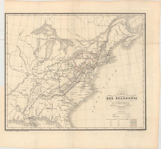
Auction 162, Lot 157
Subject: Eastern United States
Bouffard, L.
Carte des Etats-Unis d'Amerique, 1836
Size: 14.9 x 12.5 inches (37.8 x 31.8 cm)
Estimate: $160 - $190
Unsold
Closed on 4/26/2017
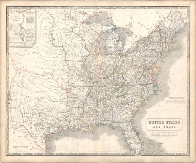
Auction 162, Lot 158
Subject: Eastern United States, Texas
Johnston, Alexander K.
United States and Texas, 1842
Size: 24.1 x 19.6 inches (61.2 x 49.8 cm)
Estimate: $1,200 - $1,400
Highly Detailed British Atlas Map Featuring the Independent Republic of Texas
Sold for: $600
Closed on 4/26/2017
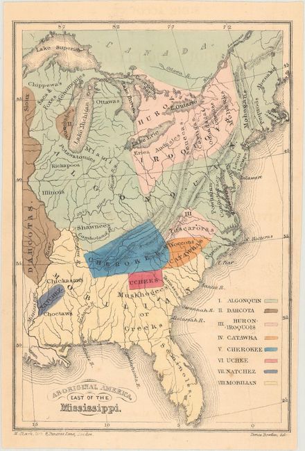
Auction 162, Lot 159
Subject: Eastern United States
Religious Society of Friends
Aboriginal America, East of the Mississippi, 1844
Size: 4.3 x 6.3 inches (10.9 x 16 cm)
Estimate: $100 - $130
NO RESERVE
Sold for: $60
Closed on 4/26/2017
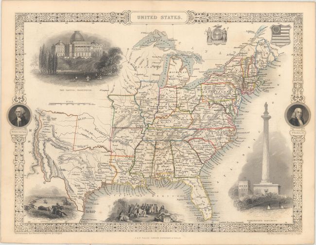
Auction 162, Lot 160
Subject: Eastern United States, Texas
Tallis, John
United States, 1851
Size: 13.5 x 9.7 inches (34.3 x 24.6 cm)
Estimate: $275 - $350
Sold for: $180
Closed on 4/26/2017
220 lots
Page 1 of 5