Filtered by Category:Canada(Show All Categories)
Showing results for:Auction 98
Catalog Archive
18 lots
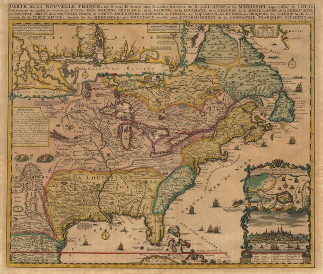
Auction 98, Lot 86
Subject: Colonial North America
Chatelain, Henry Abraham
Carte de la Nouvelle France, ou se voit le cours des Grandes Rivieres de S. Laurens & de Mississipi Aujour d'hui S. Louis, Aux Environs des-quelles se trouvent les Etats, Pais, Nations, Peuples &c., 1732
Size: 19.1 x 16.5 inches (48.5 x 41.9 cm)
Estimate: $2,200 - $2,400
Sold for: $2,300
Closed on 3/6/2002
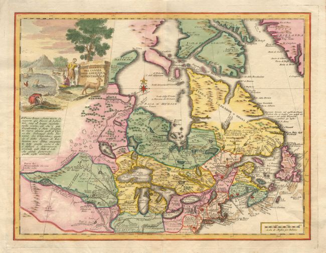
Auction 98, Lot 88
Subject: Colonial United States and Canada
Albrizzi, Girolamo
Carta Geografica del Canada nell' America Settentrionale, 1742
Size: 17 x 12.8 inches (43.2 x 32.5 cm)
Estimate: $750 - $850
Sold for: $550
Closed on 3/6/2002
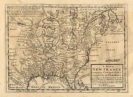
Auction 98, Lot 89
Subject: Colonial United States and Canada
Moll, Herman
A Map of New France Containing Canada, Louisiana &c. in Nth. America. According to the Patent Granted by the King of France to Monsieur Crozat, Dated the 14th of Sep. 1712 N.S. and Registered in the Parliament of Paris the 24th of Same Month, 1745
Size: 10 x 7.3 inches (25.4 x 18.5 cm)
Estimate: $400 - $450
Sold for: $375
Closed on 3/6/2002

Auction 98, Lot 90
Subject: Colonial United States and Canada - Great Lakes
Delisle/Buache
Carte du Canada ou de la Nouvelle France et des Decouvertes qui y ont ete faites Dressee sur plusieurs Observations, 1745
Size: 25.5 x 19.5 inches (64.8 x 49.5 cm)
Estimate: $2,000 - $2,500
Unsold
Closed on 3/6/2002
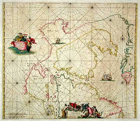
Auction 98, Lot 104
Subject: Canada
Wit, Frederick de
Septemtrionaliora Americae a Groenlandia, per Freta Davidis, et Hudson, ad Terram Novam / De Noordelyckste Zee kusten van America van Groenland door de Straet Davis ende Straet Hudson tot Terra Neuf, 1715
Size: 22 x 19 inches (55.9 x 48.3 cm)
Estimate: $1,000 - $1,200
Sold for: $600
Closed on 3/6/2002

Auction 98, Lot 105
Subject: Canada
Mount & Page
A New and Correct Chart of the Coast of New Foundland from Cape Raze to Cape Bonavista, With Chebucto Harbour in Nova Scotia Done from the latest Observations, 1755
Size: 39.7 x 16.5 inches (100.8 x 41.9 cm)
Estimate: $600 - $750
Unsold
Closed on 3/6/2002
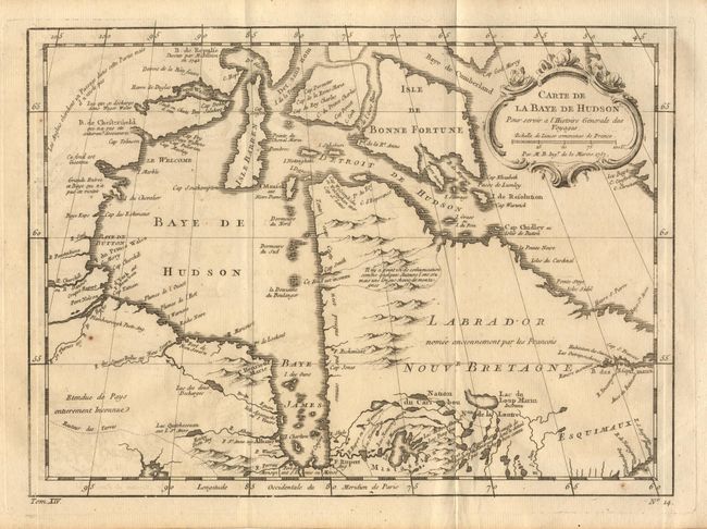
Auction 98, Lot 106
Subject: Canada
Bellin, Jacques Nicolas
Carte de la Baye de Hudson Pour servir a l'Histoire Generale des Voyages, 1757
Size: 12 x 8.7 inches (30.5 x 22.1 cm)
Estimate: $150 - $200
Sold for: $85
Closed on 3/6/2002
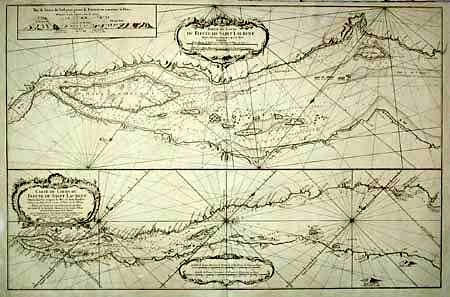
Auction 98, Lot 107
Subject: Canada
Bellin, Jacques Nicolas
Partie du Cours du Fleuve de Saint Laurent… [on sheet with] Carte du Cours du Fleuve de Saint Laurent depuis Quebec jusqu'a la Mer…, 1761
Size: 34 x 22 inches (86.4 x 55.9 cm)
Estimate: $700 - $800
Sold for: $550
Closed on 3/6/2002
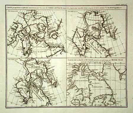
Auction 98, Lot 108
Subject: Canada
Robert de Vaugondy, Didier
Carte qui represente les differentes connoissance que l'on a eues des Terres Arctiques…, 1774
Size: 13.5 x 11.5 inches (34.3 x 29.2 cm)
Estimate: $150 - $180
Sold for: $160
Closed on 3/6/2002
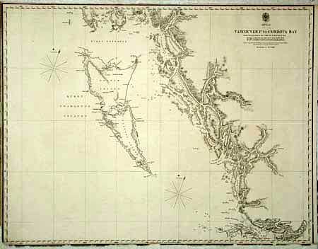
Auction 98, Lot 109
Subject: Canada
British Government
Vancouver P. to Cordova Bay From a Russian Chart of 1849 - corrected by Mr. Inskip in 1855, 1860
Size: 24.5 x 19 inches (62.2 x 48.3 cm)
Estimate: $75 - $100
Sold for: $35
Closed on 3/6/2002
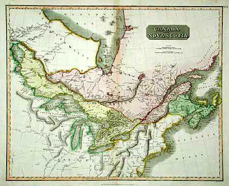
Auction 98, Lot 110
Subject: Canada
Thomson, John
Canada and Nova Scotia, 1814
Size: 23.5 x 19 inches (59.7 x 48.3 cm)
Estimate: $150 - $200
Sold for: $110
Closed on 3/6/2002
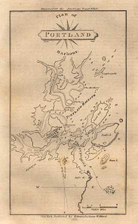
Auction 98, Lot 112
Subject: Canada & United States
Blunt, Edmund
[Lot of 3 plans] Plan of Portland Harbour [and] Isle of Sable [and] [Untitled - Newport, RI], 1833
Size: See Description
Estimate: $80 - $120
Sold for: $90
Closed on 3/6/2002
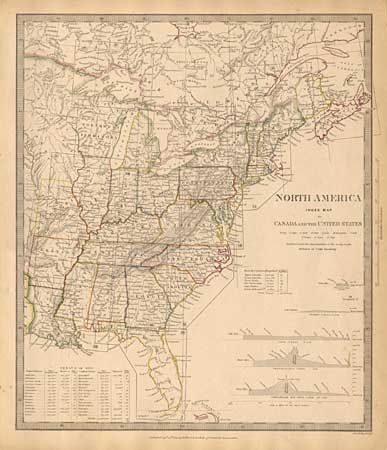
Auction 98, Lot 113
Subject: Eastern United States and Canada
SDUK Society for the Diffusion of Useful Knowledge
North America Index Map to Canada and the United States, 1834
Size: 12.4 x 14.5 inches (31.5 x 36.8 cm)
Estimate: $80 - $100
Sold for: $110
Closed on 3/6/2002
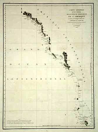
Auction 98, Lot 114
Subject: West Coast
La Perouse, Comte Jean F. Galoup, de
Carte Generale d'une Partie de la Cote du Nord-Ouest de l'Amerique reconnue par les Fregates Francaises la Boussole et l'Astrolabe, 1797
Size: 19.3 x 26.6 inches (49 x 67.6 cm)
Estimate: $300 - $350
Sold for: $220
Closed on 3/6/2002
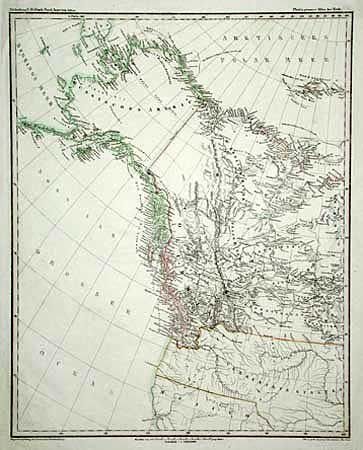
Auction 98, Lot 115
Subject: Western Canada and United States
Anon.
Abtheilung V. Britisch Nord-America. II Blatt, 1848
Size: 15 x 18.5 inches (38.1 x 47 cm)
Estimate: $150 - $200
Sold for: $140
Closed on 3/6/2002
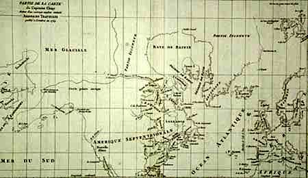
Auction 98, Lot 116
Subject: Canada and Alaska
Robert de Vaugondy, Didier
Partie de la Carte du Capitaine Cluny Auteur d'un ouvrage anglois intitule American Traveller, 1772
Size: 19.4 x 11.5 inches (49.3 x 29.2 cm)
Estimate: $200 - $250
Sold for: $180
Closed on 3/6/2002
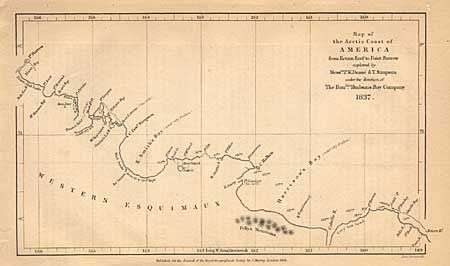
Auction 98, Lot 117
Subject: Canada and Alaska
Royal Geographical Society
Map of the Arctic Coast of America from return Reef to Point Barrow explored by Mess.rs P.W. Dease & T. Simpson under the direction of the Hon.ble Hudson's Bay Company, 1838
Size: 7.8 x 4.5 inches (19.8 x 11.4 cm)
Estimate: $50 - $60
Sold for: $35
Closed on 3/6/2002
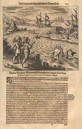
Auction 98, Lot 432
Subject: Exploration
Bry, Theodore de
[Canada], 1655
Size: 6.8 x 5.8 inches (17.3 x 14.7 cm)
Estimate: $200 - $250
Sold for: $170
Closed on 3/6/2002
18 lots