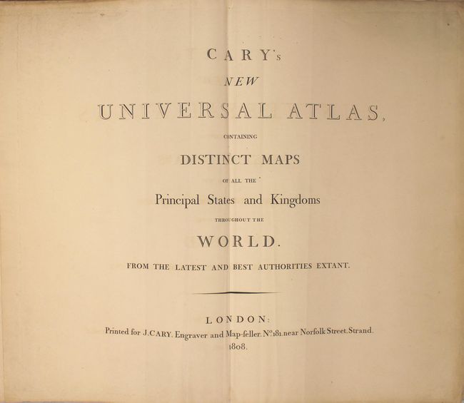
"Cary's New Universal Atlas, Containing Distinct Maps of All the Principal States and Kingdoms Throughout the World. From the Latest and Best Authorities Extant", Cary, John
Subject: Atlases
Period: 1808 (published)
Publication:
Color: Hand Color
Size:
14.8 x 21.9 inches
37.6 x 55.6 cm
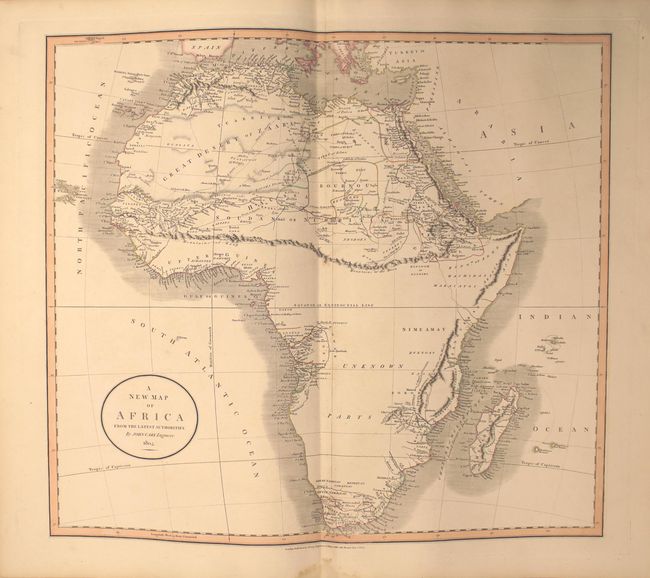
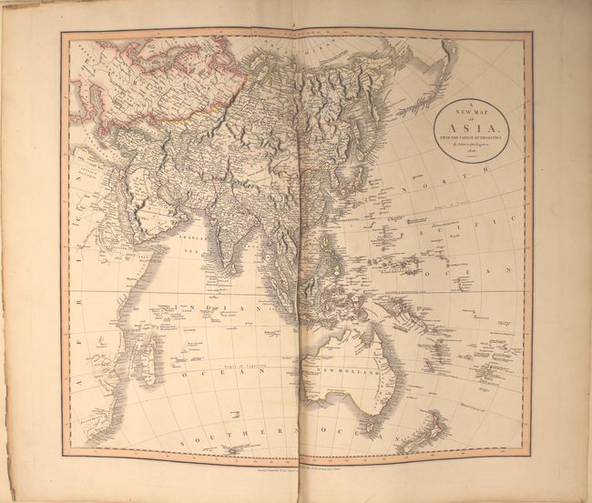
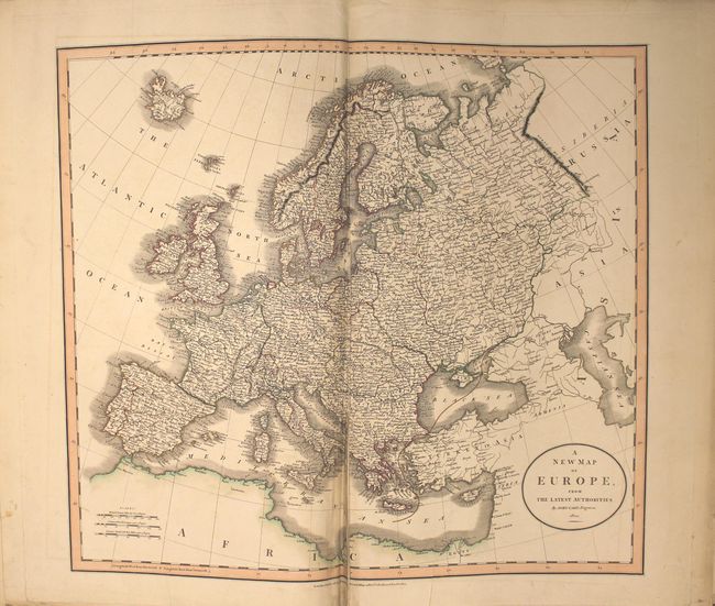
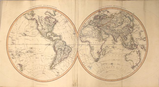
This large, complete folio atlas contains 54 maps, including four that fold out, and two that are printed on 2 separate sheets (Scotland and South America). Included are the following: double-hemisphere world, world on Mercator's projection, Europe plus 31 related to Europe, Asia plus 7 related to Asia, Africa, Egypt, western hemisphere, North America, 2 related to Canada, 4 related to the United States, West Indies, and South America. Of particular interest are the following:
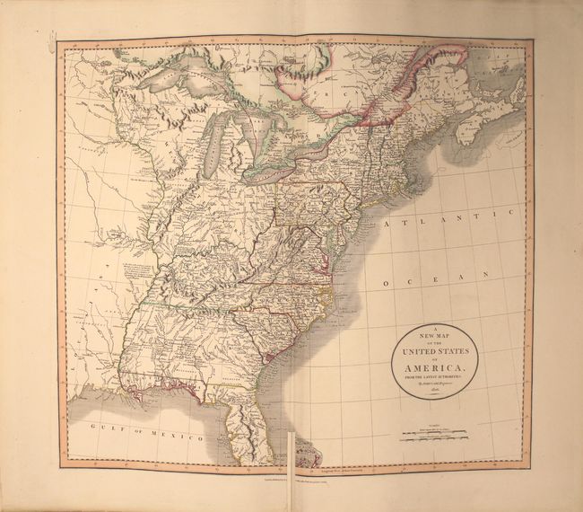
A. A New Map of the United States of America, from the Latest Authorities. This handsome map is one of the best maps of the United States to appear in the early part of the nineteenth century. It covers the country from the Atlantic Ocean westward to the Mississippi River, beyond which is a small portion of Louisiana Territory. The huge Western Territory is comprised of today's Minnesota, Wisconsin, Illinois, Indiana, Ohio and Michigan. The 1795 Boundary Line by the Treaty of Grenville is delineated across present-day Ohio. The District of Main is drawn from the British point of view with the northern portion incorporated into Lower Canada and New Brunswick. The huge Georgia Territory stretches to the Mississippi River, incorporating present-day Alabama and Mississippi. Florida is divided into the Spanish possessions of East and West Florida. The map is filled with place names, forts, Indian villages and hunting grounds, roads and interesting notations.
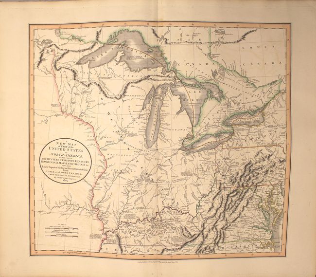
B. A New Map of Part of the United States of North America, Exhibiting the Western Territory, Kentucky, Pennsylvania, Maryland, Virginia &c. Also, the Lakes Superior, Michigan, Huron, Ontario & Erie; with Upper and Lower Canada &c. This map shows the early frontier during a period when the young United States was rapidly settling the territory between the Allegany Mountains and its boundary on the Mississippi River. The present-day states of Michigan, Indiana, Ohio, Illinois, Wisconsin and part of Minnesota are all contained within the large Western Territory. Lake Superior still shows the imaginary Isle Philippeaux, and native tribes are named throughout the map. Bounty Land Grants for the Illinois Company and the Wabash Company are named near the Illinois and Wabash rivers. Navigational and historical notes are scattered throughout the map, and roads are well-delineated. One of the most interesting of those notations is one in Kentucky that describes the region discovered by J. Macbride in 1754, explored by Daniel Boon in 1769, and settled by Boon and 'five others' in 1773.
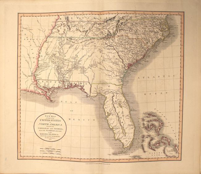
C. A New Map of Part of the United States of North America, Containing the Carolinas and Georgia. Also the Floridas and Part of the Bahama Islands &c. from the Latest Authorities. This is a wonderful map of the Southeast issued during a period of rapid change and advancement. East and West Florida exist as separate territories. West Florida was not annexed into the United States until 1810. Portions of it became Louisiana, Alabama and Florida. The map is filled with information on the roads, portages, forts, Indian villages, settlements and topography. It is also remarkable for the many interesting notes, including the Principal Hunting Grounds of the Western Party and Six Villages in Mississippi, here shown as part of the large Georgia Territory. In Florida, Fort St. Marks, Apalacha Fort, and the roads from St. Augustine are shown, with a note that the Apalachees Villages are now almost all deserted. Southern Florida is labeled Ancient Tegesta. A lake and river system connects Mayaco Lake (Lake Okeechobee) with the St. Johns River. The map extends to provide good detail of the Bahamas including a notation on Guanihani or Cat Island that it was the first Land of America Discovered by Columbus - a common misconception of the period.
The list of maps is pasted to the inside front cover. The atlas is complete. Hardbound in quarter leather with tips over marbled covers, and raised bands on spine.
References:
Condition:
The maps are all in original outline color, and the majority are clean and bright in near fine (A) or very good (B+) condition, with light offsetting, minor soiling, occasional misfolds, or short (less than 2") centerfold separations (including the map of the eastern US). There is a minor damp stain along the bottom edge of many of the sheets, always well away from the image. Ten maps have long centerfold separations at bottom that extend 6" to 15" into the image; these are the double-hemisphere world, Europe, British Isles, England, Ireland, Italy, Portugal, Asia, India, and Western Hemisphere. The front and back covers, the title page, and the front and back free endpapers are completely detached. The covers are heavily worn and the spine is chipped and cracking. This example would benefit from conservation.