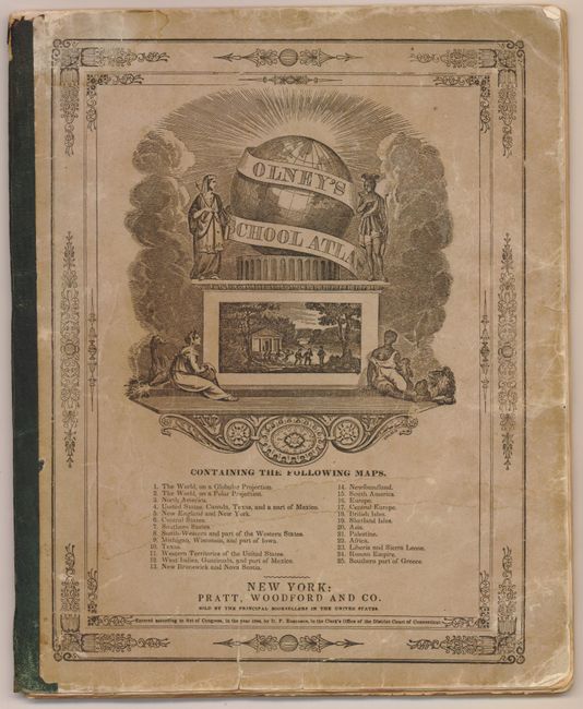
"Olney's School Atlas", Olney, A. N.
Subject: Atlases
Period: 1844 (dated)
Publication:
Color: Hand Color
Size:
9.6 x 11.9 inches
24.4 x 30.2 cm
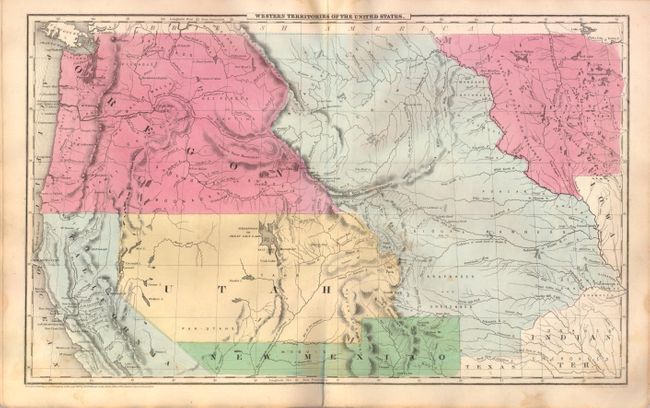
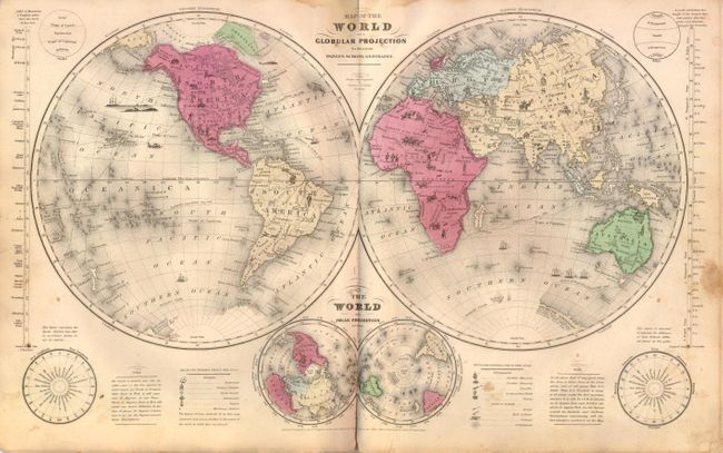
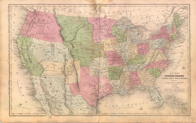
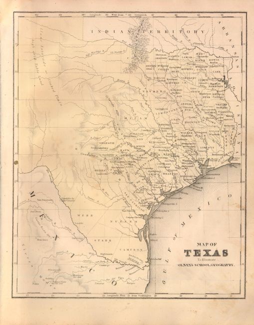
This is a complete example of Olneys' atlas with 25 maps with several related to the United States as well as maps of the world and continents. The double hemisphere world map includes quaint little vignettes throughout, such as Indians and buffalo in North America, lions and elephants in Africa, a pagoda in China and a kangaroo in Australia. The map of the United States shows New Mexico territory with a pre-Gadsden purchase border, suggesting that this atlas is circa 1850 then the 1844 date on the maps. The map of Texas shows county development confined to the east with a large Staked Plain occupying the west. Maps are printed one side only and the printed paper covers double as the title page and list of maps. Published by Pratt, Woodford & Co., New York.
References:
Condition: B
The maps are generally good with some scattered foxing, minor soiling, and a damp stain at the upper centerfold which just passes the neatline in most maps. Covers are worn and soiled with a few edge tears, as to be expected.