"[Lot of 3] Cours Inferieur du Mississippi [and] Bouches du Mississippi et Nouvelle Orleans [and] Vicksburg (Mississippi)",
Subject: Mississippi River & Vicksburg, Louisiana
Period: 1874 (circa)
Publication: Histoire de la Guerre Civile en Amerique
Color: Printed Color
Size:
16.3 x 20.6 inches
41.4 x 52.3 cm
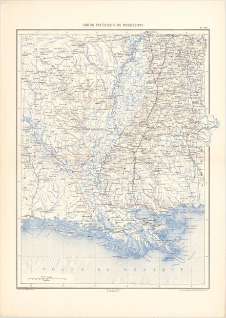
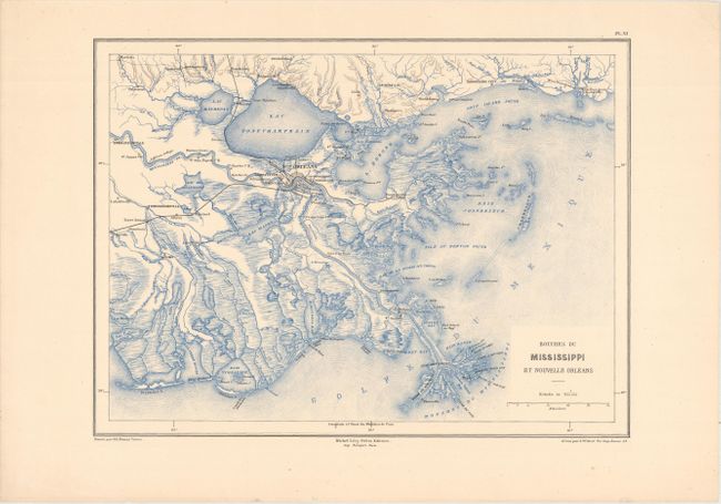
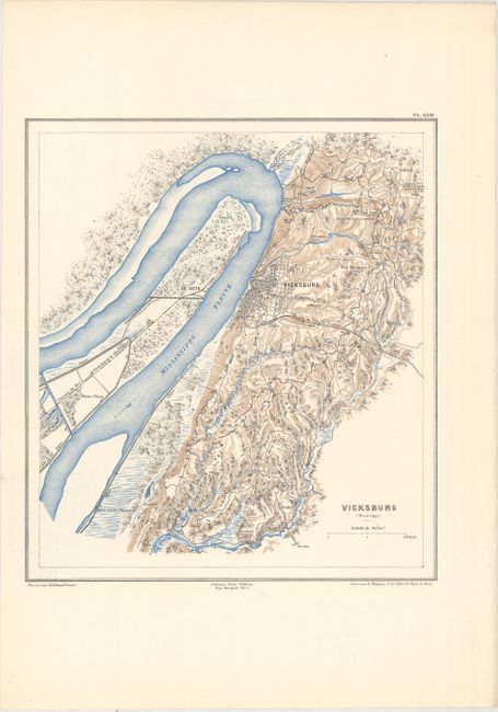
This lot includes three intricately engraved and uncommon maps of the Lower Mississippi from Michel Levy's Histoire de la Guerre Civile en Amerique, a French Civil War atlas published in 7 volumes from 1874-90. The first map traces the river in fine detail from its mouth north to Memphis. It extends to include Louisiana, Mississippi, southern Arkansas, and parts of Texas, Alabama, and Tennessee. New Orleans, Baton Rouge, Shreveport, Natchez, Little Rock, Jackson, Vicksburg, and Memphis are named along with many other towns and cities. The second map zooms in on the mouth of the Mississippi. The third map focuses on Vicksburg, shown in miniature plan form, and its immediate surroudings. Drawn by Ed. Dumas Vorzet and engraved by L. Wuhrer.
References:
Condition: A
The first sheet has a hint of toning in the blank margins, otherwise near fine. The other two sheets are faintly toned, and the second one has a chip in the top right blank margin that has been reattached with archival tape on verso.