"L'Amerique Septentrionale", Anon.
Subject: Colonial North America
Period: 1690 (circa)
Publication:
Color: Black & White
Size:
11.7 x 9.9 inches
29.7 x 25.1 cm
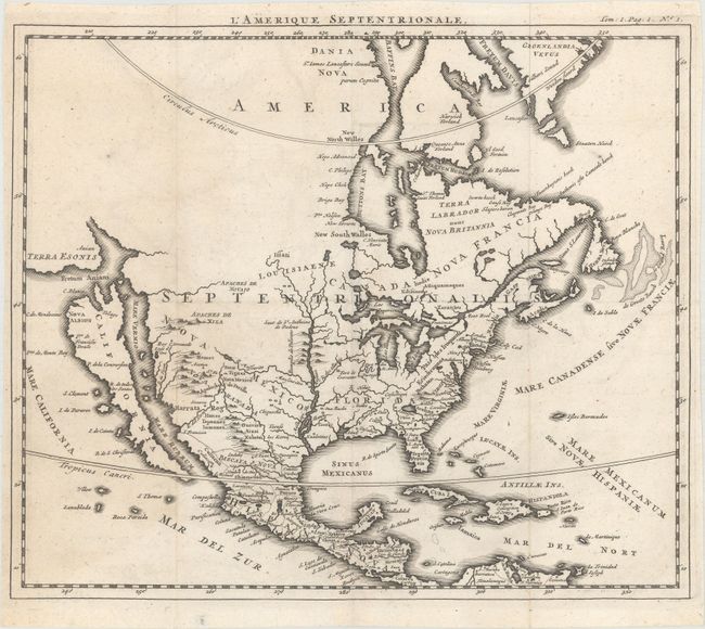
This interesting map of North America includes a number of outdated geographical misconceptions.
The island of California is shown prominently with an indented northern coastline and a number of place names, including C. Blanco, C. de Mendocino, and Nova Albion. Immediately to the north of California is Terra Esonis, separated from North America by Fretum Aniani. The remainder of the northwest remains blank. The Mississippi River is labeled Meschasipi Flu. and empties too far to the west into the Gulf of Mexico. Additionally, the Rio Grande, here R. del Norto, flows to the west and empties into the Gulf of California. The region east of the Mississippi River is labeled Florida, while the region to the west is Nova Mexico and the region to the north is Louisiaene [sic]. A number of Indian tribes and forts are located throughout.
References:
Condition: A
Issued folding with a hint of offsetting and tiny holes at the fold intersections.