Catalog Archive
Auction 166, Lot 253

NO RESERVE

"Map of the Delta of the St. Clair...", U.S. Corps of Engineers
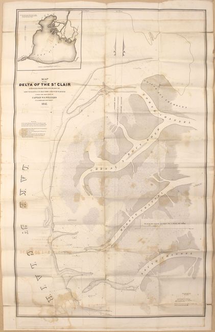
Subject: Michigan

Period: 1842 (dated)

Publication:

Color: Black & White

Size:
28.8 x 47.4 inches
73.2 x 120.4 cm
Download High Resolution Image
(or just click on image to launch the Zoom viewer)

This map depicts several channels from the St. Clair River to Lake St. Clair. It was surveyed and drawn by Lts. J. N. Macomb and W. H. Warner under the direction of Captain W.G. Williams. At top is a large inset map of the region that was copied from an original used in the Treaty of Ghent and extends to Detroit. The main map locates the Swan River and four sub-channels of the St. Claire. Drawn on a scale of 4 inches per mile.

References:

Condition: B

Issued folding with moderate offsetting, scattered stains, and several fold separations primarily at the joints.

Estimate: $110 - $140

Sold for: $5

Closed on 2/14/2018

Archived