Early Map of Golden Gate Park
"Map Showing the Golden Gate Park - The Avenue and Buena Vista Park", Britton & Rey
Subject: San Francisco, California
Period: 1893 (dated)
Publication:
Color: Hand Color
Size:
53.7 x 9.4 inches
136.4 x 23.9 cm
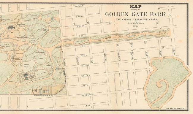
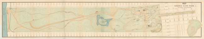
This uncommon, early map depicts the entire Golden Gate Park from Baker Street to the Pacific Ocean. The long, narrow map shows all aspects of the park including recreational buildings, roads, trails and monuments. Golden Gate Park was founded in 1871 in an unincorporated area west of San Francisco's city limits. It is similar in shape to New York's Central Park but is actually 20% larger in size. Issued on two joined sheets.
References:
Condition: B+
A bright, colorful example with two short fold separations at bottom that has been closed on verso with archival tape and a few faint spots of foxing. The lower left margin has been trimmed, but it is still adequate for framing.