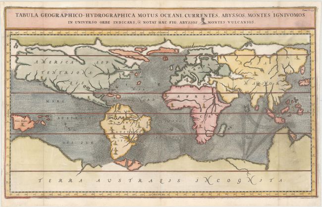
"Tabula Geographico-Hydrographica Motus Oceani, Currentes, Abyssos, Montes Ignivomos in Universo Orbe...", Kircher, Athanasius
Subject: World
Period: 1682 (published)
Publication: D'Onder-Aardse Weereld
Color: Hand Color
Size:
21.8 x 13.3 inches
55.4 x 33.8 cm
The Jesuit scholar Athanasius Kircher was one of the first compilers of semi-scientific knowledge about the physical features of the world. This extraordinary map depicts ocean currents, volcanoes and deep-sea chasms. The continents are void of political detail and only major lakes, rivers and volcanoes are shown. There are prominent Northwest and Northeast sea passages and a vast southern continent. Kircher's theories included the notion that the world's oceans were all interconnected and subterranean tunnels are shown connecting the oceans and seas. Published in a Dutch edition of Kircher's famous Subterranean World.
References: Shirley #436.
Condition: A
A crisp impression, issued folding and now flattened, with a couple of short printer's creases and a few tiny worm holes only visible when held to light.