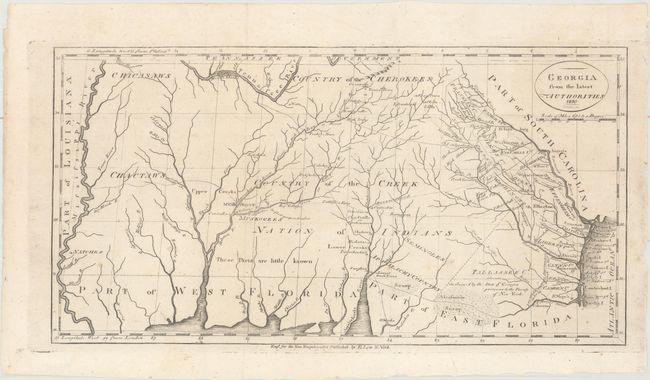
"Georgia from the Latest Authorities", Low, E.
Subject: Southern United States
Period: 1810 (dated)
Publication: Low's New Encyclopaedia
Color: Black & White
Size:
15.2 x 7.9 inches
38.6 x 20.1 cm
This is a scarce map covering from the Atlantic seaboard to the Mississippi River, including present-day Georgia, Alabama, and Mississippi. There is good topographical information, particularly for the eastern section. Early counties in Georgia are named and their boundaries given. The interior is labeled Country of the Creek Nation of Indians with several other tribes located and the notation "These parts are little known." Several trading paths to the interior are shown. Engraved by John Scoles and first published in Payne's New and Complete Universal Geography in 1799. This edition appears identical except for the date in the cartouche and the publisher's imprint below the bottom border.
References: cf. Wheat & Brun #619.
Condition: A
Issued folding with a few faint spots.