NO RESERVE
"[Lot of 3] The South View of Oswego on Lake Ontario... [and] Map of the Frontiers of the Northern Colonies with the Boundary Line Established Between Them and the Indians at the Treaty... [and] Carte des Frontieres Francoises...",
Subject: Colonial Northeastern United States & Canada, Great Lakes
Period: 1850 (circa)
Publication:
Color:
These three lithographic reproductions depict Lake Ontario and the surrounding region during the French and Indian War. Included are:
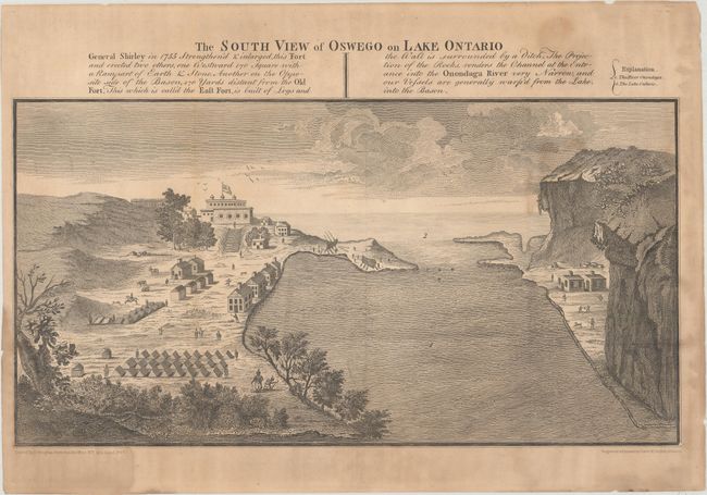
A. The South View of Oswego on Lake Ontario..., by David Vaughan, black & white (14.3 x 7.5"). This engraved print depicts Fort Oswego, commanded by General Shirley during the French and Indian War, and an important frontier post for British traders in the 18th century. During the French and Indian War, this fort was captured and destroyed by the French in 1756. The print is dated 1767 but is a 1849 facsimile from the Documentary History of the State of New York, published by R.H. Pease. Condition: Issued folding with moderate toning and damp stains. There are two short tears in the blank margins.
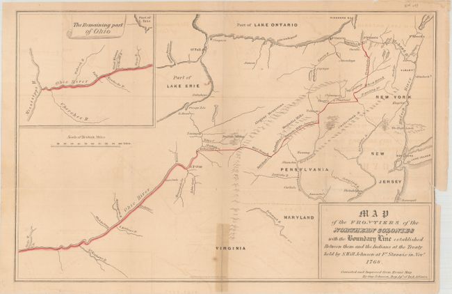
B. Map of the Frontiers of the Northern Colonies with the Boundary Line Established Between them and the Indians at the Treaty Held by S. Will Johnson at Ft. Stanwix in November 1768, by Guy Johnson, hand color (17.3 x 11.1"). Map extends from Virginia to New York, with an inset map of the remaining part of the Ohio River. The boundary line is traced in red and follows the course of the Ohio River north to Pittsburgh, and then north to Lake Oneida. The Indians were to have the lands to the west and the settlers the lands to the east. This is a 1849 facsimile from the Documentary History of the State of New York, published by R.H. Pease. Condition: Issued folding with light offsetting. There is a tape stain along a fold separation at bottom, which has been replaced with archival material, and a 4" binding tear at left that has been partially closed with archival tape. A short fold separation at left remains unrepaired.
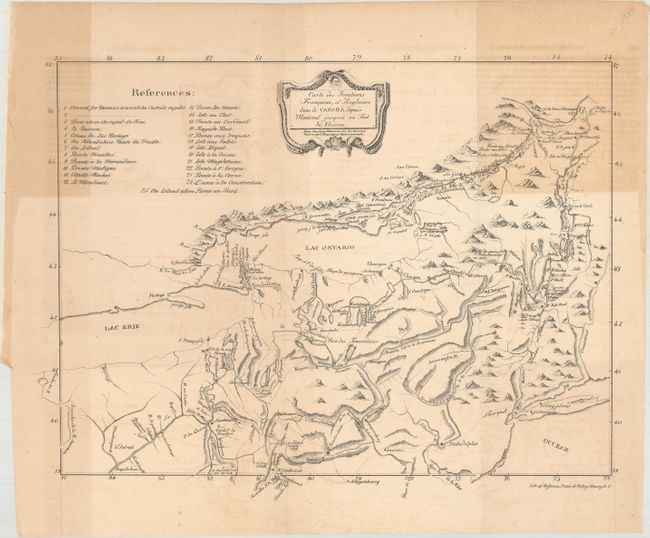
C. Carte des Frontieres Francoises, et Angloises dens le Canada Depuis Montreal Jusques au Fort du Quesne, by (Capt) M. de Pouchot, from Pouchot's Memoires sur la Derniere Guerre de l'Amerique Septentrionale, black & white (17.3 x 13.3"). This French map was prepared by Pierre Pouchot, a commander of Fort Niagara during the French and Indian War, and published in his memoires in 1781. The map shows the region between Montreal and Fort Duquesne (Pittsburgh) including all of New York and New Jersey, and most of Pennsylvania. This lithographic facsmile was created in the mid-19th century. Condition: Issued folding with light offsetting and areas of moderate toning in the top corners.
References:
Condition: B
See descriptions above.