Catalog Archive
Auction 154, Lot 11
"Typus Orbis Terrarum", Ortelius/Galle
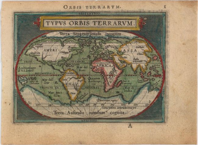
Subject: World
Period: 1590 (circa)
Publication: Epitome du Theatre du Monde d'Abraham Ortelius
Color: Hand Color
Size:
4.3 x 3.1 inches
10.9 x 7.9 cm
Download High Resolution Image
(or just click on image to launch the Zoom viewer)
(or just click on image to launch the Zoom viewer)