Catalog Archive


Auction 112, Lot 116
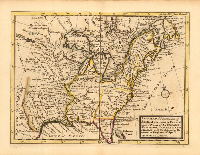
"A New Map of ye North Parts of America claimed by France under ye Names of Louisiana, Mississipi, Canada & New France, with the Adjoyning Territories of England & Spain", Moll, Herman

Subject: Colonial United States and Canada
Period: 1735 (circa)
Publication: Atlas Minor
Color: Hand Color
Size:
10.8 x 8 inches
27.4 x 20.3 cm
Download High Resolution Image
(or just click on image to launch the Zoom viewer)
(or just click on image to launch the Zoom viewer)