Showing results for:Auction 127
Catalog Archive
870 lots
Page 1 of 18
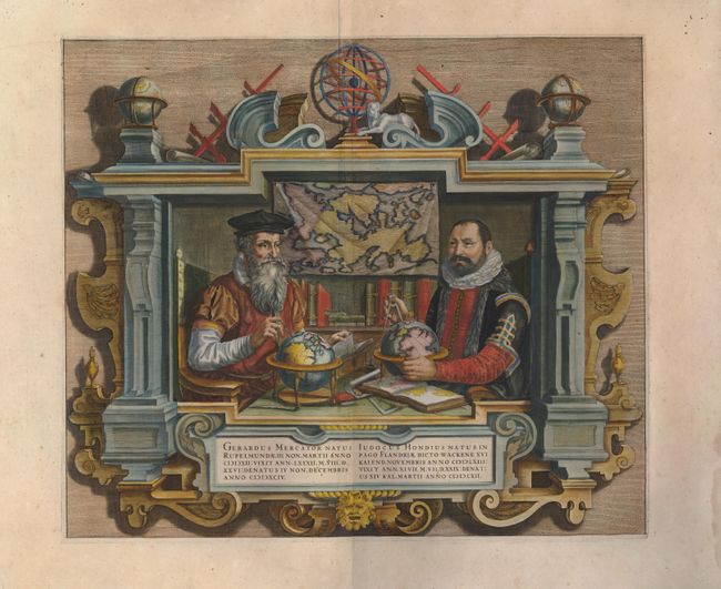
Auction 127, Lot 1
Subject: Title Pages
Hondius
Gerardus Mercator … Iudocus Hondius …, 1620
Size: 17.5 x 15 inches (44.5 x 38.1 cm)
Estimate: $3,000 - $3,500
Unsold
Closed on 2/25/2009
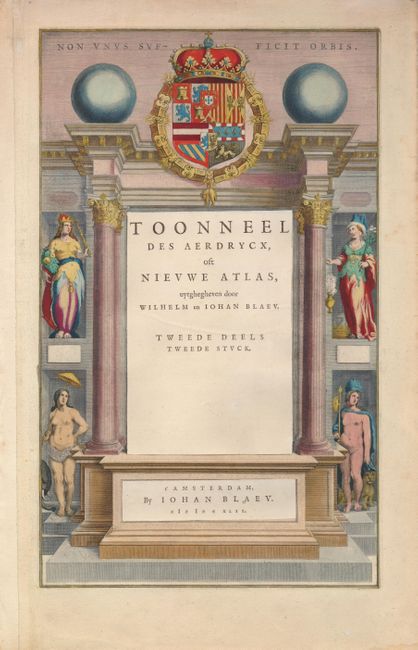
Auction 127, Lot 2
Subject: Title Pages
Blaeu, (Family)
Toonneel des Aerdrycx, oft Nieuwe Atlas, uytghegheven door Wilhelm en Iohan Blaeu. Tweede Deels Tweede Stuck, 1642
Size: 9.8 x 16 inches (24.9 x 40.6 cm)
Estimate: $350 - $400
Sold for: $190
Closed on 2/25/2009

Auction 127, Lot 3
Subject: Title Pages
Speed, John
The Theatre of the Empire of Great Britaine. Presenting an Exact Geography of the Kingdomes of England Scotland and Ireland and the Isles Adjoyning…, 1676
Size: 9.5 x 14.8 inches (24.1 x 37.6 cm)
Estimate: $425 - $500
Sold for: $550
Closed on 2/25/2009
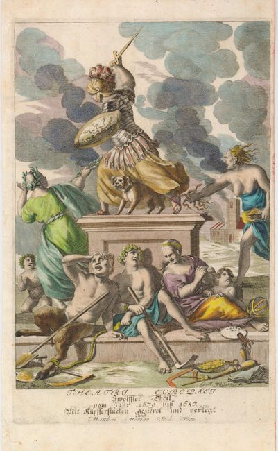
Auction 127, Lot 4
Subject: Title Pages
Merian, Matthaus
Theatri Europaei Zwolffter Theil…, 1691
Size: 7 x 10.3 inches (17.8 x 26.2 cm)
Estimate: $200 - $250
Sold for: $150
Closed on 2/25/2009
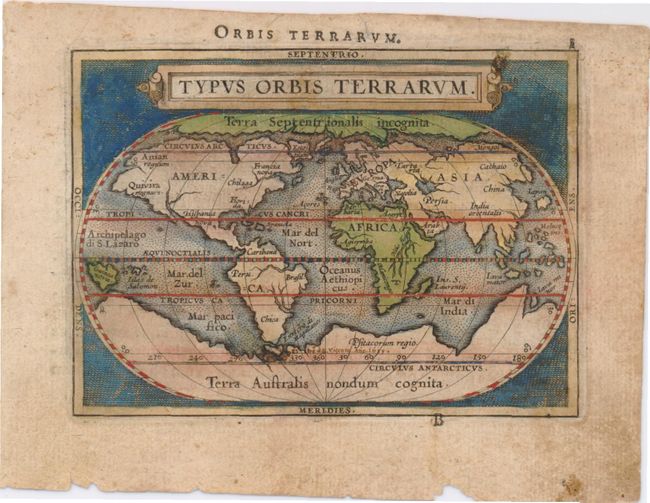
Auction 127, Lot 5
Subject: World & Continents
Ortelius/Galle
[Lot of 5] Typus Orbis Terrarum [and] Americae sive Novi Orbis Nova Descriptio [and] Asiae Nova Descr [and] Africa Tabula Nova [and] Europa, 1589
Size: 4.3 x 3 inches (10.9 x 7.6 cm)
Estimate: $2,400 - $3,000
Sold for: $1,500
Closed on 2/25/2009
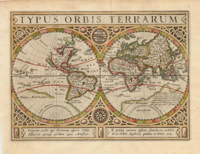
Auction 127, Lot 6
Subject: World & Continents
Cluver/Jansson
[Lot of 5] Typus Orbis Terrarum [and] Americae Descriptio [and] Asia [and] Africae Descriptio [and] Europae Nova Tabula, 1661
Size: 8 x 5.5 inches (20.3 x 14 cm)
Estimate: $2,000 - $2,500
Unsold
Closed on 2/25/2009
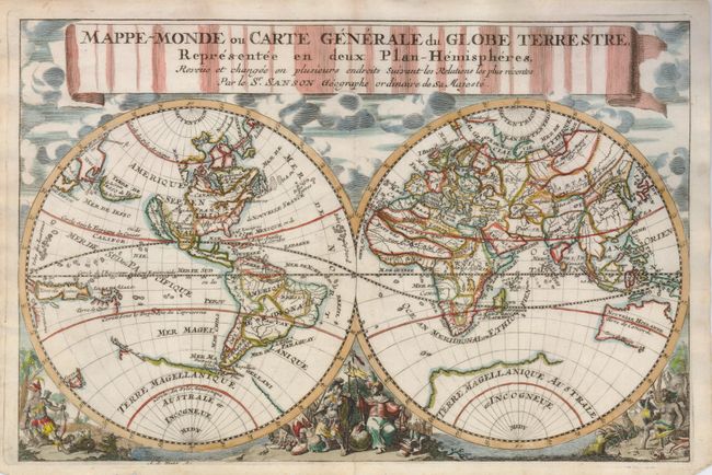
Auction 127, Lot 7
Subject: World & Continents
Sanson, Nicolas
[Lot of 6] Mappe-Monde ou Carte generale dy Globe Terrestre, Representee en Deux Plan-Hemispheres… [and] Americque Septentrionale [and] Amerique Meridionale [and] L'Asie [and] Afrique [and] Europe, 1700
Size: 11 x 7.7 inches (27.9 x 19.6 cm)
Estimate: $2,000 - $2,500
Sold for: $1,500
Closed on 2/25/2009
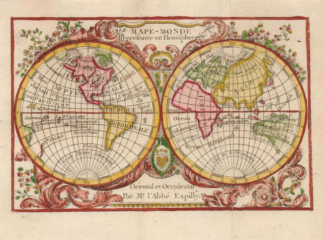
Auction 127, Lot 8
Subject: World & Continents
Expilly, Jean Joseph Georges, Abbe d'
[Lot of 5] Mape-Monde Representee en Hemispheres [and] Amerique Septentrionale et Meridionale [and] Afrique [and] Asie [and] l'Europe, 1783
Size: 4.6 x 3.7 inches (11.7 x 9.4 cm)
Estimate: $550 - $650
Sold for: $400
Closed on 2/25/2009
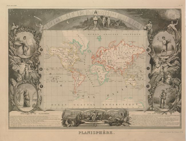
Auction 127, Lot 9
Subject: World & Continents
Levasseur, Victor
[Lot of 7] Planisphere [and] Amerique Septentrionale [and] Amerique Meridionale [and] Afrique [and] Asie [and] Europe [and] Oceanie, 1846
Size: 17 x 11 inches (43.2 x 27.9 cm)
Estimate: $800 - $950
Sold for: $550
Closed on 2/25/2009
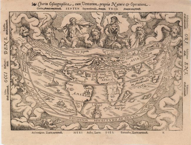
Auction 127, Lot 10
Subject: World
Apianus, Peter Bienewitz
Charta Cosmographica, cum Ventorum Propria Natura et Operatione, 1564
Size: 10.8 x 7.5 inches (27.4 x 19.1 cm)
Estimate: $5,500 - $6,500
Sold for: $3,250
Closed on 2/25/2009
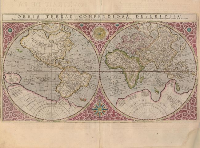
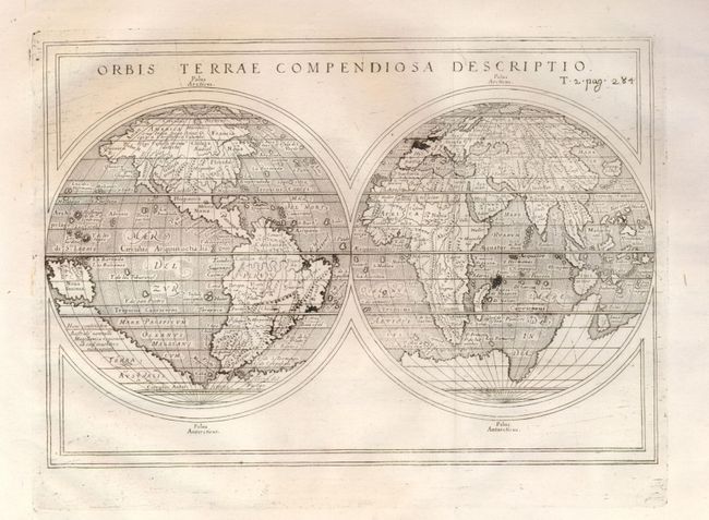
Auction 127, Lot 11
Subject: World
Mercator, Rumold
Orbis Terrae Compendiosa Descriptio…, 1587
Size: 20.5 x 11.3 inches (52.1 x 28.7 cm)
Estimate: $6,000 - $8,000
Sold for: $4,500
Closed on 2/25/2009
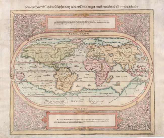
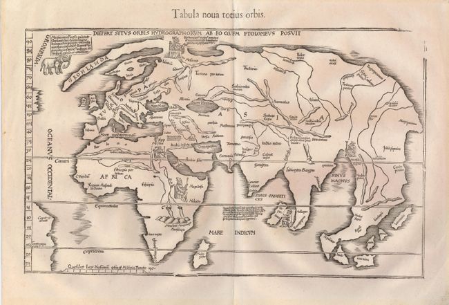
Auction 127, Lot 12
Subject: World
Munster/Petri
Die Erst General Tafel, Die Beschreibung und den Circkel des Gantzen Erdtrichs und Meers Innhaltende, 1598
Size: 14.3 x 12 inches (36.3 x 30.5 cm)
Estimate: $1,600 - $1,900
Sold for: $1,000
Closed on 2/25/2009
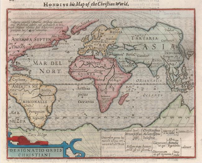
Auction 127, Lot 13
Subject: World
Hondius/Purchas
Designatio Orbis Christiani, 1625
Size: 7.3 x 5.8 inches (18.5 x 14.7 cm)
Estimate: $400 - $475
Sold for: $300
Closed on 2/25/2009
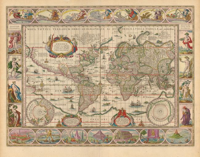
Auction 127, Lot 14
Subject: World
Blaeu, Willem
Nova Totius Terrarum Orbis Geographica Ac Hydrographica Tabula, 1640
Size: 21.25 x 16 inches (54 x 40.6 cm)
Estimate: $20,000 - $24,000
Sold for: $15,000
Closed on 2/25/2009
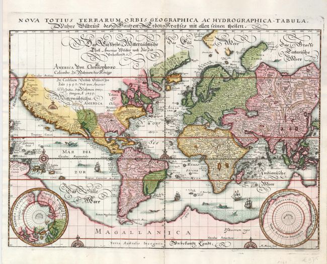
Auction 127, Lot 15
Subject: World
Merian, Matthaus
Nova Totius Terrarum Orbis Geographica ac Hydrographica Tabula, 1641
Size: 14 x 10 inches (35.6 x 25.4 cm)
Estimate: $1,900 - $2,200
Unsold
Closed on 2/25/2009
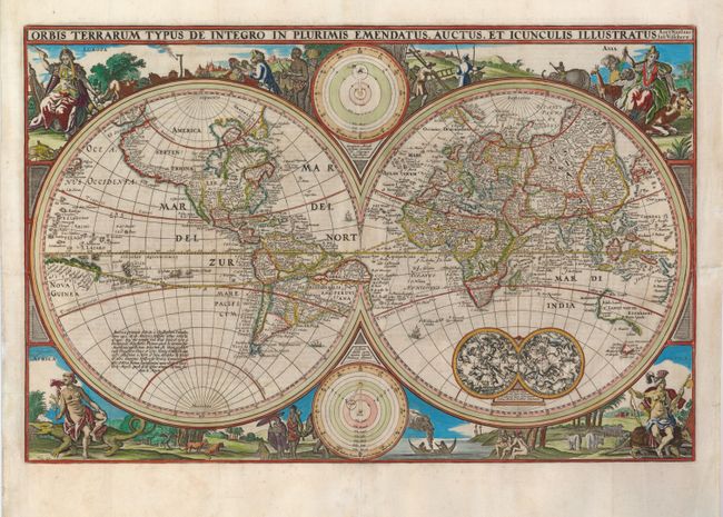
Auction 127, Lot 16
Subject: World
Visscher, Nicolas
Orbis Terrarum Typus de Integro in Plurimis Emendatus, Auctus, et Icunculis Illustratus, 1657
Size: 18.8 x 12.1 inches (47.8 x 30.7 cm)
Estimate: $2,300 - $2,750
Sold for: $1,700
Closed on 2/25/2009
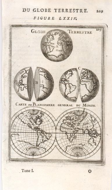
Auction 127, Lot 17
Subject: World
Mallet, Alain Manesson
Globe Terrestre [on sheet with] Carte ou Planisphere General du Monde, 1683
Size: 4 x 5.6 inches (10.2 x 14.2 cm)
Estimate: $100 - $150
Sold for: $50
Closed on 2/25/2009
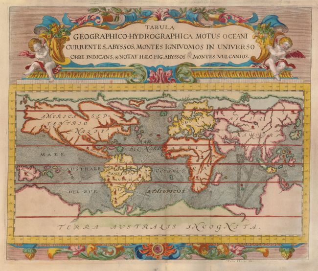
Auction 127, Lot 18
Subject: World
Zahn, Johannes
Tabula Geographico-Hydrographica Motus Oceani Currentes, Abyssos, Montes Igniuomos in Universo, 1696
Size: 16.5 x 14 inches (41.9 x 35.6 cm)
Estimate: $2,400 - $3,000
Sold for: $2,300
Closed on 2/25/2009
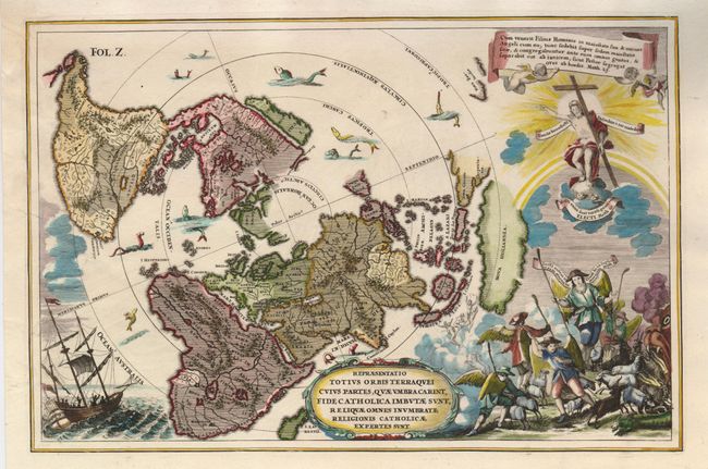
Auction 127, Lot 19
Subject: World
Scherer, Heinrich
Repraesentatio Totius Orbis Terraquei Cuius Partes, quae Umbra Carent, Fide Catholica Imbutae sunt, Reliquae Omnes Inumbratae Religionis Catholicae Expertes sunt, 1702
Size: 13.8 x 9 inches (35.1 x 22.9 cm)
Estimate: $1,100 - $1,400
Sold for: $1,300
Closed on 2/25/2009
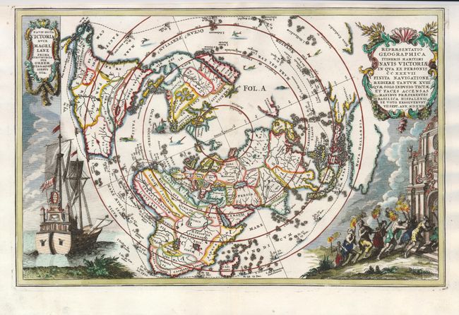
Auction 127, Lot 20
Subject: World, Polar
Scherer, Heinrich
Repraesentatio Geographica Itineris Maritimi Navis Victoriae…, 1703
Size: 14 x 9 inches (35.6 x 22.9 cm)
Estimate: $1,200 - $1,500
Unsold
Closed on 2/25/2009
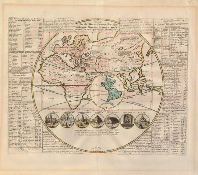
Auction 127, Lot 21
Subject: World
Chatelain, Henry Abraham
Plan de l'Histoire universelle, oul'on voit les quatre Monarchies du Monde, et tous les Anciens Etats aussi bien que ceux qui subsistent aujourdhuy, 1705
Size: 17.3 x 13.2 inches (43.9 x 33.5 cm)
Estimate: $400 - $500
Unsold
Closed on 2/25/2009
Auction 127, Lot 22
Subject: World
Rosaccio, Guiseppe
Orbis Terrae Compendiosa Descriptio, 1713
Size: 9.8 x 6.8 inches (24.9 x 17.3 cm)
Estimate: $600 - $700
Unsold
Closed on 2/25/2009
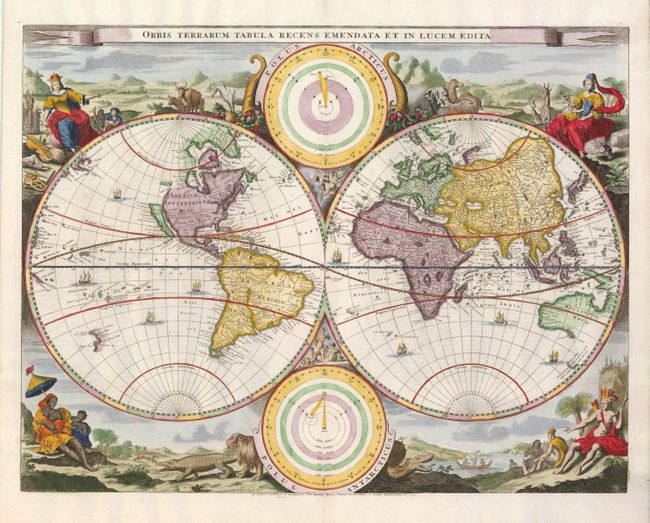
Auction 127, Lot 23
Subject: World
Stoopendaal, Daniel
Orbis Terrarum Tabula Recens Emendata et in Lucem Edita, 1714
Size: 18 x 14 inches (45.7 x 35.6 cm)
Estimate: $2,400 - $2,750
Unsold
Closed on 2/25/2009
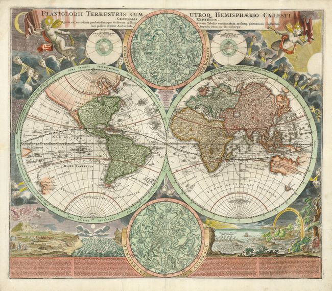
Auction 127, Lot 24
Subject: World
Homann, Johann Baptist
Planiglobii Terrestris cum Utroq Hemisphaerio Caelesti Generalis Exhibitio, 1716
Size: 22.5 x 19.3 inches (57.2 x 49 cm)
Estimate: $2,750 - $3,500
Sold for: $2,200
Closed on 2/25/2009
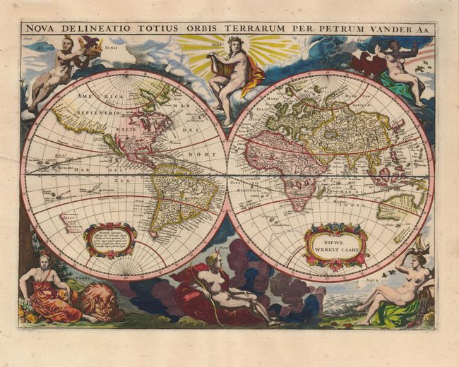
Auction 127, Lot 25
Subject: World
Aa, Pieter van der
Nova Delineatio Totius Orbis Terrarum Per Petrum Vander Aa, 1720
Size: 13.5 x 10 inches (34.3 x 25.4 cm)
Estimate: $2,000 - $2,500
Sold for: $1,700
Closed on 2/25/2009
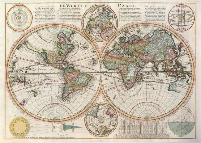
Auction 127, Lot 26
Subject: World
Danckerts, Cornelius
De Werelt Caart, 1728
Size: 20.2 x 14.3 inches (51.3 x 36.3 cm)
Estimate: $1,500 - $1,800
Sold for: $1,200
Closed on 2/25/2009
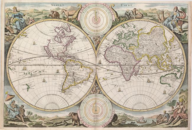
Auction 127, Lot 27
Subject: World
Stoopendaal, Daniel
Werelt Caert, 1730
Size: 18 x 12.3 inches (45.7 x 31.2 cm)
Estimate: $1,000 - $1,400
Sold for: $750
Closed on 2/25/2009
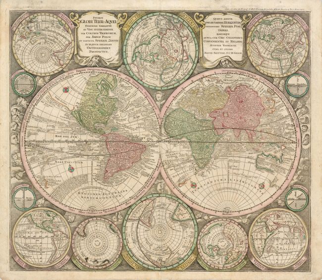
Auction 127, Lot 28
Subject: World
Seutter, Matthias
Diversi Globi Terr-Aquei Statione Variante et Visu Intercedente per Coluros Tropicorum per Ambos Polos…, 1740
Size: 22.7 x 19.5 inches (57.7 x 49.5 cm)
Estimate: $3,000 - $3,500
Sold for: $1,600
Closed on 2/25/2009
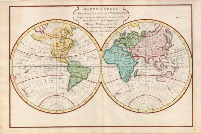
Auction 127, Lot 29
Subject: World
Krevelt, A. van
Mappe-Monde ou Description du Globe Terrestre…, 1773
Size: 14.8 x 9.8 inches (37.6 x 24.9 cm)
Estimate: $350 - $425
Sold for: $190
Closed on 2/25/2009
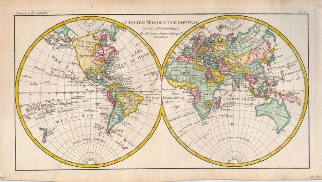
Auction 127, Lot 30
Subject: World
Bonne, Rigobert
L'Ancien Monde et le Nouveau en deux Hemispheres, 1785
Size: 16 x 8.3 inches (40.6 x 21.1 cm)
Estimate: $240 - $300
Sold for: $150
Closed on 2/25/2009
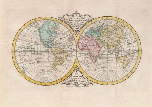
Auction 127, Lot 31
Subject: World
Elwe, Jan Barend
Universele of Waereld-Kaart Volgens de Laatste Ontdekkingen van Capt. Cook, 1785
Size: 8.2 x 5 inches (20.8 x 12.7 cm)
Estimate: $300 - $375
Unsold
Closed on 2/25/2009
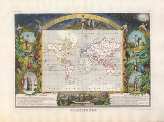
Auction 127, Lot 32
Subject: World
Levasseur, Victor
Planisphere, 1845
Size: 15.5 x 11 inches (39.4 x 27.9 cm)
Estimate: $275 - $375
Sold for: $200
Closed on 2/25/2009
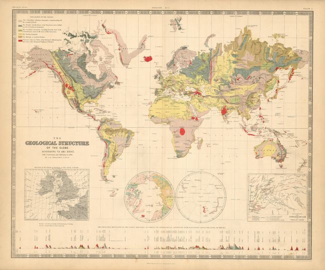
Auction 127, Lot 33
Subject: World
Johnston, Alexander K.
The Geological Structure of the Globe According to Ami Boue with Corrections and Additions to 1855, 1856
Size: 24.3 x 20 inches (61.7 x 50.8 cm)
Estimate: $200 - $300
Sold for: $650
Closed on 2/25/2009
Auction 127, Lot 34
Subject: Ancient World
Waldseemuller/Fries
Tabula Nova Totius Orbis, 1541
Size: 18 x 11.3 inches (45.7 x 28.7 cm)
Estimate: $4,000 - $4,750
Sold for: $4,250
Closed on 2/25/2009
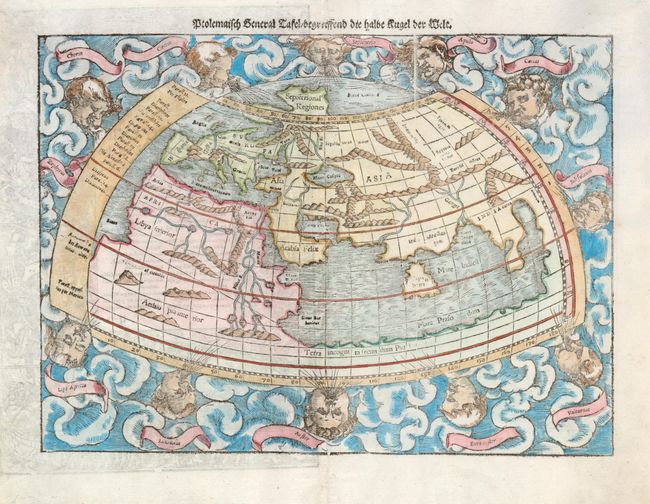
Auction 127, Lot 35
Subject: Ancient World
Munster, Sebastian
Ptolemaisch General Tafel Begreissend die halbe Rugel der Weldt, 1550
Size: 13.5 x 10 inches (34.3 x 25.4 cm)
Estimate: $950 - $1,200
Unsold
Closed on 2/25/2009
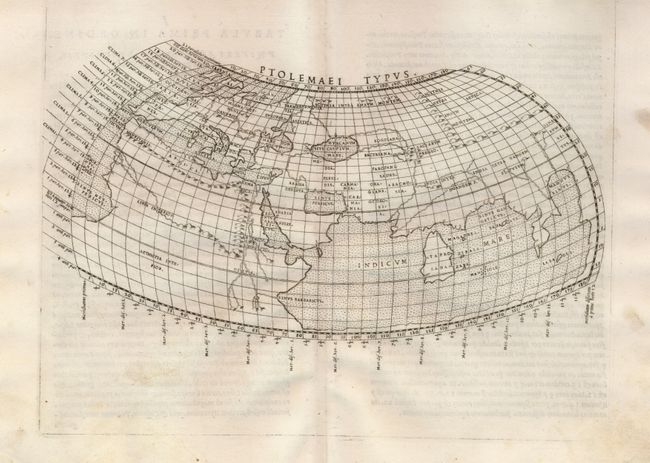
Auction 127, Lot 36
Subject: Ancient World
Ruscelli, Girolamo
Ptolemaei Typus, 1562
Size: 10 x 6 inches (25.4 x 15.2 cm)
Estimate: $450 - $550
Sold for: $325
Closed on 2/25/2009
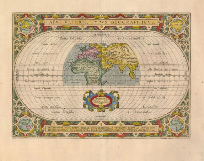
Auction 127, Lot 37
Subject: Ancient World
Ortelius, Abraham
Aevi Veteris, Typus Geographicus, 1590
Size: 17.5 x 12.3 inches (44.5 x 31.2 cm)
Estimate: $1,300 - $1,500
Sold for: $1,000
Closed on 2/25/2009
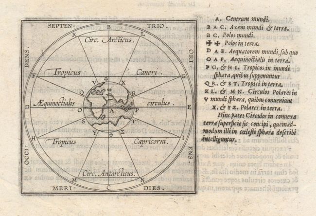
Auction 127, Lot 38
Subject: Ancient World
Ortelius/Galle
[De Circulis Minoribus], 1601
Size: 3.5 x 3.5 inches (8.9 x 8.9 cm)
Estimate: $250 - $300
Sold for: $275
Closed on 2/25/2009
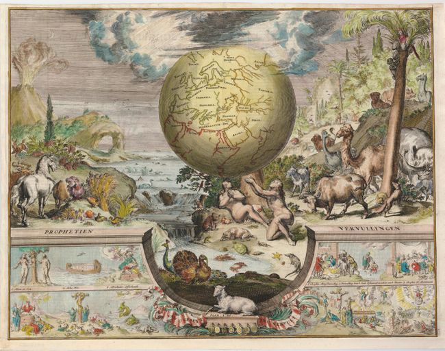
Auction 127, Lot 39
Subject: Ancient World
Hooghe, Romain de
[Prophetien - Vervullingen], 1687
Size: 18.5 x 14 inches (47 x 35.6 cm)
Estimate: $550 - $650
Sold for: $900
Closed on 2/25/2009
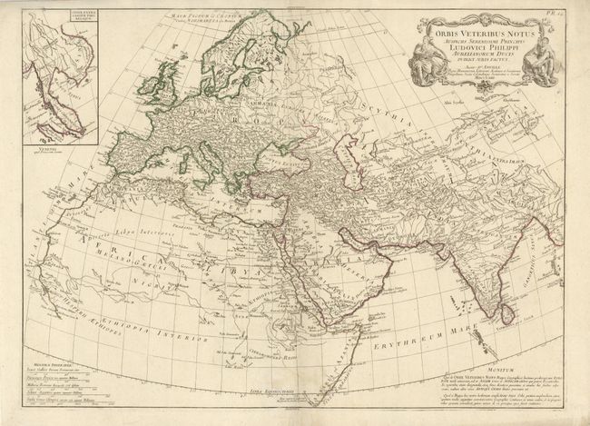
Auction 127, Lot 40
Subject: Ancient World
Anville, Jean Baptiste Bourguignon d'
Orbis Veteribus Notus Auspiciis Serenissimi Principls Ludovici Philippi Aurelianorum Ducis Publici Juris Factus, 1763
Size: 26 x 19 inches (66 x 48.3 cm)
Estimate: $200 - $250
Unsold
Closed on 2/25/2009
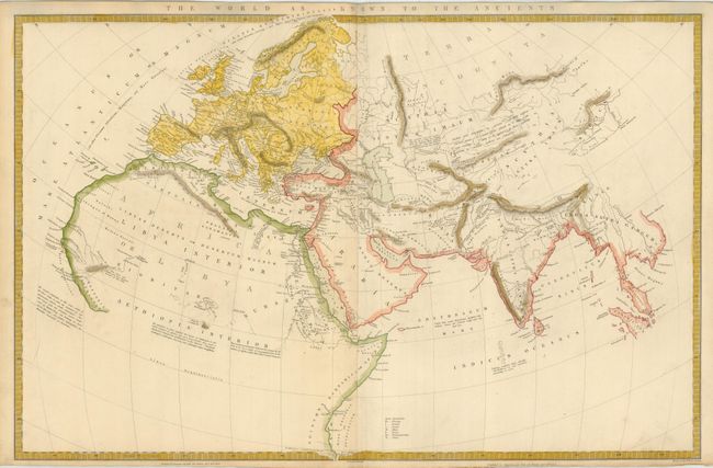
Auction 127, Lot 41
Subject: Ancient World
SDUK Society for the Diffusion of Useful Knowledge
The World as Known to the Ancients, 1842
Size: 23.8 x 15.5 inches (60.5 x 39.4 cm)
Estimate: $100 - $140
Sold for: $75
Closed on 2/25/2009
Auction 127, Lot 42
Subject: North Pole
Jansson, Jan
Septentrionalium Terrarum Descript., 1630
Size: 8 x 5.6 inches (20.3 x 14.2 cm)
Estimate: $300 - $400
Sold for: $200
Closed on 2/25/2009
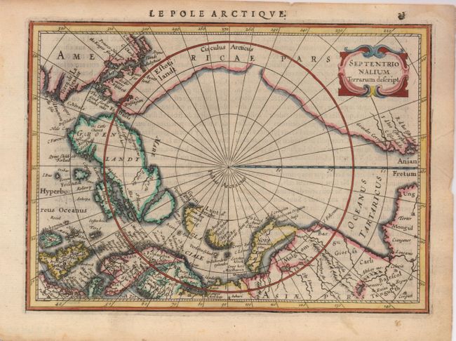
Auction 127, Lot 43
Subject: North Pole
Blaeu, Willem
Regiones Sub Polo Arctico, 1649
Size: 20.8 x 16 inches (52.8 x 40.6 cm)
Estimate: $800 - $1,000
Sold for: $600
Closed on 2/25/2009
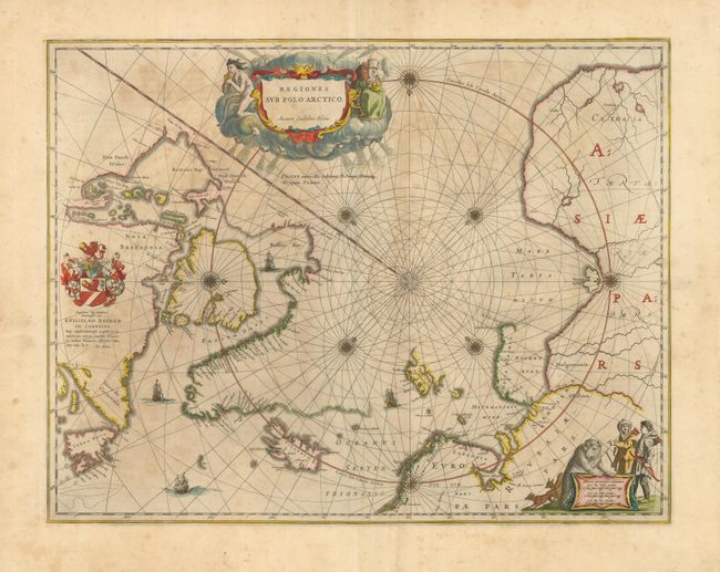
Auction 127, Lot 44
Subject: North Pole
Scherer, Heinrich
Regionum Circum Polarium Lapponiae Islandiae et Groenlandiae Novae et Veteris Nova Descriptio Geographica, 1701
Size: 13.8 x 9.2 inches (35.1 x 23.4 cm)
Estimate: $700 - $800
Sold for: $750
Closed on 2/25/2009

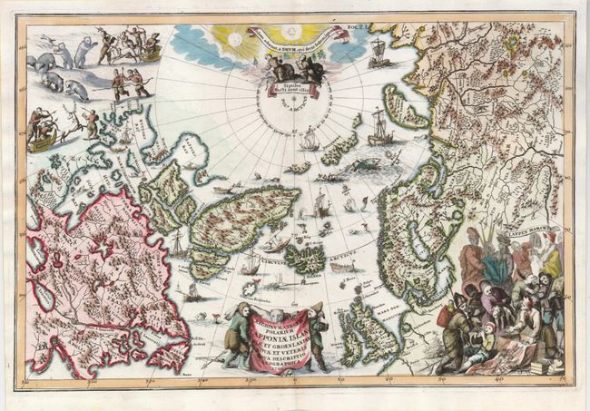
Auction 127, Lot 45
Subject: North Pole
National Geographic Magazine
Map of the North Pole Regions, 1907
Size: 17.5 x 17.5 inches (44.5 x 44.5 cm)
Estimate: $150 - $190
Sold for: $150
Closed on 2/25/2009
Auction 127, Lot 46
Subject: Cartographic Miscellany
Galluci, Giovanni Paolo
[Lot of 3 - Astronomic Diagrams], 1657
Size: 7 x 10.4 inches (17.8 x 26.4 cm)
Estimate: $200 - $250
Unsold
Closed on 2/25/2009
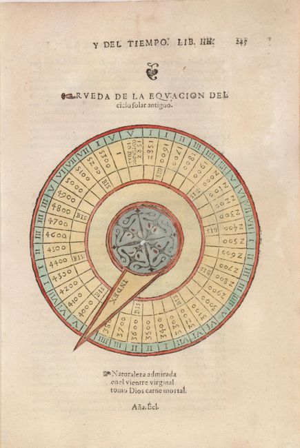
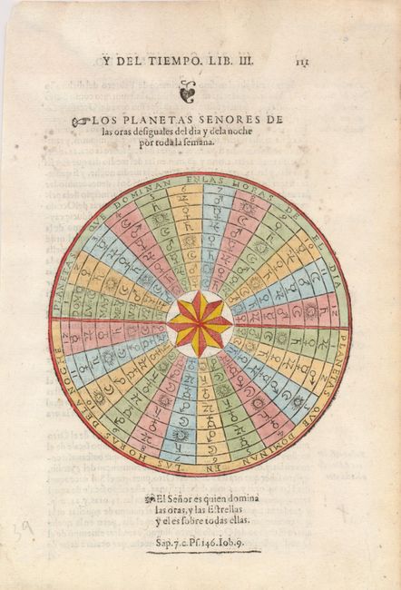
Auction 127, Lot 47
Subject: Cartographic Miscellany
Galluci, Giovanni Paolo
[Volvelle] Rueda de la Equacion del Ciclo Solar Antiguo, 1657
Size: 7 x 10.4 inches (17.8 x 26.4 cm)
Estimate: $150 - $200
Sold for: $110
Closed on 2/25/2009
Auction 127, Lot 48
Subject: Cartographic Miscellany
Sanson, Nicolas
[Lot of 4] Sphere [and] Globe Celeste [and] Globe Terestre [and Compass], 1700
Size: 5 x 7 inches (12.7 x 17.8 cm)
Estimate: $375 - $450
Sold for: $325
Closed on 2/25/2009
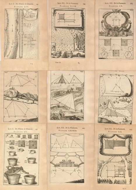
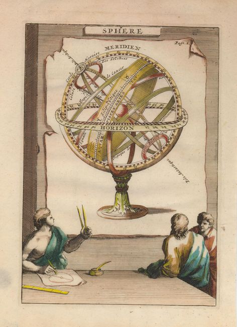
Auction 127, Lot 49
Subject: Cartographic Miscellany
Mallet, Alain Manesson
[Lot of 43 - Geometry Plates], 1702
Size: 4 x 5.8 inches (10.2 x 14.7 cm)
Estimate: $180 - $220
Sold for: $100
Closed on 2/25/2009
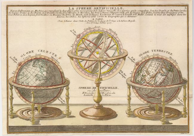
Auction 127, Lot 50
Subject: Cartographic Miscellany
Fer, Nicolas de
La Sphere Artificielle, 1717
Size: 12.8 x 9.1 inches (32.5 x 23.1 cm)
Estimate: $240 - $300
Sold for: $120
Closed on 2/25/2009
870 lots
Page 1 of 18